
Maps across changing states
These maps show the fortress, Dniester crossing, and surrounding districts at different scales. Each entry identifies the period depicted and, where different, the date of the map’s creation.
Before 1812: Fortresses, campaigns, and the Ottoman–Moldavian frontier
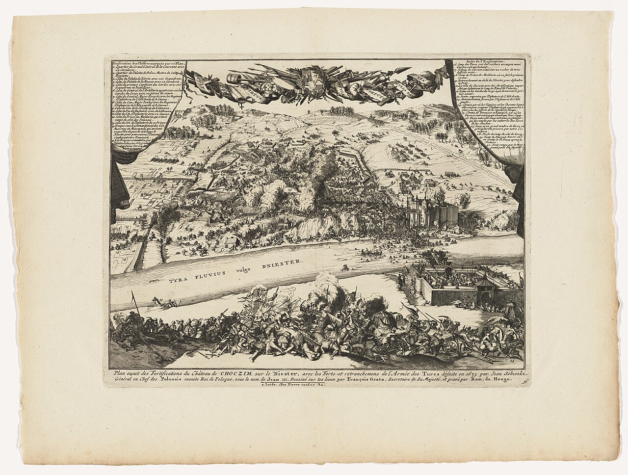
1729: Fortress and Dniester plan
The plan shows the fortress, river, and surrounding approaches.
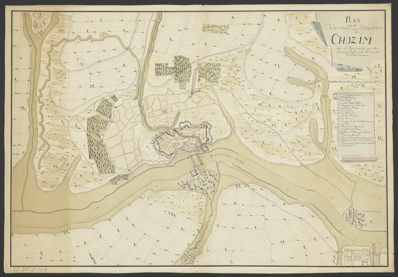
c. 1739: Fortress and settlement
The fortress and civilian settlement appear together above the Dniester.
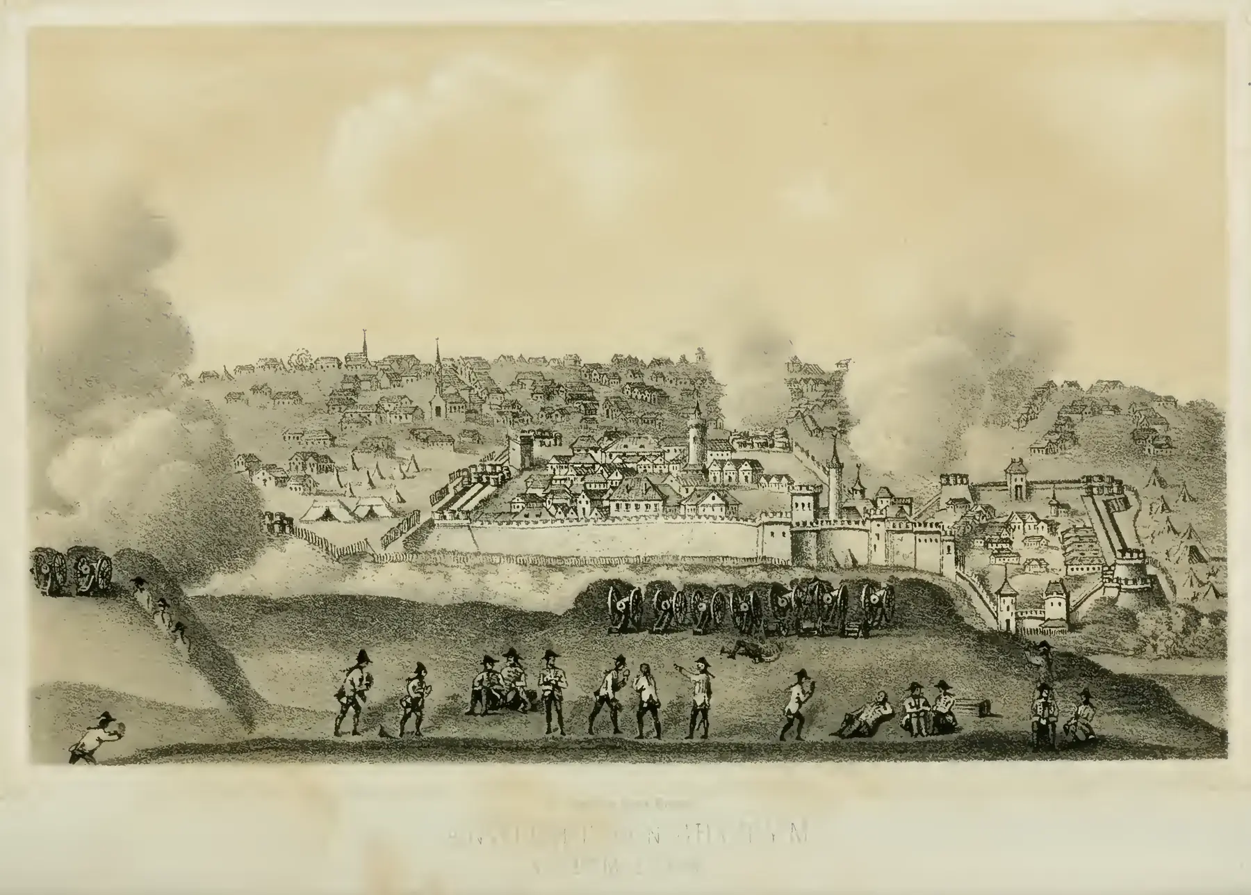
1788 campaign: Depiction published in 1859
A retrospective depiction of the campaign, including the fortress, batteries, and military positions.
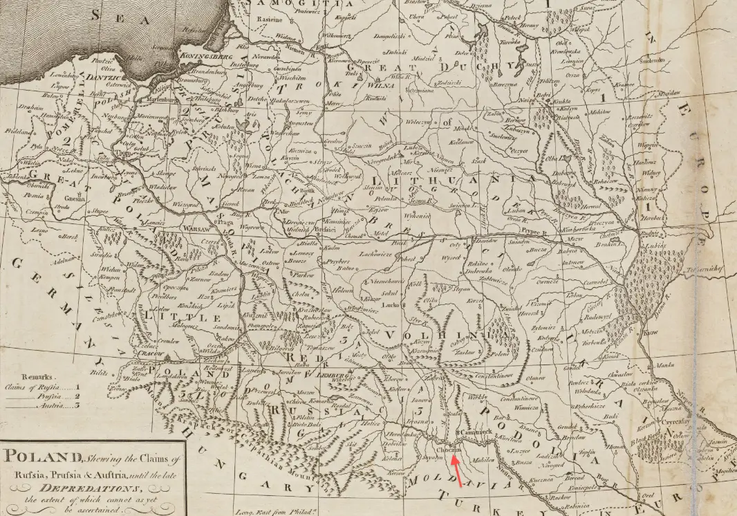
1800: Choczim and neighboring territories
The regional map places Choczim among neighboring territories before Russian annexation.
1812–1918: Russian Bessarabia
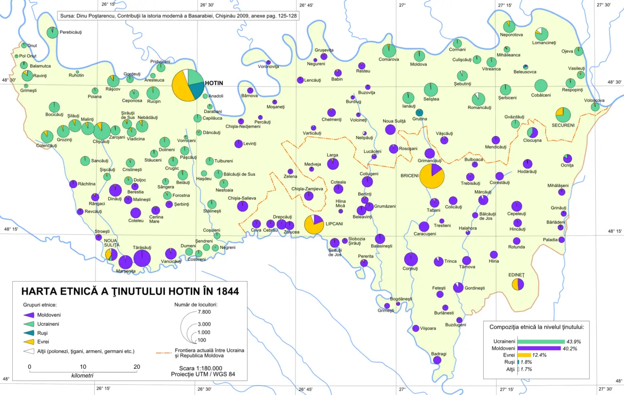
1844 population geography: Modern reconstruction
This later reconstruction depicts historical population geography. Its date label refers to the period represented.
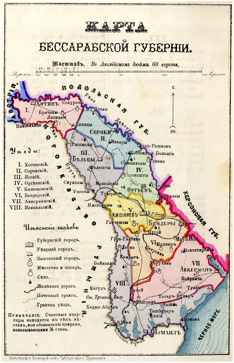
1883: Russian Bessarabia
This provincial map is useful for placing Khotyn within the Russian Imperial administrative and transport landscape late in the nineteenth century, close to the Austrian frontier and the northern edge of Bessarabia.
1918–1940: Khotyn under Romanian rule
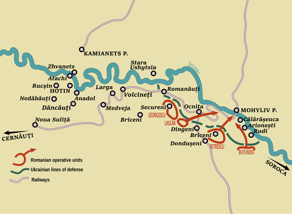
January 1919: Uprising map created in 2020
The reconstruction shows the geographic extent of the uprising along the Dniester.
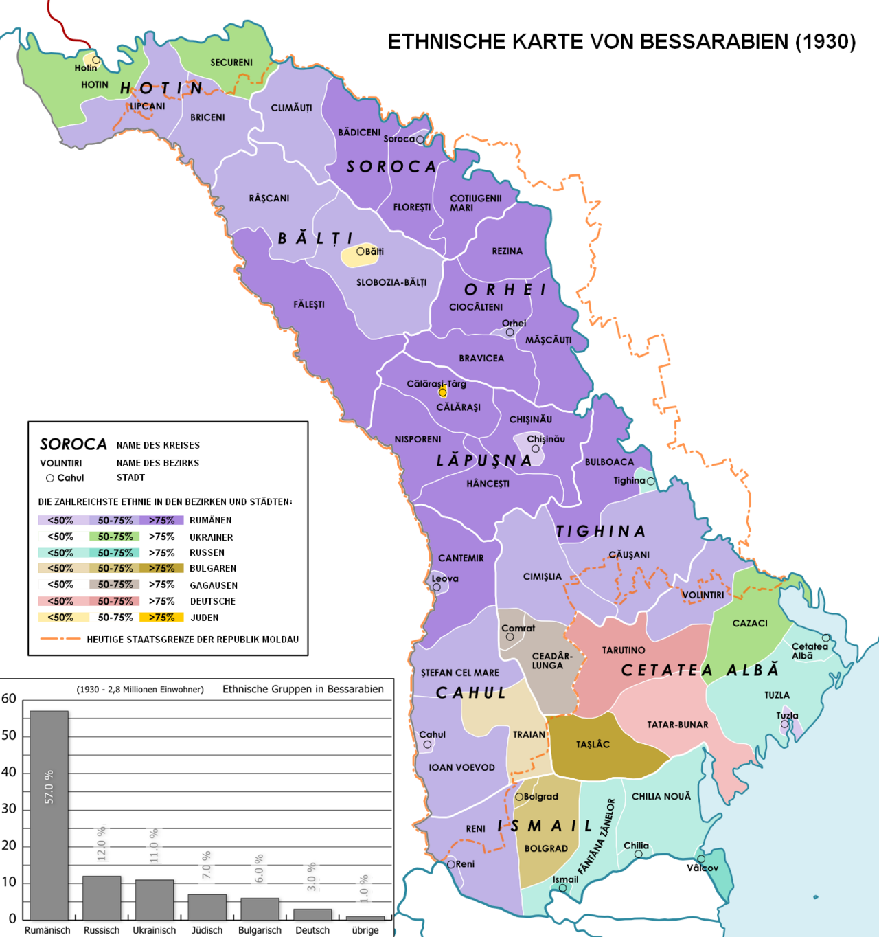
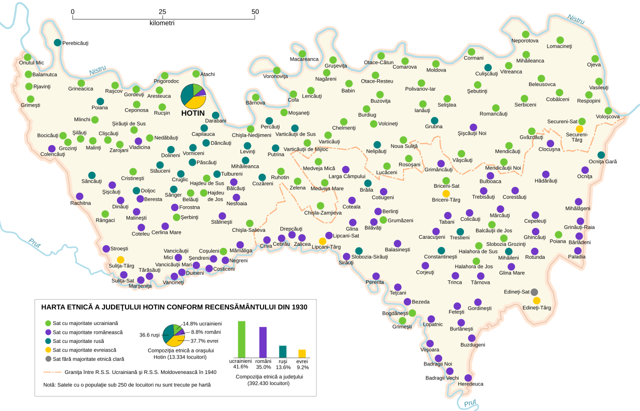
1930 census geography: Later thematic maps
These later thematic maps depict regional population patterns using categories derived from the Romanian census.
1991–Present: Modern Khotyn and research geography
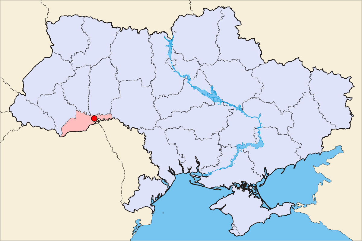
2007: Khotyn within Ukraine
This national locator map shows Khotyn’s position in Ukraine. For street-level orientation, consult a current map and the linked cemetery and synagogue locations.
Map catalogues and collections
The catalogue lists displayed maps and linked collections. Creation dates and dates depicted are distinguished where they differ.
| Date | Map / resource | Era | Creator / repository | Status | Link |
|---|---|---|---|---|---|
| 1729 | Plan exact des fortifications du Château de Choczim sur le Niester | Before 1812 | François Grata; Pieter van der Aa; Romeyn de Hooghe. Leiden. Harvard Map Collection copy; public-domain historical map. | Displayed above | Open |
| c. 1739 | Map of Khotyn and the fortified landscape | Before 1812 | Staatsbibliothek zu Berlin, call no. Kart. X 48630. Public-domain digital reproduction. | Displayed above | Open |
| 1769 | Battle Near Chozim on 18 September 1769 | Before 1812 | Daniel Nikolaus Chodowiecki, after. Los Angeles County Museum of Art, accession 55.103.163. Public domain. | External | Open |
| 1788 / 1859 | 1788 siege, depicted in an 1859 publication | Before 1812 | Published by August von Witzleben in 1859 from the history of the 1788 campaign; public-domain reproduction. | Displayed above | Open |
| 1800 | Choczim on Mathew Carey’s map of Poland and adjoining lands | Before 1812 | Mathew Carey, 1800. Boston Public Library, Norman B. Leventhal Map & Education Center, item 12332. | Displayed above | Open |
| 1800–1942 | Bessarabian maps: collection reference — Fond 11 collection | 1812–1918 | National Archives Agency of the Republic of Moldova, Fond 11, cartographic collection; item-level citation should be taken from the archive catalog. | Collection catalogue | Open |
| 1844 | Hotin district in 1844: Modern reconstruction | 1812–1918 | Andrein/ArdadN, after Dinu Poștarencu (2009). | Displayed above | Enlarge map |
| 1883 | Russian Bessarabia | 1812–1918 | Russian Bessarabia map; Wikimedia Commons file record | Displayed above | Open |
| 1919 / 2020 | Khotyn Uprising | 1918–1940 | Modern map by Dahn (2020), based on published historical mapping; CC BY 4.0. | Displayed above | Open |
| 1930 | Ethnic map of Bessarabia | 1918–1940 | Interwar demographic mapping drawing on Romanian census-era categories; Wikimedia Commons and historical atlases contain versions. | Displayed above | Enlarge map |
| 1941 | Deportation and Holocaust geography | 1940–1944 | Romanian/German wartime maps of Bessarabia, Bukovina, and Transnistria; compare with Holocaust Commission and United States Holocaust Memorial Museum (USHMM) geographic documentation. | External | Open |
| 2007 | Khotyn locator map within Ukraine | 1991–Present | Dmytro S. / DDima, 2007. | Displayed above | Open |
| Present | Jewish cemetery location and survey maps | 1991–Present | JewishGen, European Jewish Cemeteries Initiative (ESJF), Center for Jewish Art, and modern satellite/street mapping. | External | Open |
1800–1942: National Archives of Moldova, Fond 11
One of the most promising cartographic collections for Khotyn research is Fond 11 of the National Archives Agency of the Republic of Moldova. The collection contains approximately 1,930 cartographic units dated from 1800 to 1942. Because historical Bessarabia crossed today’s Ukrainian–Moldovan border, a Moldovan archive can hold maps crucial to a city now in Ukraine.
Fond 11 is an archival collection. Individual maps are identified by their title, date, inventory, and file or item number in the archive catalogue.
More maps from BessarabiaSIG
The military-topographical map collection includes sheets labelled “26-4 — Khotin uezd” and “26-5 — Khotin Ataki (near Khotin) Brichany.” The regional map collection includes maps of Bessarabia and an entry labelled “HotinMap.” Open the images in those collections to explore neighboring settlements.
Sources for maps from 1729–Present
- François Grata; Pieter van der Aa; Romeyn de Hooghe. Plan exact des fortifications du Château de Choczim sur le Niester [Exact plan of the fortifications of Khotyn Castle on the Dniester], 1729. Leiden; Harvard Map Collection copy; digital reproduction via Wikimedia Commons. View image and rights
- Staatsbibliothek zu Berlin. Map of Khotyn, c. 1739, call no. Kart. X 48630; digital reproduction via Wikimedia Commons. View image and rights
- Daniel Nikolaus Chodowiecki, after. Battle Near Chozim on Sept. 18, 1769, eighteenth century. Los Angeles County Museum of Art, accession 55.103.163; public-domain digital image. View image and rights
- Witzleben, August von. Published depiction of the siege/battle of Khotin in 1788, in an 1859 historical work; public-domain digital reproduction via Wikimedia Commons. View image and rights
- Carey, Mathew. Khotin/Choczim detail from a map of Poland and adjoining lands, 1800. Boston Public Library, Norman B. Leventhal Map & Education Center, item 12332; public-domain map. Read source
- Dahn. “Khotin Uprising on January 19, 1919,” 2020, based on published historical mapping; CC BY 4.0; Wikimedia Commons. View image and rights
- National Archives Agency of the Republic of Moldova. Fond 11, cartographic collection, approximately 1,930 units dated 1800–1942; includes Bessarabian and Khotin-region maps. Consult the archive catalog for item-level call numbers. Read source
- Ștefan Ciobanu, ed., Basarabia: Monografie Regională (Chișinău: Imprimeria Statului, 1926), pp. 195–199. Read source
- Encyclopedia of Ukraine. “Khotyn Uprising.” Read source
- International Commission on the Holocaust in Romania. Final Report, ed. Tuvia Friling, Radu Ioanid, and Mihail E. Ionescu (Iași: Polirom, 2004), especially the Bessarabia, Bukovina, and Transnistria chapters. Read source
- European Jewish Cemeteries Initiative (ESJF). “Khotyn Jewish Cemetery.” Survey: site adjacent to 3 Tychyny Street, Khotyn, Chernivtsi Oblast, Ukraine; coordinates 48.52322, 26.46852; perimeter 1,120 m; approximately 3,000 extant gravestones; stone fence, ohel, and administration building recorded. Direct survey.
- Khotyn State Historical-Architectural Reserve. Official heritage information on the fortress and modern site. Read source
See the Sources & Bibliography for publication details, original-language titles, and image credits.
Further map research
Town plans, postal-road maps, military topographic sheets, and wartime maps may offer more detailed views. For material not displayed here, consult the National Archives of Moldova cartographic collection and the repositories in the bibliography. Confirm an individual map’s title, date, and sheet number in its catalogue record.