Maps
© Valerie Schatzker 2016
This page is hosted at no cost to the public by JewishGen, Inc., a non-profit corporation. If you feel there is a benefit to you in accessing this site, your JewishGenerosity is appreciated. http://www.jewishgen.org/JewishGen-httperosity
Sambor Circle
Losy de Losenau Map of Galician Kreise
Gesher Galicia has posted a map of the Sambor Circle, the Austrian Administrative District in 1790. See the Losy de Losenau Map of Galician Kreise: Sambor & Stryj from the early Atlas des Roiaumes de Galicie et de Lodomerie by FJ Maire under the direction of engineer LC Losy de Losenau, printed by T. Mollo & Co. of Vienna in 1790.
See: http://maps.geshergalicia.org/galicia/galicia-kreis-1790-9/
Cadastral Maps
See the Gesher Galicia Website for Cadastral Maps of Drohobycz and Borysław:
Drohobycz: http://maps.geshergalicia.org/cadastral/drohobycz-drohobych-1853/
Borysław: http://maps.geshergalicia.org/cadastral/boryslav-boryslaw-nd/
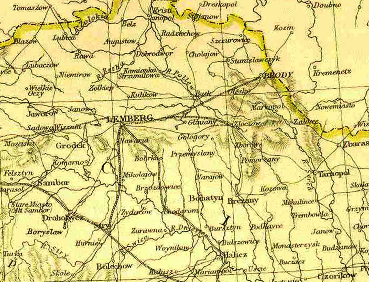
Drohobycz Area Map
circa 1910
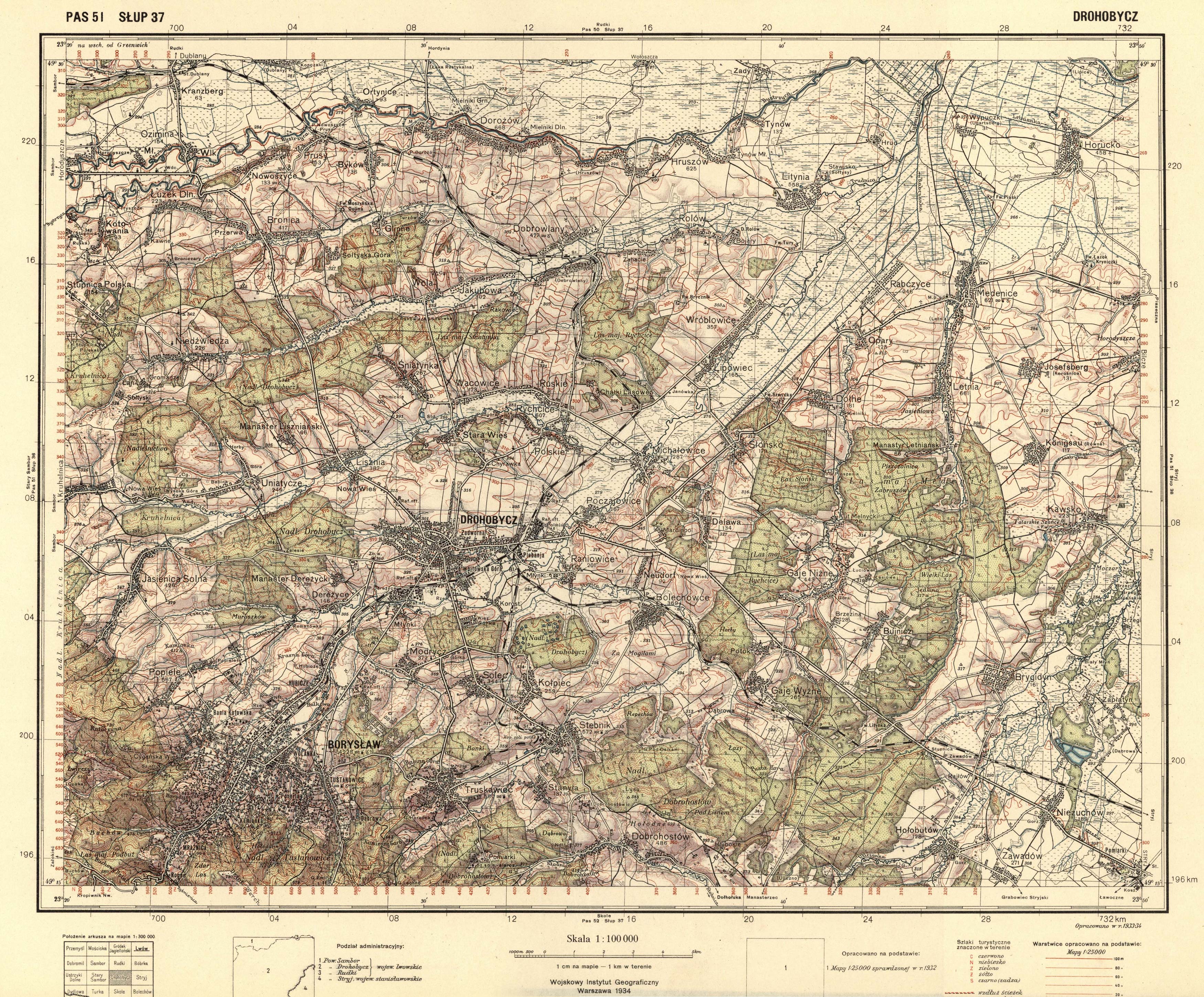
Map of Drohobycz Area
1934
Gesher Galicia has posted several maps of Galicia representing various stages in its history on its website. See http://maps.geshergalicia.org/
Maps of Galicia
This is an excellent, detailed map of the area around Drohobycz from the 3rd Military Mapping Survey of Austria-Hungary from the Department of Cartography and Geoinformatics of the Eötvös Loránd University Faculty of Informatics.hSee: http://lazarus.elte.hu/hun/digkonyv/topo/200e/41-49.jpg
More maps of the area can be seen at http://lazarus.elte.hu/hun/digkonyv/topo/3felmeres.htm
Map of Borysław
City Maps:
Drohobycz, Borysław,
Truskawiec
This map was hand-drawn in 1917 with family names in one suburb of Borysław – mainly where the Jewish Ghetto was later established by the Germans. Family names can be identified although the resolution of the image is not high. It can be found at the website borislavroots: https://borislavroots.files.wordpress.com/2012/07/1920map.jpg
The website below publishes street maps of various years of Drohobycz, Boryslaw, and Truskawiec.
A map of Drohobycz and the surrouding area produced by the Warsaw military cartographic institute can be seen at : http://www.studiolum.com/wang/drohobycz/drohobycz_1934.jpg
Topographical Maps of Eastern Europe
A collection of historical maps of Eastern Europe, including many of Galicia.
The Borders of Galicia shown on a modern map of Europe
This map presents a rough outline of the borders of Galicia in the Austro-Hungarian Empire on a map of modern-day Eastern Europe.