Kherson Colonies
Chart: The Black Sea Settlements Prior to 1918 - Kherson
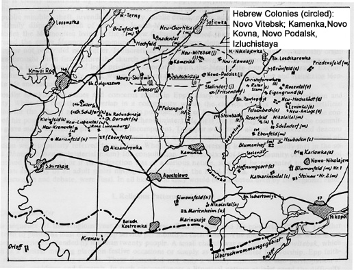
Map from: Journal of the American Historical Society of Germans from Russia, Summer 1982.
| Gross-Nagartaw (Bereznegovatoye) | original | |
| Klein-Nagartaw | original | |
| Gross-Siedeminucha | original (Seideminucha) | 47° 07' / 32° 59" |
| Klein-Seideminucha | ||
| Brobrowikut | original | 47° 06' / 32° 57' |
| Ephenger | original | 47° 24' / 32° 19' |
| Inguletz | original | 47° 44' / 33°15' |
| Kamianka | original | |
| Islutshista | 47° 55' / 33° 46' | |
| Israelewka |
48° 01'/ 32° 37' |
|
| Sagaidak |
48° 02' /32° 45' |
|
| Neu-Poltava | ||
| Romanow | ||
| Lemberg Lvova | ||
| Neu Breslau | ||
| Volnaya | ||
| Gromoklaya | ||
| Dobraya | ||
| Neu Zhitomir | ||
| Neu Kovno | ||
| Neu Podalsk | ||
| Neu Vitebsk |
|
Colonies in the Kherson Region 1807-1925; 1925 and 1926 |
|
Editors Note: For orientation see Alexandrovka which appears on both maps. Map from Zvi
Livne-Lieberman |
.jpg)
|
|
Research Contact: Chaim
Freedman
This page maintained by Max Heffler
Updated Thursday March 07 2024. Copyright © 1999 [Jewish Agricultural
Colonies of the Ukraine]. All rights reserved.