| JewishGen.org KehilaLinks Home Page |
|
|||||||
 |
|
| JewishGen.org KehilaLinks Home Page |
|
|||||||
|
|
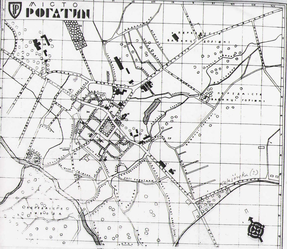
Howard Steinmetz sent me this map in order to share it with others interested in our shtetl. Donia Shwarzstein, another Rohatyner, got this map while she was in Rohatyn. She told me that the map "is unusual in that it is a map from the Nazi period and - as you can see it has the German Police station, etc. - and the ghetto, which was already then destroyed, is shown as a blank." The translations below were done by Donia: "it was painstaking work... with a magnifying glass because the print was so unclear and tiny; but it helped that I knew the town". Thank you Donia and Howard for your contributions to this web page.
There are two listings, the first of institutions, the second
of street names. You'll find the legend on the top and right
side of the map.
This page is hosted at no cost to the public by JewishGen, Inc.,
a non-profit corporation.
To support this and other projects of JewishGen, please consider
making a donation to JewishGen-erosity
Your contribution would be deeply appreciated.
Compiled by Phyllis Kramer z"l (1999-2019) and Alexander Feller
(2026-)
Last Update: June 1, 2026
Copyright © 1998 Phyllis Kramer z"l