Maps
Paterson is a city located in northeastern New Jersey (15 miles from New York City), the third most populous city in the state and the county seat of Passaic County. Detailed analysis of the 2011 U.S. Census Bureau data reveals that Paterson has the second-highest density of any U.S. city with over 100,000 people, behind only New York City. [From Wikipedia, the free encyclopedia.]
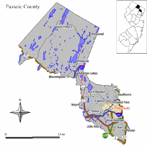
Map of Paterson in Passaic County, NJ, USA
(Inset shows relative location in NJ)
[Original work by Jim Irwin, December 2005, from Wikipedia.]
Google Map of Paterson
and surrounding towns
[Use this link for Google Earth's street view: then click on "more" and then "Zoom here"" and then drag the man to the location you want to see in street view. You can also first move the map around to find the street you want and then drag the man to that street for street view. Have fun exploring the map and modern-day Paterson.]
Street Name Changes
Click on above link for a list, compiled by the Passaic County Historical Society, of streets in Paterson that were renamed in later years. The current name is the one on modern maps.
Streets Added and Removed
Click on above link for a list, compiled by the Passaic County Historical Society, of streets in Paterson that were addded or removed over the years.