Logo
Olyka, Ukraine

Olik - אוליק
                                                                                               
Alternate names: Olyka [Rus, Ukr], Ołyka [Pol], Olik [Yid], Olika
Coordinates: 50°43' N, 25°49' E


Contents

Home
Maps
Pictures: People
Pictures: Places and Memories
History
Cemetery
Documents and Research Records
Memoirs and Family Stories
Yizkor Book
Additional Links and References
Acknowledgements

logo

JewishGen Home Page

logo

KehilaLinks Home Page

Description: C:\Users\Susana\Pictures\UKRAINE SIG.jpg
www.jewishgen.org/Ukraine/

http://www.jewishgen.org/jri-pl/header.750.jpg
www.jewishgen.org/jri-pl/
____________

Compiled by
Toby Brief Updated April 2015
Copyright © 2012-2015 Toby Brief
Email Toby
Webpage Design by Ronald Miller
Email Ron

Copyright © 2012 Toby Brief 

MAPS


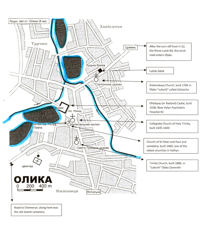
Below is an annotated map of Olyka. Areas or buildings which can be identified today are located. We hope to “build” a picture of what Jewish Olyka looked like pre-WWII. Click HERE for another view of the map and the clues we have collected. We hope to be able to incorporate the clues onto the map someday and re-create a better sense of the town.

image

LINK to JewishGen map with list of nearby communities. Various map viewing options are available.

https://www.jewishgen.org/Communities/community.php?usbgn=-1049331


View Larger Map

Use map features on the map above to view Olyka in various modes and also for expandings views.

Click to view a larger map then use browser <back page> to return to this page.


View Larger Map

Use map features on the map above to view Olyka in various modes and also for expandings views.

Click to view a larger map then use browser <back page> to return to this page.