 |
|
| Contents | |
| Lida Uezd Homepage | |
| Lida Uezd History | |
| Lida Uezd Towns | |
| Lida Uezd Maps |
|
| Searchable
Databases |
|
| Lida Uezd
during the Holocaust |
|
| JewishGen
Home Page |
|
| KehilaLinks
Home Page |
|
|
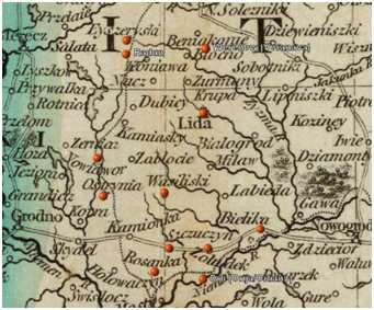
Aleksandrov Region
to the localities in this area! For instance, today's Zemaciu Namiestis was known as Aleksandrovo in the past.
There's another Tatarka in Belarus, near Minsk. There's another Aleksandrovo near Minsk.
compiled by Ellen Sadove Renck from the sources listed
Be careful when searching for information on this region! There are many larger places with names similarto the localities in this area! For instance, today's Zemaciu Namiestis was known as Aleksandrovo in the past.
There's another Tatarka in Belarus, near Minsk. There's another Aleksandrovo near Minsk.
This region of Lida District contained the following estates & villages:
Poletskishki vil., Aleksandrov area
Pogorodnia vil., Gorodnia Community, Aleksandrov area
Povilantsy vil., Gorodnia Community, Aleksandrov area
Zhiliantsy vil., Gorodnia Community, Aleksandrov area
Podli vil., Gorodnia Community, Aleksandrov area
Tatarka vil., Gorodnia Community, Aleksandrov area
Gorodno estate, Gorodnia Community, Aleksandrov area
Osova vil., Gorodnia Community, Aleksandrov area
Kozakovshchizna, Aleksandrov area
Vashkeli vil., Aleksandrov area
Pusiavory vil., Aleksandrov area
Narkushki estate, Aleksandrov area
Voidaki vil., Aleksandrov area
Dovgialy vil., Aleksandrov area
Malyie Dovgialy vil., Aleksandrov area
Iundzilishki vil., Aleksandrov area
Ianiantsy vil., Aleksandrov area
Kuzhi vil., Aleksandrov area
Drabishuny vil., Aleksandrov area
Doilinde vil., Aleksandrov area
Butrilantsy vil., Raklishki Community, Aleksandrov area
Novyie Raklishki estate, Raklishki Community, Aleksandrov area
List from an 1875 list of Jewish
families at the Lithuanian National Archives
Locating these villages on modern maps is quite challenging, and we haven't managed them all. However, the Yahoo group LidaRoots
has detailed maps of Poland from before 1939 in its files. IMap 32-40NE and map 32-40SE had to be joined. Some of the villages on this list are underlined in red,
and only part of the central section of the map is included. For orientation on modern maps, the village of Bastuny, at the lower right of this map, is on modern maps.
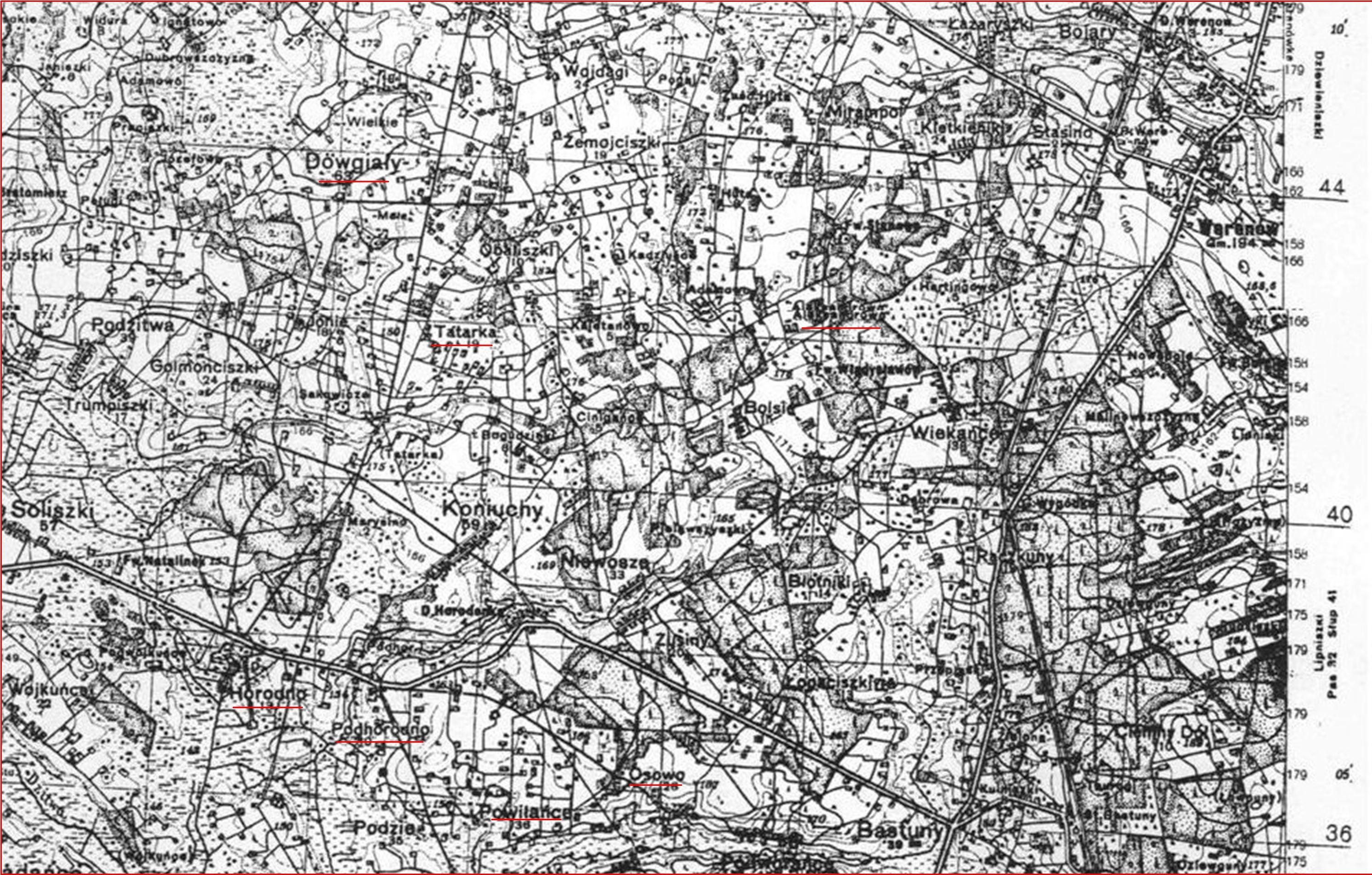
- WIG map 1:100,000 named Ejszyszki: Wyszukane mapy https://igrek.amzp.pl/result.php?cmd=id&god=P32_S40&cat=WIG100
- Map at igrek.amzp.pl https://igrek.amzp.pl/result.php?cmd=id&god=P32_S40&cat=WIG100
|
If
you have Lida uezd
materials to share, please considering donating it.
If you read Yiddish or Hebrew, please contact us.
Records are
held both in Grodno and Vilna archives.For Lida records translation,
your tax deductible contribution by credit card via the secure server
at either group or by mail will grow our knowledge. For a $100
donation, you receive all these records translated two years ahead of
their posting on JewishGen. Every penny collected is used for Lida uezd
projects only. Records include censuses; family lists; marriages,
births, death records; prenumeraten lists; and more. Please contact Judy Baston
with any questions.For current translations, please see the ALD:
All Lithuanian Database and Belarus
SIG Database.
|