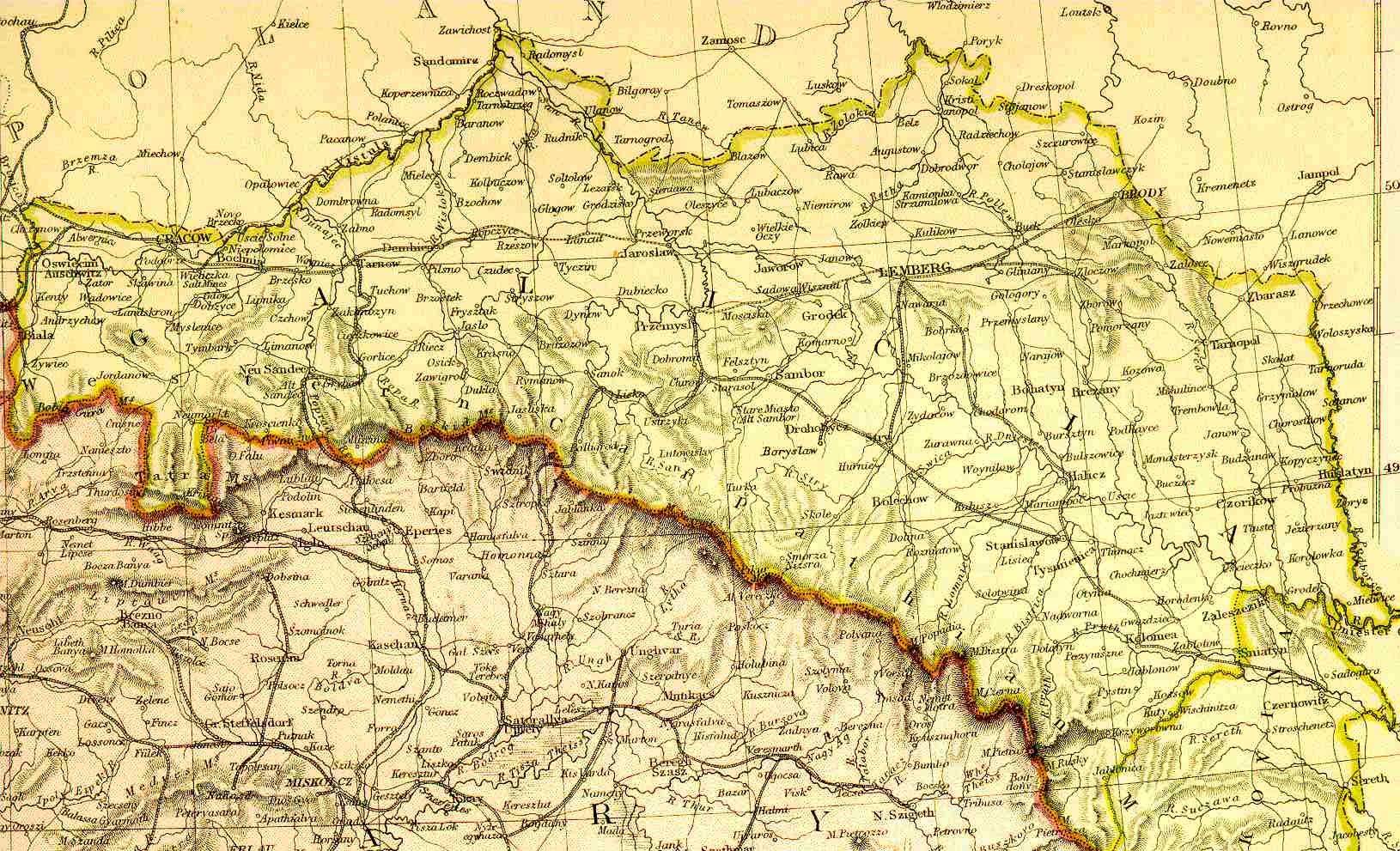
KehilaLinks

Stanisławów Maps


Contents

HOME

What's New

Maps

Photos

History

Ancestral Trip

Research

Acknowledgments

Google Map View of Stanisławów & Vicinity
(now Ivano Frankivsk, Ukraine)


View Larger Map

JewishGen Locality Page with maps, links to nearby communities and much more. DO NOT MISS THIS PAGE.
Map of Austro-Hungarian Empire (1882) -- Galicia from Blackie & Sons Atlas (Edinburgh, 1882).
Regional Area Map, showing the general region of Ivano Frankivsk, south of Lviv with clickable towns to some of the neighboring ShtetLinks sites Home Pages - Bolekhov, Delyatin, Dolina, Ivano Frankivsk, Kalush.
Excerpt from an area map showing an overview of Stanisławów with only the general shape of the major streets in town, from a 1905 military map. 
"Walk the Streets of Old Jewish Stanisławów!" An Interactive Tour & Database


Stanisławów Home | JewishGen Home | KehilaLinks Directory


Webpage created, compiled and maintained by Susannah Juni until 2001; compiled and maintained by Suzanne Scheraga since 2013.
Webmasters: David Richter and Suzanne Scheraga; Webpage Design by Ron Miller and Suzanne Scheraga
Email Suzanne Scheraga or David Richter
Copyright © 2013 Suzanne Scheraga