What is an Austrian
Administrative
District?
For most people today Galicia is place where people came from, parents, grandparents, or survivors. The very name belongs to a lost era and can evoke many emotions: sometimes feelings of nostalgia and longing, sometimes bitter memories.
The name, Galicia, has an ancient pedigree. In the mid 13th century, under the reign of a powerful prince, it became known as Regnum Galicia et Lodomeria, or the Kingdom of Galicia and Volhynia. Then for many centuries, while it was part of the Polish empire, it was known simply as Rus czerwona or Ziemnia ruska, red Rus or red earth. When the Polish Commonwealth was carved up by the three greedy powers, Prussia, Russia, and Austria, the new Austrian rulers reverted to the ancient name and created the two provinces, Galicia and the eastern section, Bukowina, formerly Volhynia.
After the First World War when Galicia once more became part of Poland, it was known as Małopolska. After the end of the Second World War, eastern Galicia became part of Western Ukraine and western Galicia became part of Poland.
Since the Middle Ages Jews have lived in Galicia with many other people: Armenians, Slovaks, Roma, Hungarians, Poles, Germans, Austrians, Ruthenians or Ukrainians, and the mountain tribes, the Boyko, Lemko, and Hutzuls. For Jews it was, at different times, a haven, a land of economic opportunity, wealth, and protection under the royal court, or a place of grinding poverty, religious persecution, contradictory and restrictive laws, and anti-Semitism.
When the army of the Third Reich invaded in the mid-twentieth century, ten centuries of Jewish life in what had been known as Galicia came to an end in the devastation of the Holocaust. An entire society was annihilated. This site is dedicated to remembering that society.
Galicia became a crown land (Kronland) of the Austrian Empire in 1772. To govern the new province, the Austrian government divided it into circles (Kreise) with smaller units, called districts. This system was modified in 1783 to eighteen circles and remained in place until about 1865. During this period, the towns of Drohobycz, Borysław, and neighbouring, smaller towns and villages were part of the Sambor Circle.
By 1867, these circles had been eliminated and replaced by a system in which the area was divided into districts. From 1867 to 1918, the area around Drohobycz was part of the Drohobycz Administrative District. This system was used until the end of the First World War when Galicia became part of Poland.
© Valerie Schatzker 2016
This page is hosted at no cost to the public by JewishGen, Inc., a non-profit corporation. If you feel there is a benefit to you in accessing this site, your JewishGenerosity is appreciated.
Where was Galicia?
You will not find it
on a modern map
Galicia
A Brief Hisory
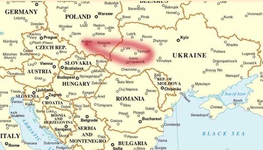
The province of Galicia in the Austro-Hungarian Empire was a crescent-shaped area of land from Kraków in the west, to the Romanian border in the southeast, following the northern slopes of the Carpathian Mountains. In this area to the north of the mountains a vast depression, the sub-Carpathian or Galician depression, extended. This depression is traversed by three main rivers, the Vistula, the San, and the Dniester.
The western section, known as western Galicia is a triangular area with its apexes at Kraków, Sandomierz, and Przemyśl. By the early nineteenth century, this area had already been denuded of its forests and its iron and salt mining industries had all but disappeared. Former western Galicia is now part of modern Poland.
The eastern section of the Galician depression is swampy and subject to flooding. It was rich in oil, ozokerite, layers of rock salt and potash salts. It is also famous for salt springs which supply famous spas. Former eastern Galicia is now part of modern Ukraine.
The part of Galicia that was home to the Drohobycz Administratve District is known geographically as Prikarpatye or Podkarpatye (literally: near the Carpathian Mountains or the Carpathian foothills). The mountains are covered with evergreen forests, and numerous mountains streams flow among the rolling hills. The scenery is similar to Vermont in New England.
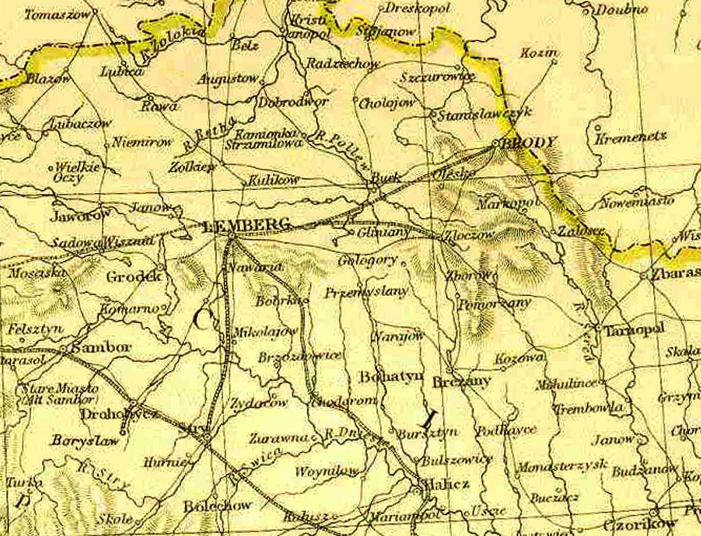
A contemporaty map below roughly shows the borders of Galicia when it was part of the Austrian Empire.