Notes concerning Gorsdy Postcards -
Rönne family; Bridge over Minija River; Minijos gatve (Street)
Postcards provided courtesy of S. Arthur Boruchoff, M.D.
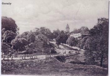
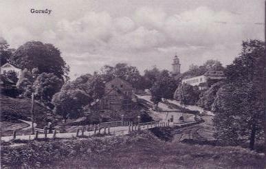
This page concerns two of the postcards which Dr. Henry and Frances Boruchoff obtained on their trip to Lithuania in 1923. The two cards are based on the identical photograph, as is shown by the location of the people on the road.
The same postcard also appears in the Gorzd Memorial Book, p. 11 [Image 490], posted by the New York Public Library.
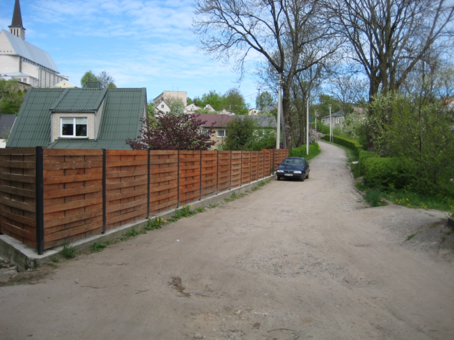
The building at the far left of the lower postcard is the chapel. For a
present day view of the chapel, click here.
Yellow peak of chapel roof is also visible in the following view from the
foot of Minijos gatve, which is the street from the north center of
Gargzdai to the Minija River:
The buildings at right of postcards (the tower and roofless building, evidently part of the palace) had been part of the estate of the Rönne family. A history of the family is given in Janina Valanciute, Gargzdu miesto ir parapijos istorija, Vilnius: Diemedzio Leidykla, 1998 (ISBN 9986-23-047-0). The English summary at page 503 indicates that the owner of the estate from 1875 to 1895 was Baron Eugenijus Rönne, and then his widow Gabriele until 1912. The estate suffered damage during World War I. The absence of a roof in the postacard photos may reflect this wartime damage.
The Baron's sister Anele owned lands on the east bank of the Minija,
which gave rise to the placename Anieliske
(or Anielin). For further information about lands owned by the
Rönne family, see the following sections of the present site:
Greetings
from Garsden (Palace)
Blick
von Schlossplatz (View from Palace Grounds)
For further information about the Rönne family, see Family
von
Rönne in the Baltics, page 28 (VR 194c) - information about
Felix II Baron Rönne (b. ca. 1797), his son Eugene Baron Rönne (1830 -
1895), Eugene's wife Gabriela Princess Oginska, and Eugene's sister,
Aniele Amalia Baroness Rönne. For additional information about the Rönne
family (in German) and picture of Eugene Baron Rönne, see
Baron Rönne in Litauen, page 14 (VR063a). Eugene was a noted
poet and dramatist. See also genealogy pages at geni.com regarding Aniela
Helena Mielżyńska (Rönne), Eugeniusz
von Rönne, Feliks
Filip von Rönne and Baron
Felix von Rönne.
In Yiddish, the Baron was called the "Graff," Gorzd
Memorial Book, p. 43 [Image 458], which means "Count" or "Earl." A.
Harkavy, Yiddish - English - Hebrew Dictionary (YIVO Institute, 1928). He
is mentioned in Gordz
as she lives in Our Memory, by Yehudis Lashem, in the Jewishgen
Translation of the Gordz Memorial Book.
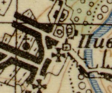
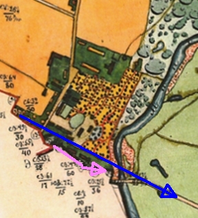
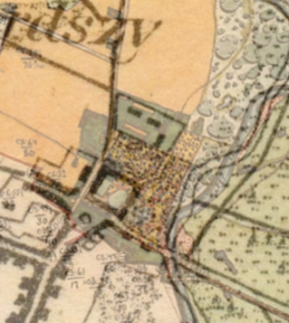
The Town Diagram in the Gorzd
Memorial Book [Image 12], indicates that the bridge pictured in the
postcards is an overpass over a road or path, and was not the bridge over
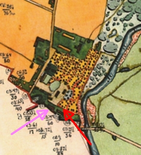
the Minija. This small bridge appears on one available map - Russian
Military, ca. 1910 (1:50,000) (see pink arrow below), which shows
that this path led to the Jewish Cemetery. This map also contains the
symbol for a mill (green arrow), which may be the building
in the mid-foreground of the postcard.
|
|
|
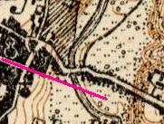
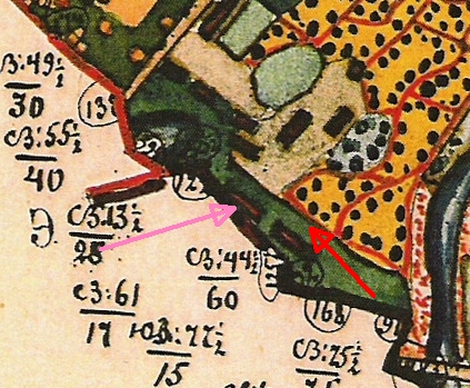
Comparison
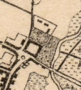
between the aerial photos of January, 1945, and the 1886 Russian map
of estate lands, while not an exact process, suggests that the
palace shown in the postcards had not yet been constructed in
1886. In the diagrams below, red arrow points to approximate
location of palace, which seems to be north of building shown on the
map. The 1886 map may show the brewery (purple arrow), ruins of
which are visible in the aerials.
 |
 |
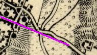
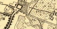
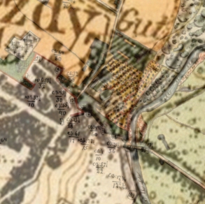
I. Road heads from Catholic cemetery through town center directly to river and approximately straight across. See Russian Empire (1866-1872); Prussian General Staff Map (1860); Karte des Deutschen Reiches (1860 - 1880; supplemented 1910).
 |
 |
| Bridge
location ca. 1860 (?) Karte des Deutschen Reiches (1860 - 1880; supplemented 1910) |
Enlarged view |
 |
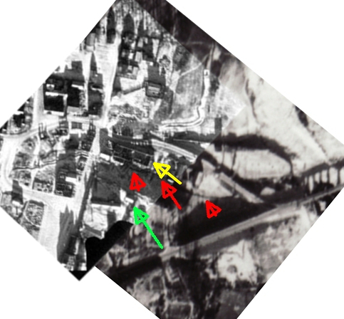 |
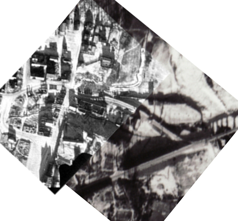
| Blend of aerial # 157
and # 158
(January 16, 1945) |
Red arrows show possible remnant
of original Bravoras Mountain Way. Yellow arrow shows brewery ruins. Light green arrow shows chapel. Brewery may be visible in pre-war postcard of Minijos gatve at miestai.net (group # 5) |
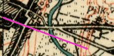
II. Russian Map of Estate Lands (1886) shows that the bridge was moved slightly south, and angled somewhat more to the northeast when crossing the river from west to east. Valanciute, p. 502 says bridge was reconstructed in 1853-54, and in 1864-67, and its "location was slightly changed."
 |
 |
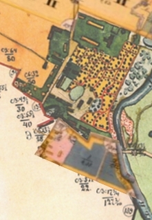 |
| Bridge in 1886 Map does not show location of approach road to bridge from west. |
Blended view comparing Bridge in 1860 (?) and 1886 | Strip
from 1862, showing church lands, added to 1886 map Note: placement of strip is uncertain |
|
|
|
| 1913-1915 |
1921-1929 |
V. Direct road constructed from town center to bridge. See Birman photo October, 1937; Lithuanian Army Topographic (1938); photo postcard of road construction at miestai.net, group # 5 (third postcard).
VII. Aerial photo, January 16, 1945 shows temporary
military bridge to south of bombed concrete bridge.
VIII. Present bridge rebuilt in 1955. Valanciute, p. 508.
Other sources of information:
Postard from ca. 1930 showing Minijos g. from the top and showing brewery on right. miestai.net at #5
Gargzdai Area Museum announcing an exhibit regarding the history of bridge. The announcement summarizes the history, and includes a 1949 photograph showing reconstruction after the War.
Aerial photo of current bridge on Google
Earth.
 |
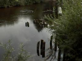 |
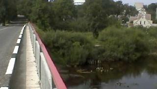
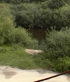
| Landing at foot of Minijos gatve - possible remnant of a prior bridge? |
View of river and pilings from landing. A resident of Gargzdai indicates these pilings are not remnants of a bridge, but instead are to protect the bridge from ice in winter. |
|
|
|
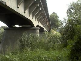
| View of landing and pilings from bridge | Bridge in 2001 |
This page updated 3/23/2020
Copyright © 2004 - 2020 John S. Jaffer