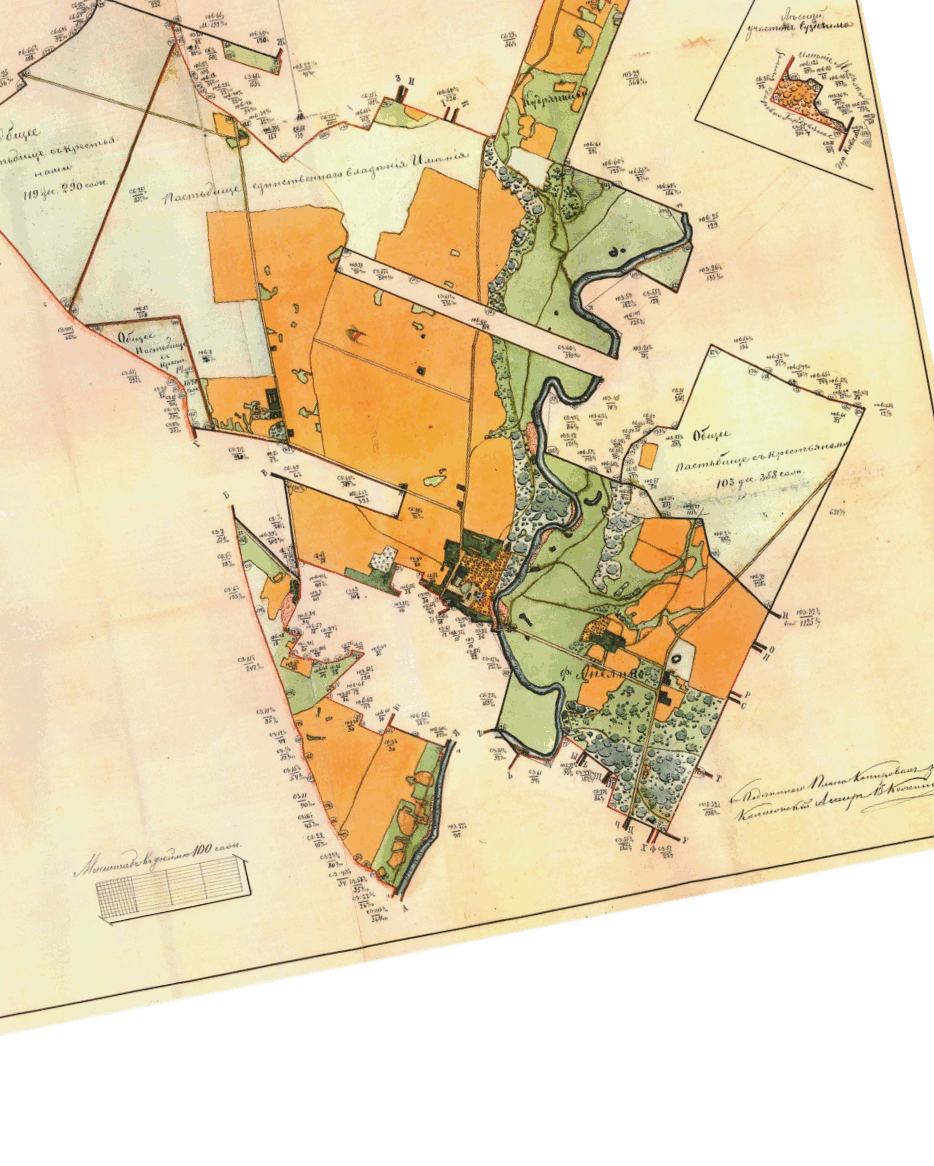
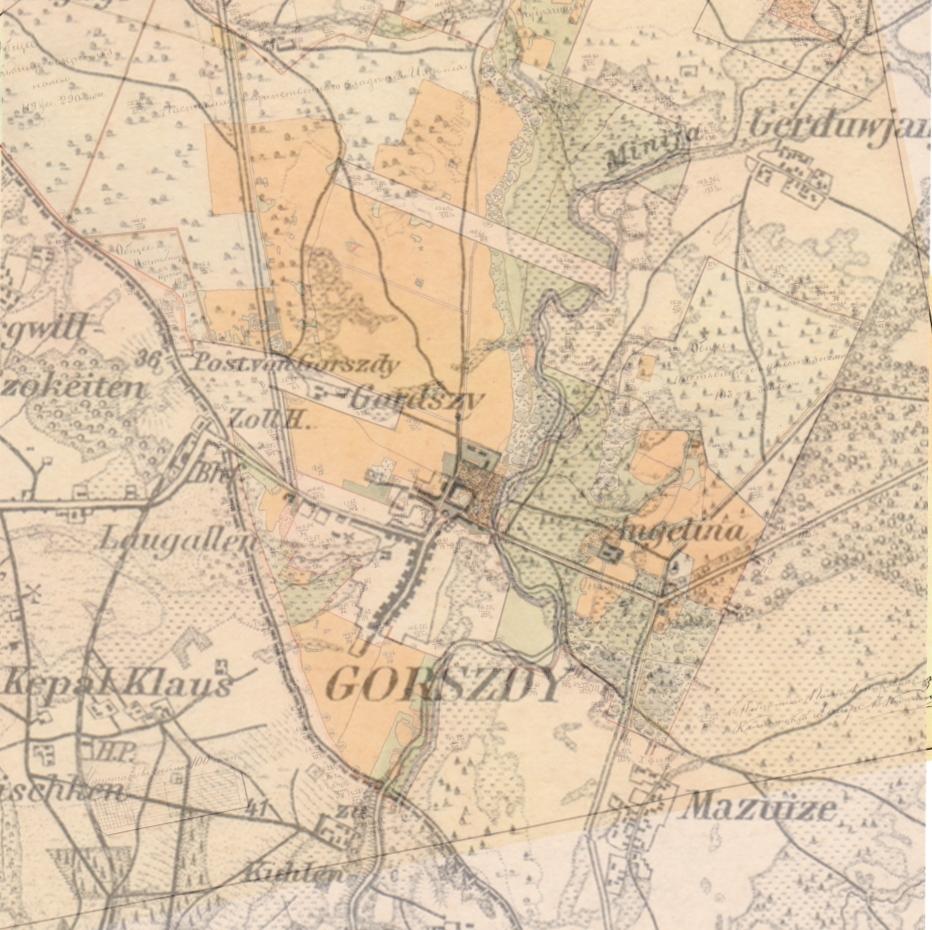
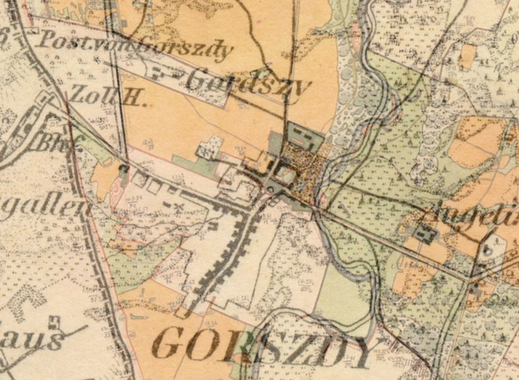
Comparison of Russian Map of Estate Lands
Surrounding Gargzdai (1886)
with
Karte des Deutschen Reiches
(1860, New Edition 1880, Suppl. 1910)
The following animation compares Russian
Map of Estate Lands Surrounding Gargzdai (1886) with
Karte
des Deutschen Reiches, Sheet 4, Paaschken (1860, new
edition 1880, supplemented 1910). A comparison is helpful
because the Russian map omits the town itself and other lands
not part of the Estate. The omitted areas may be
filled in by comparison with the German map, which is the
complete map closest in time to the Russian one.
At top of page is a .gif animatiion, which may not
be visible in some browsers or operating systems. At
bottom are two blended versions showing both maps.