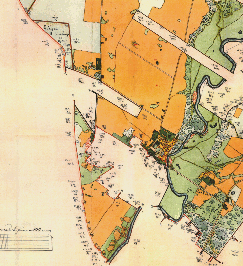
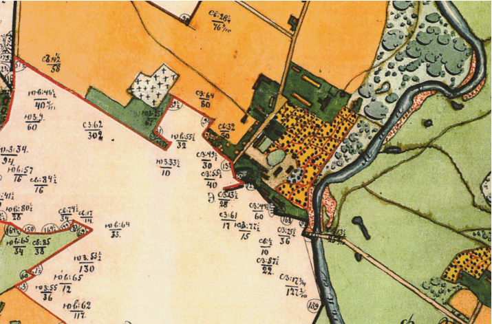
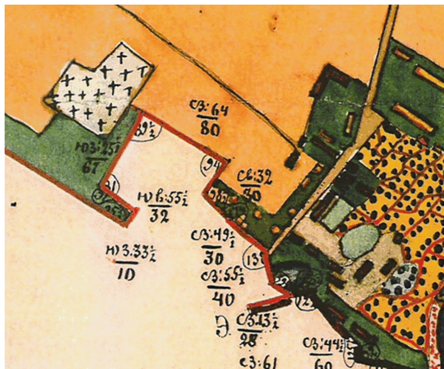
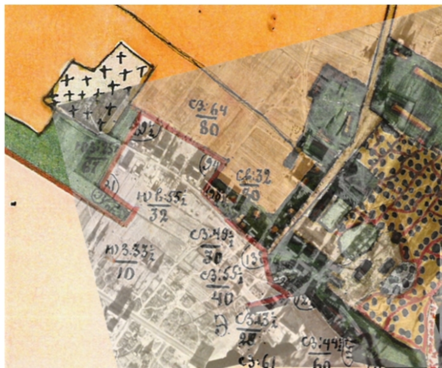
Comparison of Aerial Photographs (1945) with
Russian Map of Estate Lands Surrounding Gargzdai
(1886)
A comparison between Russian
Map of Estate Lands Surrounding Gargzdai (1886) with aerial
photos # 158 and 157
shows that many features on the ground in 1945 had been carried over
from the time of the Estate.
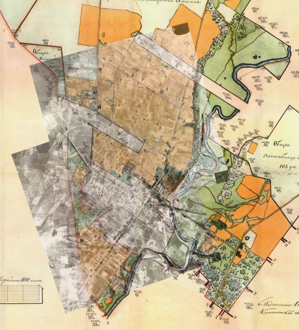
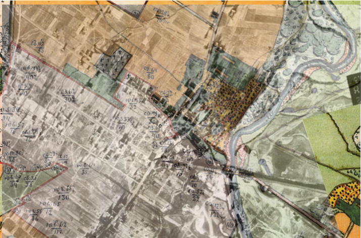
Comparison is not an exact process because of inaccuracies
in map, distortions in photographs, and impossibility of any flat map or
photo to duplicate curvature of the earth. Different comparisons
are possible, depending on which features are aligned.
In each pair below, the top image is a .gif animatiion
comparing the map and photographs, which may not be visible in some
browsers or operating systems. The bottom of each pair is a
blended version showing the map and photographs.