Photo courtesy Mitchell Polman, 2020
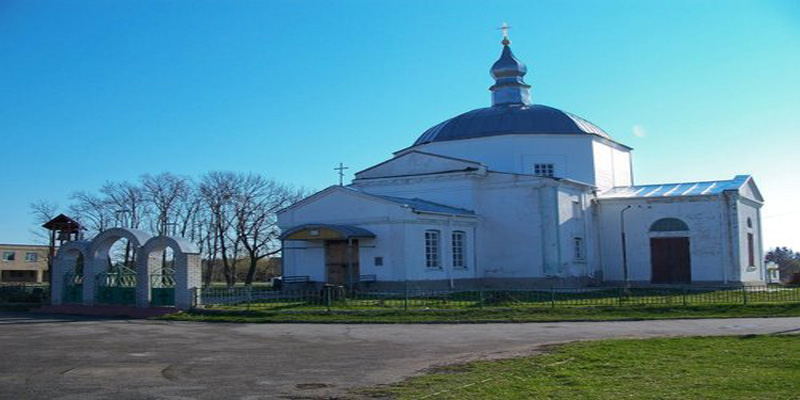
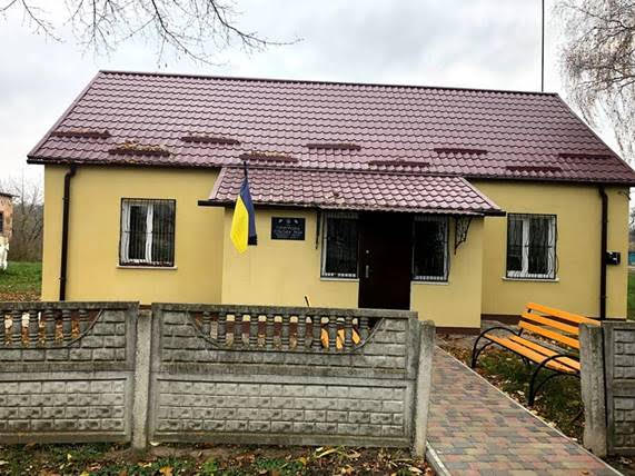
This is the village government offices. It may have been a shul,
synagogue or
beit midrash at one time. When I visited in 1995 there was a bust
of Lenin
in front of it.
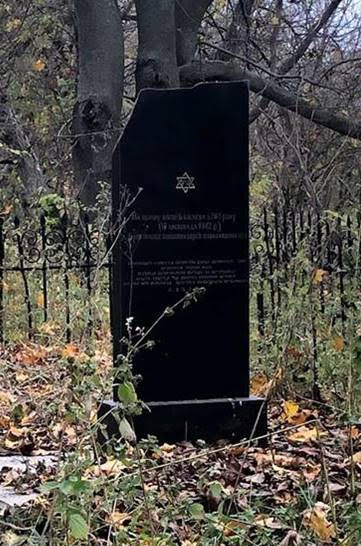
Photo courtesy Mitchell Polman, 2020
First of two mass grave sites from the Holocaust.
I was told that every year on the anniversary of
the killings the village school children lay flowers
on the mass graves and have a moment of silence.
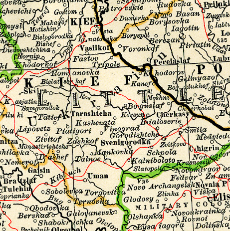
P'yatyhory & Its Surroundings
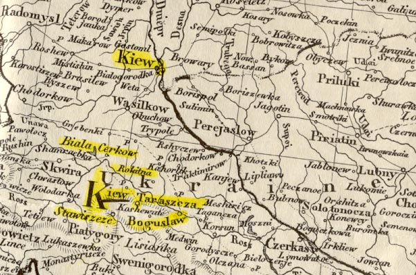
The history of Poland and Ukraine is one of political domination by a variety of different countries.
As a consequence, there are several different transliterations of P'yatyhory's name into English:
P'yatyhory [Ukrainian]
Pyatigory [Russian]
Piatohor [Yiddish]
Piatyhory [Polish]
The Ukrainian and Yiddish language versions of P'yatyhory are, respectively:
Stavishche is located twelve miles east of P'yatyhory. At the start of the twentieth century 3,917 Jews
lived in the town.1
A yizkor book exists and has been translated
into English by Ida Selavan Schwarcz.
The Stavishche Kehilalink, sponsored by Vivian M. Linderman,
contains a great deal of information about this shtetl.
More can be read at the Ukraine SIG Town Page
and at the JewishGen
Stavishche Community Page.
Tarashcha
Thirty miles east-northeast of P'yatyhory and sixty miles south of Kiev, is the small town of Tarashcha.
Tarashcha experienced a significant decline in population during the half-century prior to World War II;
the Jewish population dropped from 4,905 people
in 1897 to 1,140 people in 1939. This decline was due, in part, to emigration in search of jobs. Many other Jews, however,
left as a result of the pogroms that swirled around the Russian Civil War of 1919 - 1921.
The Tarashcha Kehilalink contains much material
on these pogroms, including a victims list, as well as reports on the Nazi crimes during World War II.
Also of some interest are the JewishGen
Tarashcha Community Page and the Ukraine SIG's Town Page.
Tetiyev
Tetiev is situated twelve miles west of P'yatyhory.1 In 1900, Tetiev had a Jewish population of 3,323.
There have been a few documents written about Tetiev and the pogroms of 1919-1920 that took place in the town
and surrounding communities. You can read more about Tetiev and these horrific times on the
Tetiev KehilaLinks Site on JewishGen.
The Kiev Gubernia is situated on a vast fertile plain that rises southward
towards the southern steppes. The northern region consists of large swamps.
The plain is drained by the Dnieper River system, which is fed by several
tributaries, among which is the Ros River which flows to the west of Tarashcha,
circles to its north and then moves southeastward past Boguslov, emptying into
the Dnieper River on the eastern edge of the Kiev Gubernia.
The Kievian climate is dry, with average annual rainfall of 25.6 inches. The
average annual temperature for the region is 45° F, varying from a winter average value
of 13.1° F to 54.5° F during the summer.
Sixty percent of the land area, consisting of fertile black soil is devoted
to agriculture; forests and grasslands make up the remaining land.
The region around P'yatyhory consists of wide meadows and rich agricultural land.
The village of P'yatyhory encompasses 4,129 acres of arable land.
A significant portion of the population is involved in agricultural work.
Throughout the nineteenth century and into the
1920's, the region was known
as the breadbasket of Europe, producing large quantities of grain: oats, wheat,
barley, rye, millet, and buckwheat. Other agricultural products were beets,
potatoes, vegetables, pears, nuts, and hemp. The grasslands supported the
raisng of horses, cattle, and sheep.
Important industries during the 1880's were the production of beet sugar and
tobacco; distilleries; flour mills; and tanneries. Peasants made their own
tools as well as boats and carts. The Jewish population was involved in trade.
By the beginning of the twentieth century, peasants owned 45% of the land in
the Kiev Gubernia; the nobility owned about 41%. After Stalin forced the kulaks (former peasants who became affluent independent farmers)
onto the collective farms in the 1930's, the breadbasket
of Europe was no more.
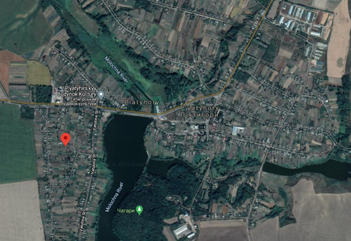
P'yatyhory, a village in southwestern Ukraine, near the Molochna (Milky) River, can be traced back to at least the sixteenth century.
Prior to 1596, the village was an hereditary estate known as Trynozhyna. The ownership of the hereditary family was lost as a result of
damage done by Tatar raids. The new owner changed the village name to P'yatyhory and then proceeded to build defensive
fortifications against further Tatar attacks.
During the mid-seventeenth-century Khmelnytsky (a Cossack military leader) uprising to free Ukraine of Polish domination,
there was a 1655 battle fought near P'yatyhory. The Poles and their Tatar allies were defeated with heavy losses. Many
thousands of Ukrainian Jews were brutally massacred by Bohdan Khmelnitsky and his followers during the eight year period ending in 1656;
Jews living in P'yatyhory were among the victims of Khmelnitsky's attempt to expunge Ukraine of all Jews.
The oppression by the Polish nobilty of Ukrainian cossacks and peasants who lived west of the Dneiper River led, in 1768, to
the Koliivshchyna (Haydamak) rebellion. Thousands of Polish noblemen and ordinary Poles, Jews, and Catholic priests were massacred during
the year-long uprising. During this revolt, too, P'yatyhory Jews were included among the victims.
The second partition of Poland in 1793 resulted in the region of Poland west of the Dnieper River coming under the political control
of Tsarist Russia.
P'yatyhory was designated the county seat of Bratslav Gubernia. Four years later, the village was downgraded to an ordinary town in Kiev Province.
P'yatyhory has three Jewish cemeteries, two of which are mass graves dug during 1941 under Nazi occupation
to contain the bodies of P'yatyhory's murdered Jews.
There are no markers to distinguish these mass graves.
The International Association of Jewish Genealogical Societies has surveyed these cemeteries through its International Jewish
Cemetery Project and has placed its
report online detailing the location and status of the cemeteries.
Many eastern Europeans, after arriving in the United States and in other countries, formed community associations or
landsmanschaft (Yiddish) with other "landsman" who were now beginning a new life in a new land.
These associations were often extensions of those that existed in their hometowns. The groups helped new
immigrants navigate the complexities of the new world while providing a foundation of old and new friends from back home.
Along with hosting meetings and social activities, the associations also raised money for landsman in need and to send
back to those remaining in the country of origin. Many associations also encouraged their members to write down their
remembrances
and then publish books memorializing their towns and its residents killed during the Russian Revolution and during the Holocaust.
These books, known as Yizkor books, can be found in libraries throughout the world. Unfortunately, there does not appear to be
a Yizkor book for the shtetl of Pyatigory.
Yivo, located in New York City, has a large collection of Landsmanshaftn. Included in this collection are the
records for the
Piatigory Landsmanshaft, Piaterer Progressive Benevolent Society, Inc. These records, found in Record Group 1085,
are for the years 1926 and 1939 - 1970's. They consist of the 1926 Certificate of Incorporation; minutes for the 1939 - 1967
period; a dues ledger; correspondence; and photographs.
The New York City Piaterer Progressive Benevolent Society, Inc. was established in 1925 and incorporated
the following year.
The society provided relief for Piatigory Jews after the First World War. During the Second World War, the benevolent
society provided aid to landslayt with the help of the Russian War Relief. After The War, the
Piaterer Progressive Benevolent Society built a youth center in Israel2.
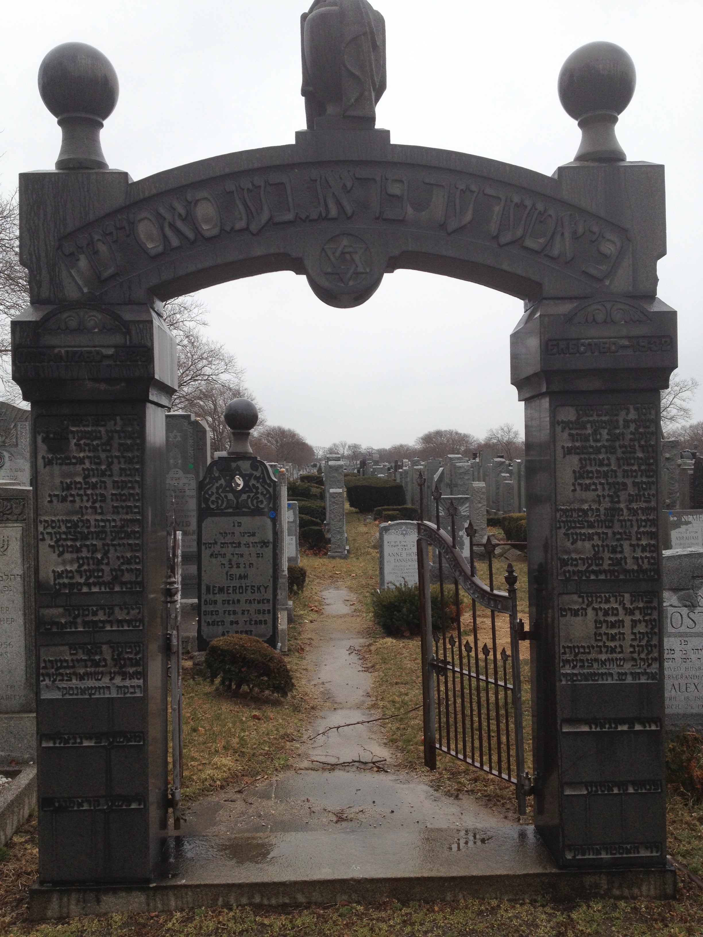
Society Gate Beth David Cemetery Elmont, N.Y. (credit: Michael Moritz)
(click to enlarge)
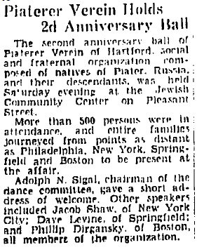
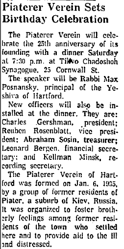
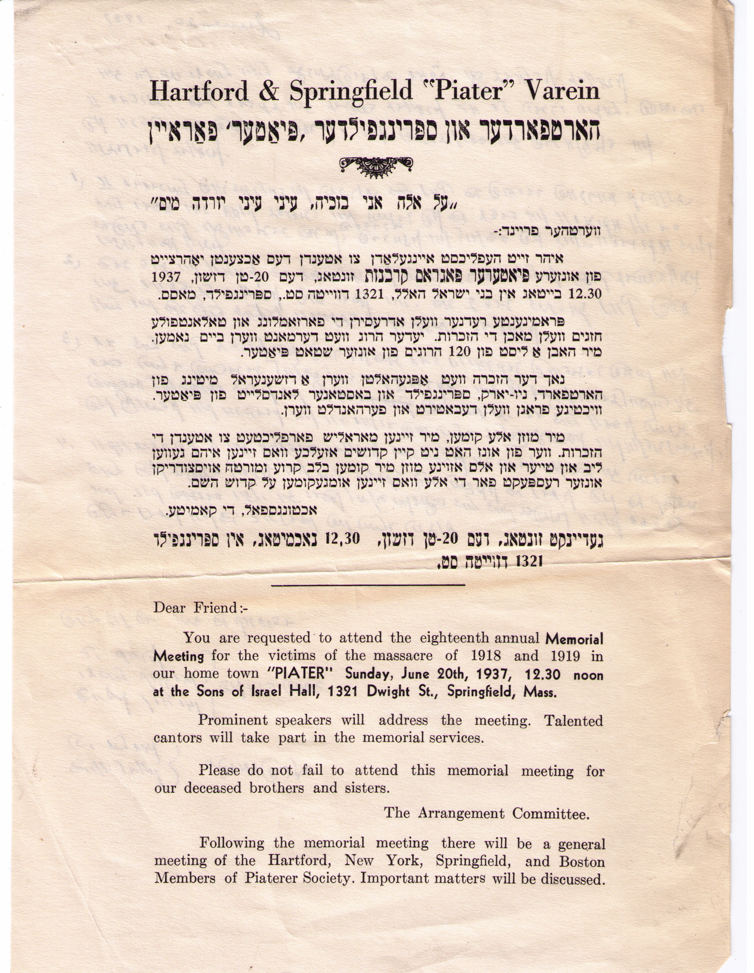
Below are two newspaper articles from the Hartford Courant announcing the anniversaries celebrating the
establishment of the Piaterer Verein. Beneath the newspaper articles is a flyer for the 1937 meeting
of the Hartford and Springfield Piater Varein.
1JewishGen Community Page 2From Alexandrovsk to Zyrardow, A Guide to Yivo's Landsmanshaftn Archive by Rosaline Schwartz & Susan Milamed
(publ. 1986); p. 42.