
קרית טבעוֹן Coordinates: 32° 43' 26.00" N 35° 07' 38.00" E 
|
||
|
קרית טבעוֹן Coordinates: 32° 43' 26.00" N 35° 07' 38.00" E
|
||
| Home | Maps | Links | Census |
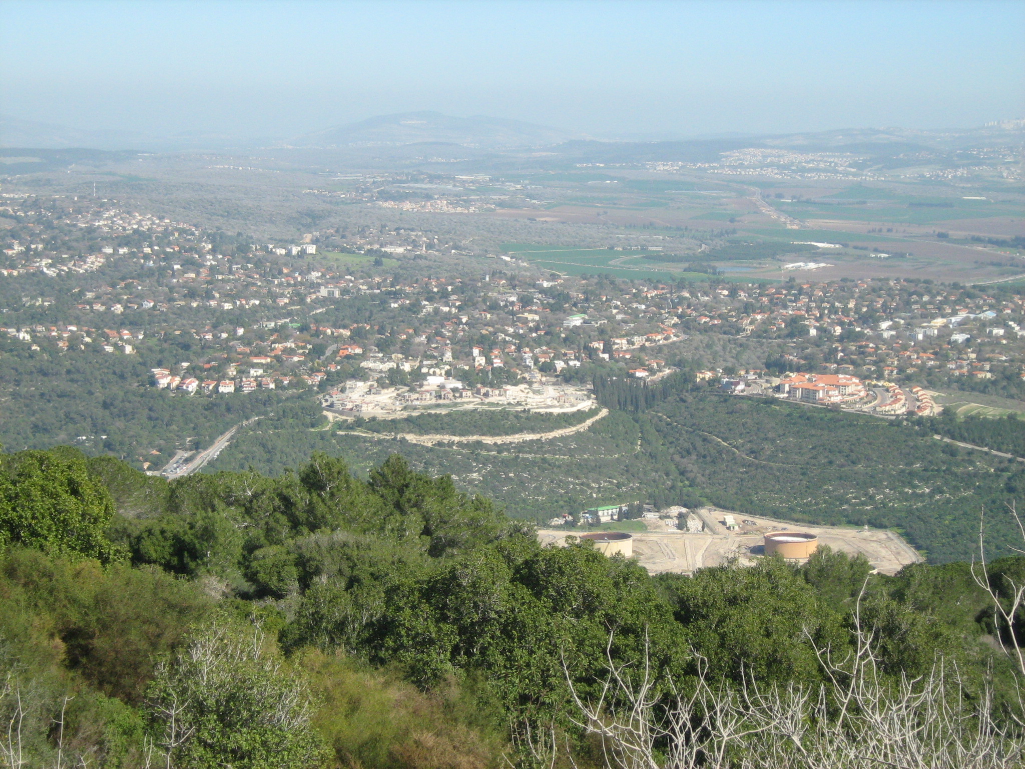
Kiryat Tiv'on1 is a hill town, on the main road to Nazareth, located between the Zebulon and Jezreel Valleys. Haifa is fifteen kilometers northwest of Kiryat Tiv'on. The following three settlements, Tiv'on, Elro'i, and Kiryat Amal merged into a single municipal entity, calling itself Kiryat Tiv'on, in 1958; Kiryat HaRoshet joined the group in 1979. These settlements were founded, respectively, in 1947, 1935, 1937, and 1935.
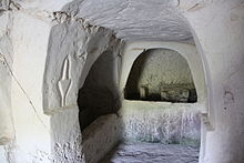
Southwest of Kiryat Tiv'on is a national park, Beit She'arim ('House of the Gates'). During Roman times the town of Beit She'arim2 was a Jewish spiritual center and necropolis. The latter is the most ancient extensive Jewish Cemetery, containing many inscriptions in Hebrew, Aramaic, and Greek. At one time Beit She'arim was the seat of the Sanhedrin 3.
During the late Ottoman Period, in 1859, the village of Tubaun encompassed an area of farmland of twenty-two feddans, approximately equivalent to 22.836 acres. An 1875 visitor to the region, Victor Guérin, noted that Tubaun had about two-hundred residents. Six years later a survey of Palestine described the village as consisting of adobe buildings sited on high ground near a wood. A census taken in 1887 counted ninety people living in Tubaun; all the residents were Muslim.
Soon after the British Mandate was established in Palestine, the mandate authorities took a census of its newly acquired land; the 1922 population of Tub'un was then one-hundred-fifty-one Muslims. Nine years later, the British Mandate Authorities decided to take another census. The result of this 1931 count indicated that Tabun had a population of two-hundred-thirty-nine Muslim residents; no other religious group lived in the village.
In the mid-1920's a Zionist organization purchased thirty feddans (about thirty-one acres) from the Sursak family. The purchased land was located in Kiskis and Tabon, currently the villages of Alonim and Kiryat Tiv'on. Even though the land had been fairly purchased, the Jewish Agency was not able to take immediate possession of the farmland from the tenant farmers.
Notable Residents
|
Please contact Leah Haber Gedalia with your additions, questions, corrections, or comments! webmaster: richard L. baum |
|
This page is hosted at no cost to the public by JewishGen, Inc., a non-profit corporation. If it has been useful to you, or if you are moved by the effort to preserve the memory of our lost communities, your JewishGen-erosity would be deeply appreciated. |
|
KehilaLinks Home |
JewishGen Home
|
Created: 30 June 2018
Last Modified: 07-08-2018
Copyright © 2018 Leah Gedalia
All Rights Reserved.