| Home Page |
| Agricultural Colonies |
| Maps |
| Memories |
| Pictures |
| Bibliography |

Kolonia Yakovlevo
Yakovleva, Belarus
Maps
|
Kolonia Yakovlevo
|
|
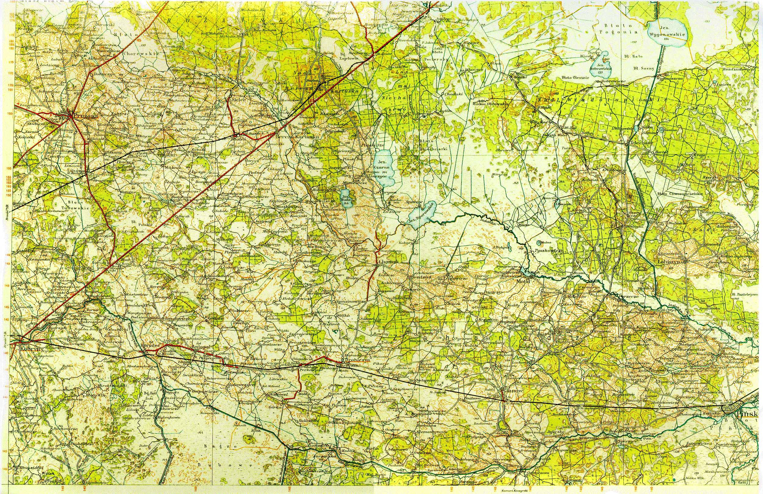
A section of a detailed map from 1930 (retrieved from stephenmorse.org). Go to this link to see the complete map of the region. Half-way between Drohiczyn and Janow, along the train route, you will see Ogdemier. Just above that, you will see Hutowo, and to the immediate southwest, Kolonia Jakowlewo. (Kolonia is abbreviated as Kol. The second half of the word Jakowlewo is underneath the first half.)  Map image above links to larger size map (18 inches wide) These black and white maps can be placed side by side, connecting along the railroad line, where Drohiczyn is on the left side. (From the Collections of the Library of Congress Geography and Map Division.) 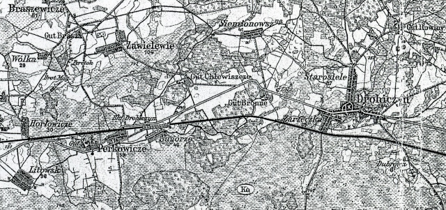
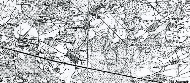
A small section of the 3rd Military Mapping Survey of Austria-Hungary showing Yakovleva. 
See: Polish Military Tactical Map
|
|||||||
|
Compiled by Debbie Kroopkin with significant research and input by Miriam Steinberg, who has visited the site of Yakovlevo. Last updated 21 January 2021 Copyright © 2010 Debbie Kroopkin Webmaster: Ron Miller | |
|
This site is hosted at no cost by JewishGen, Inc., the Home of Jewish Genealogy. If you have been aided in your research by this site and wish to further our mission of preserving our history for future generations, your JewishGen-erosity is greatly appreciated. | |
JewishGen KehilaLinks Directory |
JewishGen Home Page |