|
Podu Turcului, Romania
Coordinates: 46.204°N 27.386°E |

|
|
Podu Turcului, Romania
Coordinates: 46.204°N 27.386°E |

|
| Home | Maps | Photos | Cemetery | Memoirs | Database | Contact |
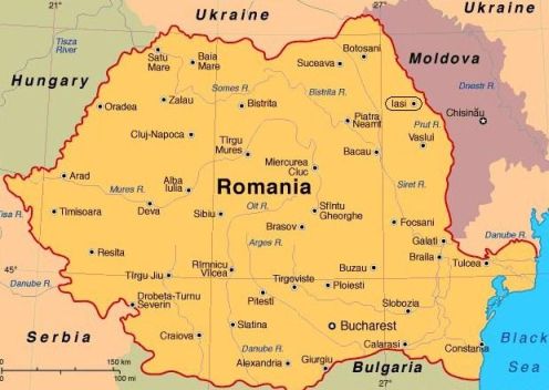
The map on the left below shows modern-day Romania. The city of Bacău is in the northeast, a little southwest of Iaşi, which is circled on the map. The map on the right (from Wikipedia) shows the location of Bacău County in today’s Romania.


The map below (from Wikipedia) shows the extent of Romania in 1942. It included areas that are now in Moldova and Ukraine, but some areas of modern Romania belonged to Hungary at that time. Bacău County is the yellow block just to the east near the end of the tongue of Hungary that protruded into Romania. Click on the that map to see it full-size in a new tab.
For additional geographic information, see the JewishGen locality page for Podu Turcului.
| JewishGen Home Page | KehilaLinks Directory | Romania SIG |
|
Compiled and copyright ©2025 by
Jay Sage.
Site last updated: 13 July 2025 |
||