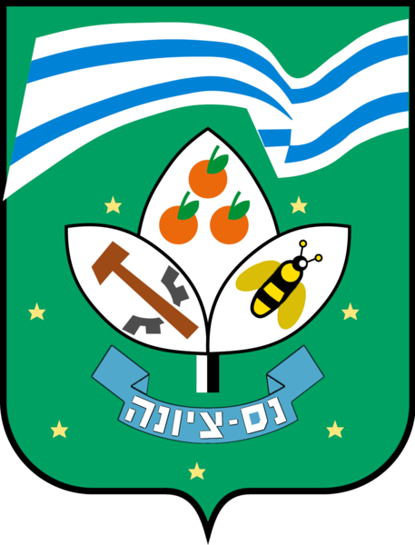
נס ציונה ישׂראל Coordinates: 31° 56' N 34° 48' E 
|
||

נס ציונה ישׂראל Coordinates: 31° 56' N 34° 48' E 
|
||
| Home | Maps | Community | The Fallen | Links | Census |

Ness Ziona (Hebrew: Nes Tziyona), founded in 1883, is located on Israel's coastal plain, ten kilometers from the Mediterranean Sea and south of Tel Aviv. It has an area of 15.579 square kilometers (6.015 miles2) and a 2015 population of 46,891 people.
The Babylonian Talmud states that during the Second Temple period it was customary to ask, when the first of the barley and wheat harvests (Omer) were brought to the Temple, where the harvests were reaped; it was not permissible to bring them from outside the land of Israel. On one occasion, the authorities did not know the source of the Omer. A deaf mute, who knew the source, tried to communicate with his hands by pointing to makeshift booths (tzarifin) and then to rooftops (ğağōth); the latter rhymed with "gardens" (ğinōth). No one knew of a place called Ğağōth Tzarifin (Rooftops of the Booths). The sages eventually realized that there was a place called Inōt Tzarifīn and accepted the deaf-mute's offering of the Omer. The ruin of an Arab Village, Arfān (Hebrew: Inōt Tzarifīn), lies within Ness Ziona's city limits.
Ness Ziona was first known as Wadi Chanin named after the local Arab village; later, in 1883, it was known as Nahalat Reuben (Reuben's Estate), named after Reuben Lehrer, who founded a Jewish settlement there in that year. Five years earlier, the German Templer Gustav Reisler purchased land in Wadi Hunayn where he planted an orchard and lived with his family. Wadi Chanin became the standard Western name for the place. After Reisler's wife and children died from malaria, he returned to Europe. In 1882, Reisler traveled to Odessa where he met Reuben Lehrer, a religiously observant Russian Jew with Zionist ideals. Lehrer owned farmland in Russia; Reisler traded his Palestine land for Lehrer's land.
Lehrer made aliyah (immigrated to Palestine) with his eldest son Moshe in 1883; his wife and four of his children arrived over the following year. Lehrer placed ads near Jaffa port inviting others to join him. The pioneers established a neighborhood named Tel Aviv (the city of that name did not yet exist) within the Wadi Chanin region. In 1888, Avraham Yalovsky, a blacksmith, was killed defending his property from Arab gangs.
Ness Ziona has a conservation center and memorial, Beit Rishonim (Founders' House), that documents the history of the colony since its founding by Reuven Lehrer and his family.
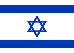
In 1891 Michael Halperin purchased land in Wadi Chanin. Halperin gathered a group of people on the Hill of Love where he unfurled a blue and white flag with the words "Ness Ziona" ("Banner to Zion") emblazoned in gold. This motto is based on a verse in the Book of Jeremiah (Jeremiah 4:6). The flag is similar to the official flag of Israel adopted at the first Zionist Congress seven years later.
On the first day of 1891, according to historical sources, the Reuven Estate settlement's first newborn male had his Brith. A local youngster, Michael Halperin, arrived riding his horse and waving a blue and white flag inscribed with the words Nes Zioyyna, meaning Banner to Zion. This was a very brave gesture in an era when the Ottoman authorities prohibited the hoisting of any flag. This action led the settlers to change the settlement's name to Nes Zioyyna. There is no known source that describes Halperin's flag. A reconstruction of what Halperin's flag may have looked like can be found on Nes Ziona's municipal website. (source: Dov Gutterman, 29 Aug. 2001). Wikipedia (Hebrew) .
In due course, the colonies of Wadi Chanin (Nahalat Reuben) and Ness Ziona, along with the Arab Wadi Hunayn located across the Jaffa-Jerusalem road, merged into a single, larger village. Until the 1948 Arab-Israeli War this amalgamated village was the only mixed Arab-Jewish village in Mandate Israel. The co-existence of Arabs and Jews was, on the whole, peaceful.
The British Mandate census of 1922 listed Ness Ziona as having a population of 319 Jews. The 1931 census indicated that the Jewish population increased more than three-fold, to 1,013 inhabitants living in 221 houses (indicating an average family size of about five people).
In 1924, the British Army contracted with the Israel Electric Company to supply wired electric power. The contract allowed the electric company to extend the electric grid beyond the contractual geographic limits. The extended high-tension power line ran alongside some major towns and agricultural settlements, providing connections to the Jewish settlements of Rishon Le-Zion, Ness Ziona, and Rehovot. The Arab towns of Ramleh and Lydda located along the route of the power line, remained unconnected.
|
Please contact Leah Haber Gedalia with your additions, questions, corrections, or comments! webmaster: richard L. baum |
|
This page is hosted at no cost to the public by JewishGen, Inc., a non-profit corporation. If it has been useful to you, or if you are moved by the effort to preserve the memory of our lost communities, your JewishGen-erosity would be deeply appreciated. |
|
KehilaLinks Home |
JewishGen Home
|
Created: 20 April 2017
Last Modified: 05-20-2018
Copyright © 2017 Leah Gedalia
All Rights Reserved.