Relief Map of the
Kremenets Hills, c.1883
Scale 1:250,000. Shows Kremenets,
Berezhtsy, Pochayev, Vishnevets, and Novyy
Oleksinets. From Elisee Reclus, The
Earth and Its Inhabitants, Europe,
Volume V. New York: D. Appleton
& Co., 1885.
Kremenets-District Towns, 1913 and 1929 Based on Entire Southwest Territory: Reference and Address Book for the Kiev, Podolsk, and Volyn Provinces, 1913 and Ksiega Adresowa Polski (Wraz z w.m. Gdanskiem dla Handlu, Przemyslu Rzemiosl I Rolnictwa) [Directory of Poland (including Gdansk) for Trade, Industry, Handicraft and Agriculture] (Warsaw, 1929)
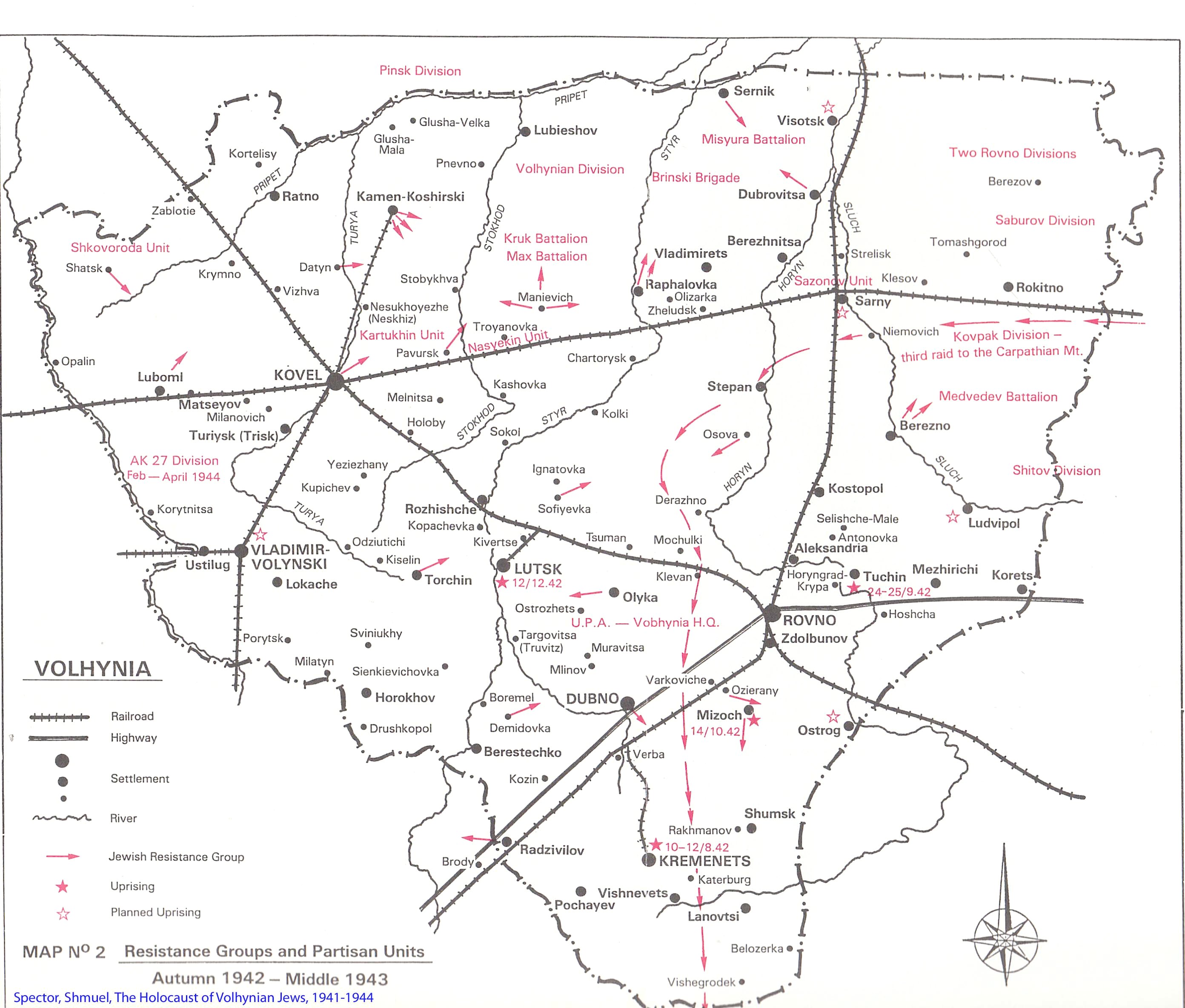
Volhynia during World
War II Activities of
Jewish resistance groups and partisan
units in Volhynia from autumn 1942
through mid-1943. This map shows major
rivers, roads and railroads. From The
Holocaust of Volhynia Jews, 1941-1944,
by Shmuel Spector, p. 224.
Topographical Map of Ternopil and
Khmelnitsky Oblasts, 1942 This military map
(in Russian) shows key towns, including
Lanovtsy, Yampol, Belozirka, Teofipol
Voronovtsy, Tichomel, Olshanitsa, and
many others. UC Berkeley Maps
collection, M-35-077.
Street Map of Vishnevets, 1941-1942
(Word)
From the flyleaf of Sefer Vishnevits.
Reconstructed and hand-drawn from memory
by Moshe Segal, son of Hersh Matisis. It
shows Vishnevets with Jewish and other
landmarks during the early Nazi era,
around 1941-1942.


