|
|
Ivano Frankivsk, Ukraine
& Vicinity |
| Google Map View of Kalush |
MapQuest View of Kalush |
View Larger Map |
|
|
 Map of Austro-Hungarian Empire (1882) -- Galicia. From Blackie & Sons Atlas (Edinburgh, 1882). NOTE: Will open in a new browser window or tab Map of Austro-Hungarian Empire (1882) -- Galicia. From Blackie & Sons Atlas (Edinburgh, 1882). NOTE: Will open in a new browser window or tab
|
 Regional Area Map, showing the general region of Ivano Frankivsk, south of Lviv, with clickable towns to some of the neighboring ShtetLinks sites Home Pages - Bolekhov, Delyatin, Dolina, Ivano Frankivsk, Kalush. NOTE: Will open in a new browser window or tab Regional Area Map, showing the general region of Ivano Frankivsk, south of Lviv, with clickable towns to some of the neighboring ShtetLinks sites Home Pages - Bolekhov, Delyatin, Dolina, Ivano Frankivsk, Kalush. NOTE: Will open in a new browser window or tab
|
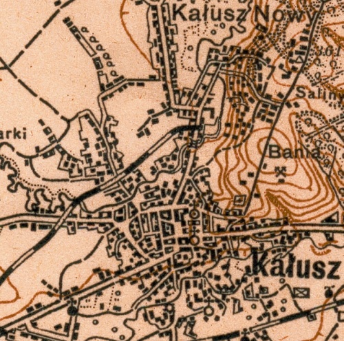
 Cadastral Map of the town center of Kalush Cadastral Map of the town center of Kalush
Cadastral feldskizzen map of the town center of Kalush (Kalusz),
administrative district of Kalush, region of Ivano-Frankivsk, undated.
The six map sheets copied cover the entire residential area and all
houses; also included are the residential districts of New Kalush (Neu
Kalusz), Bania, and Zahirya Zagorze). A Jewish cemetery and associated
Jewish community lands are located to the northwest of the town
center. A revised cadastral map showing house numbers, and many of the
field parcels have householder names. |
Kalusz military map scale 1:100000 c1910 showing town details.

|
|
|


