Maps
|
Introduction to Geography of the Ekterinoslav Colonies by Chaim Freedman | ||||
|
Grafskoy resurrected - recreating one's ancestral home
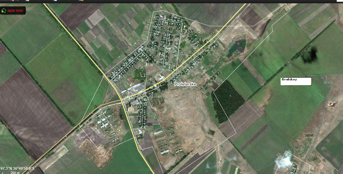
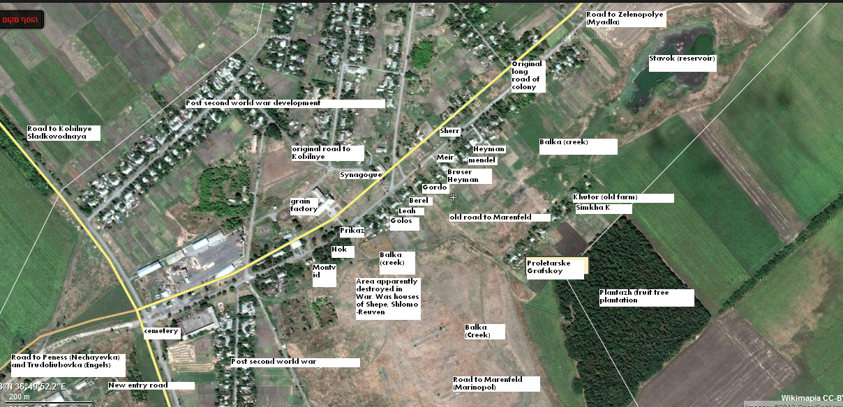
I used a satellite photo of Proletarsky, formerly Grafskoy, to recreate a photo of the home of the Komisaruk family.
I compared the current satellite photo from Google Earth which has great resolution and was able to identify buildings based on:
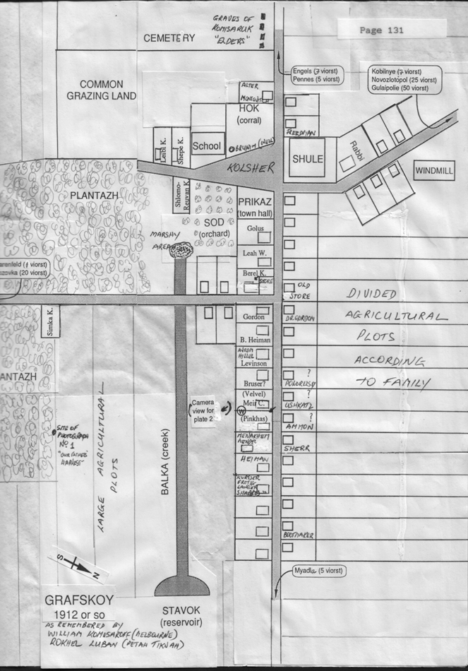
Willie Komesaroff's plan of Grafskoy, drafted about 1970 and based on his memories until about 1919. (see this site).
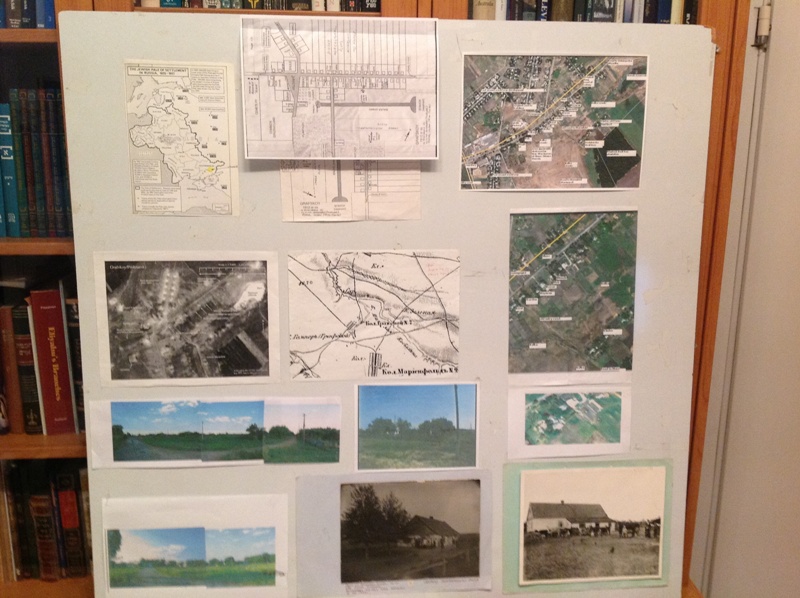
I built a model of Grafskoy placing photos on a table around roads and features derived from the above sources.
Attached are photos and a video of "Grafskoy resurrected" from my presentation.
|
Maps: Black Sea Area
The Black Sea Settlements Prior to 1918 (Jonathan Sheppard map reprint)
(Drawn in Germany to show location of the German settlements in southern Russia. Includes districts of Bessarabia, Chersson, Taurida, Jekaterinaslaw, Crimea and the western portion of the Don district. The map includes a key for identifying both the German and Russian settlements.)
|
Bessarabia (Northern Section) | |
|
Bessarabia (Southern Section) | |
|
Kherson (Northern Section) | |
|
Kherson (Southern Section) | |
|
Ekaterinoslav (Northern SectionA1) | |
|
Ekaterinoslav (Southern SectionB1) | |
|
Ekaterinoslav (Northern SectionA2) | |
|
Ekaterinoslav (Southern SectionB2) |
Maps: Jewish Agricultural Colonies of Ukraine
|
Podalsk (Balta Colonies) | |
|
Zaporozhe District Map |
|
|
Research Contact: Chaim
Freedman
This page maintained by Max Heffler
Updated Thursday March 07 2024. Copyright © 1999 [Jewish Agricultural
Colonies of the Ukraine]. All rights reserved.