

|
|
|
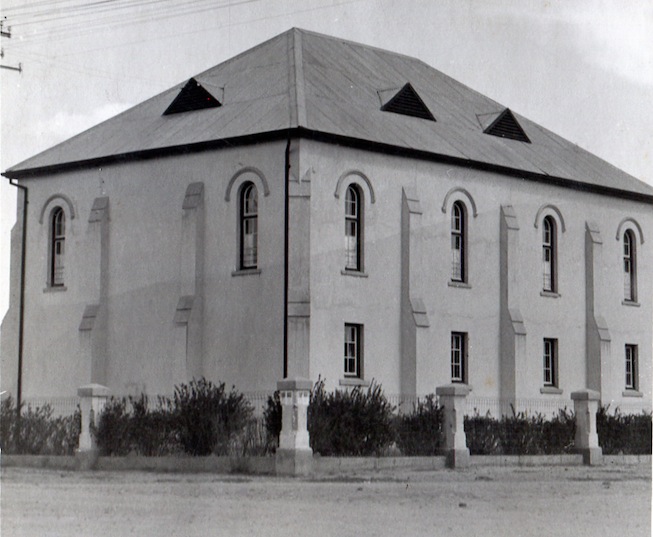
Upington Jewish Community
South Africa
In the beginning

|
Jewish Chronicle (London), November 1896 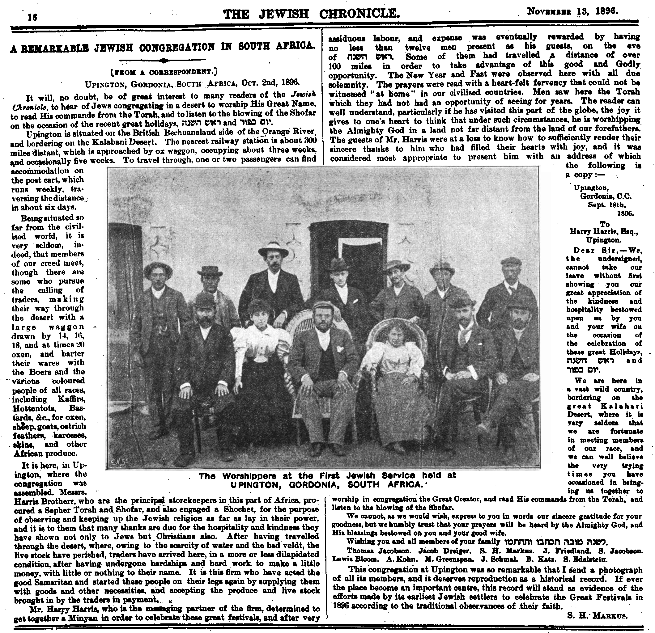
|
|
Survey map, 1893 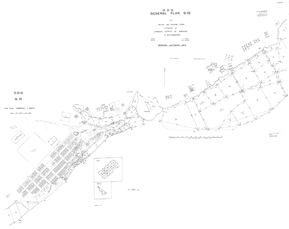
|
 |
 |
 |
 |
 |
 |
 |
 |
 |
Updates
|
Last update April 2021 |
This page is hosted at no cost to the public by JewishGen, Inc. and part of the KehilaLinks Project. If it has been useful to you, or if you are moved by the effort to preserve the memory of our lost communities, your JewishGen-erosity would be deeply appreciated. |