
Gargzdai (Gorzd),
Lithuania
Town Diagram - Vilnius Archives (1853) -
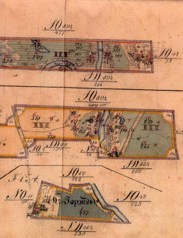
Bottom Part
"The 1853 plan of the state village of Kvietniai and
parsonage of Gargzdai which are situated among the lands of
Mr. Baron Renne"
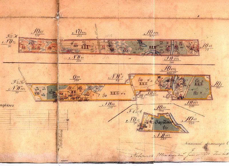
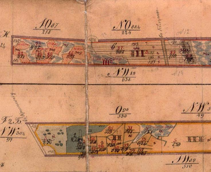
The 1853 Diagram is evidently based on magnetic north rather than true north, a difference of about 20 degrees.
The 1853 diagram, Bottom Part may be compared to the 1860-1880 Karte des Deutschen Reiches in the picture below.
Discrepancies could be due to migration of the river, the difficulty of surveying close to the river or in elevated areas, changes in road locations, and possible inaccuracies in the maps.
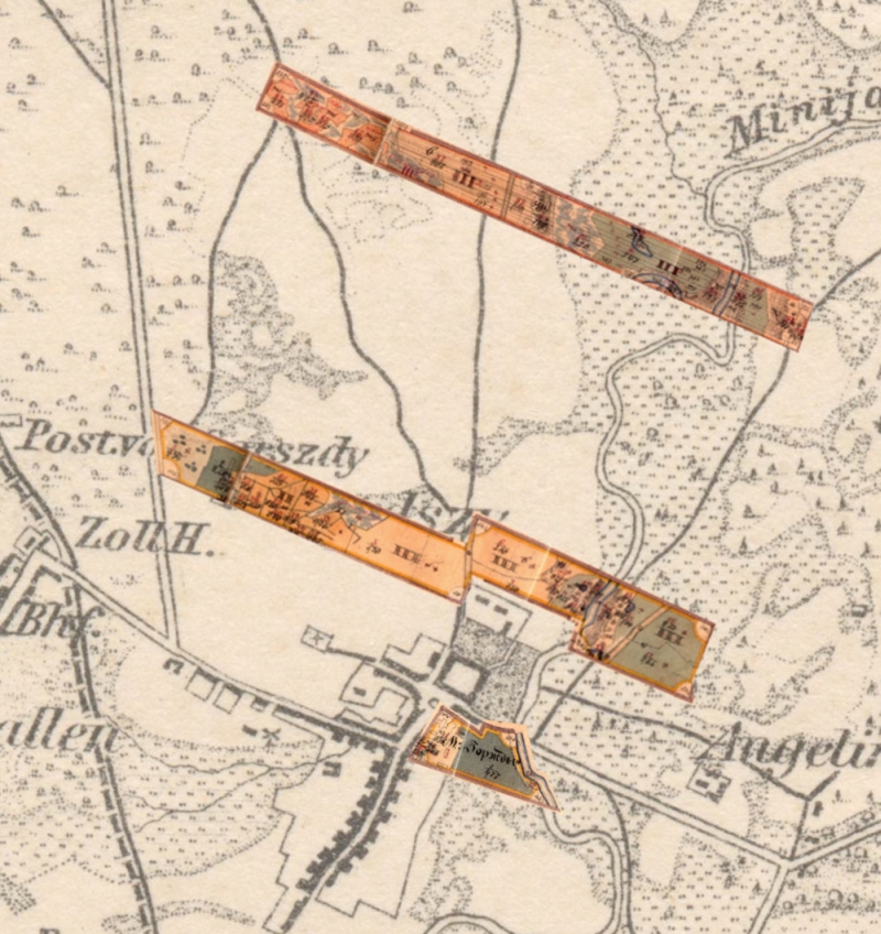
The 1853 Diagram may also be even more closely
compared with a map from 1886, from Lietuvos valstybinio
istorijos archyvo f. 544, ap. 1, b. 4531, k. 1-3, which is
shown at Gargzdu
Miesto Parkas and Gargzdu
parkas. Faktai, p. 3:
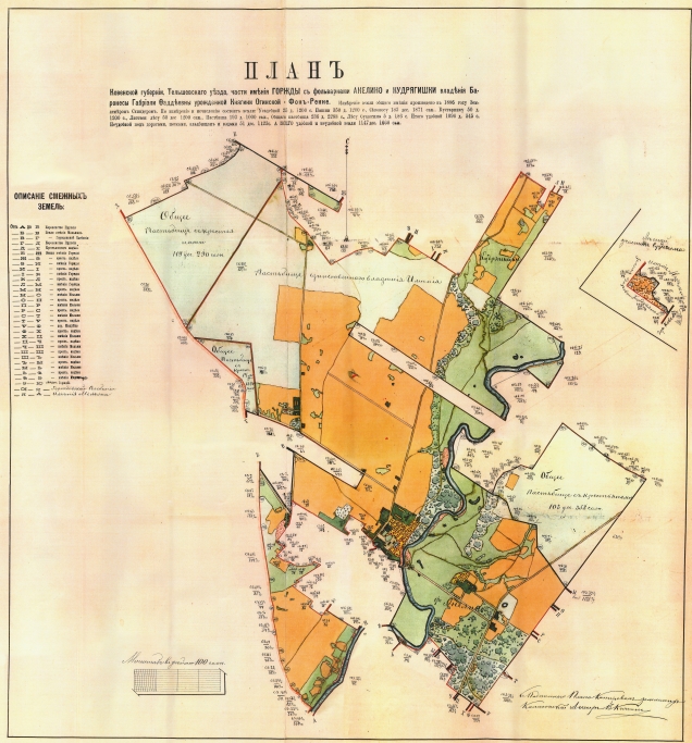
Although not yet translated from Russian
into English, the 1886 map evidently shows the lands
surrounding Gargzdai owned by Baron Rönne, from which two
narrow rectangular strips are omitted. The strips
from the 1853 diagram fit into the 1886 map as
shown:.
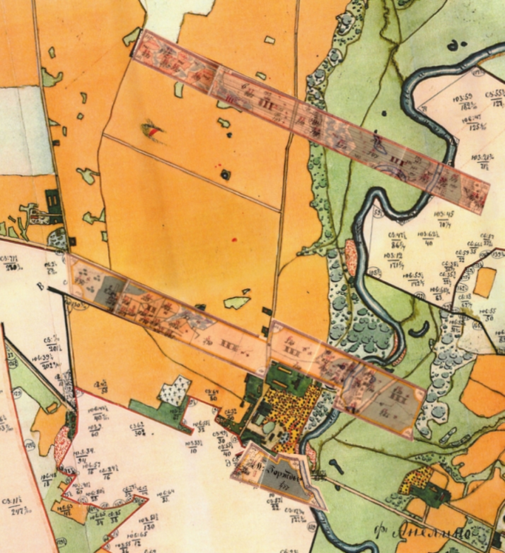
There is an excellent correspondence between
the top empty strip in the 1886 map and the lands
shown belonging to the parsonage in the 1853 diagram.
The middle empty strip in the 1886 map only partially
corresponds to the 1853 diagram. The 1853 diagram
reaches farther to the east than does the empty strip in the
1886 map.
Some lands in the eastern portion of 1853 strip were apparently acquired as part of the Estate by 1886. These changes may be related to the government's confiscation of church lands following revolts of 1831 and 1863. For information regarding the confiscation, see Janina Valanciute, Gargzdu miesto ir parapijos istorija, Vilnius: Diemedzio Leidykla, 1998 (ISBN 9986-23-047-0) 501 - 502; see also istorija (History) portion of the Town of Gargzdai website; Wikipedia article regarding the "January Uprising."
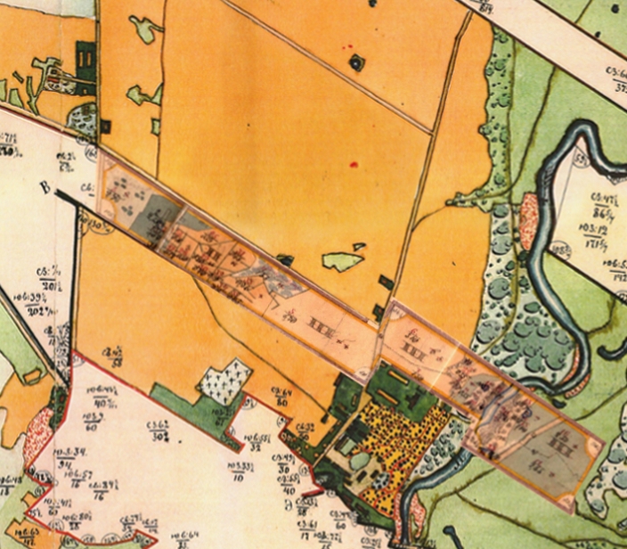 |
 |
| Strip from 1853 diagram
inserted into 1886 map |
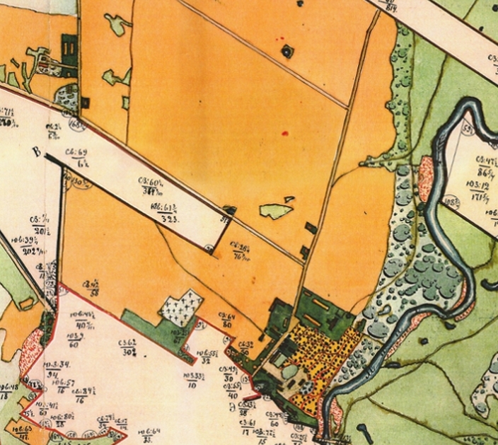
Same area of 1886 map
without insert |
Some lands in the eastern portion of 1853 strip were apparently acquired as part of the Estate by 1886. These changes may be related to the government's confiscation of church lands following revolts of 1831 and 1863. For information regarding the confiscation, see Janina Valanciute, Gargzdu miesto ir parapijos istorija, Vilnius: Diemedzio Leidykla, 1998 (ISBN 9986-23-047-0) 501 - 502; see also istorija (History) portion of the Town of Gargzdai website; Wikipedia article regarding the "January Uprising."