|
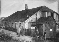
Yurovshchina
|
Also known as
Lubin or Labun'
|
|
|
50°01'
N,
27°22'
E.
The
village
is
within
the
Khmel'nyts'kyy
Oblast
in
western
Ukraine.
|
|
|
|
Updated
22 May 2011
|
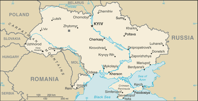
Yurovshchina
is
represented,
above,
by
the
gray
square
south
of
the
word
Zhytomyr.
Nearest
Large Cities:
20 miles NNE of Starokostyantyniv;
62
miles
WSW
of
Zhytomyr;
65
miles
SE
of
Rivne
(Rovno); 144 miles WSW of Kiev |
|
|
|
Click on map to see larger
version of map
|
|
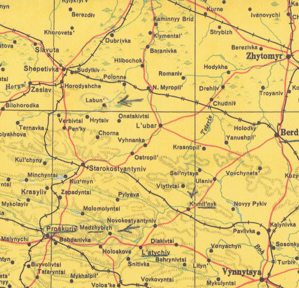
Labun and nearby communities, 1955.
For
scale,
Starokostyantyniv
is
about
20
miles
from
Labun;
Polonne,
about
10
miles;
Hrytsiv,
about
8
miles. Red lines
indicate roads. The black lines
with hatch marks are rail lines: single hatch=single track;
double hatch=double track. The nearest rail access
for
Labun was in Polonnoye. Special
thanks
to
Peter
Myers
who
found
the
source
map
in
a
New
York
City
bookstore
("The
Map
of Ukraine," Sponsored by the League of Americans of Ukrainian Descent,
State Organization of Ukrainian Congress Committee of America, Chicago,
Illinois, 1955). |
|
|
|
 |
|
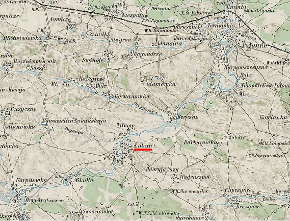
Labun, 1889. The
shtetl
is
at
the
confluence
of
the
Khomora
and
Poganka
Rivers
10 miles SW of Polonnoye
(Polonne) and 8 miles ENE of the closest neighboring Shtetl: Gritsev
(Hrycow).
|
|
|
|
|
|
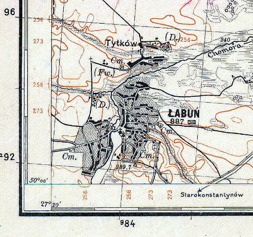
Labun,
1931. This is a small corner of a larger map
centered on Polonnoye and shows developments within the
town. The map was made by the Polish Military
Geographical Institute. Cm.= cemetery;
Fw.=grange (i.e., outlying farmlands, historically belonging to a
feudal lord); solid black dots with crosses=churches or temples; the
triangle with 289.7 indicates a survey marker at 289.7 meters above sea
level.
|
|
|
|
|
 Top of page Top of page
|

|
|
Copyright
©
2010-2011
Emily
Garber
|
|
|