
Historical Maps
All maps appear here courtesy of Andrew Kapochunas of http://lithuanianmaps.com/
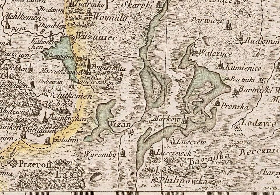
1772
"No. 6: "Część połnocna Pruss
Elektorskich, Woiewodztwo Trockie y Xięstwo Żmudzkie."
(Northern part of the Elector's Prussia, the Voivodship of
Troki and the Duchy of Żmudź.) From SDL
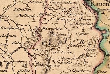
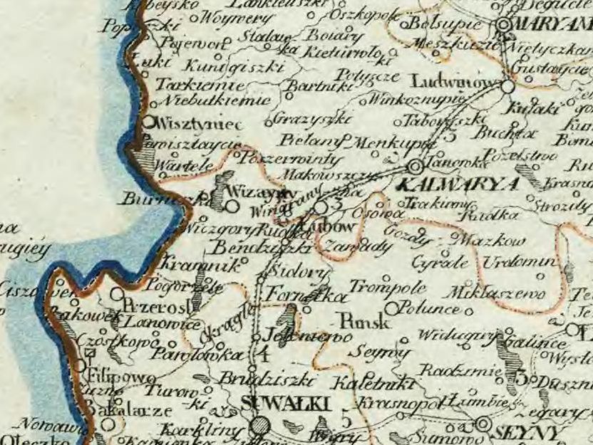
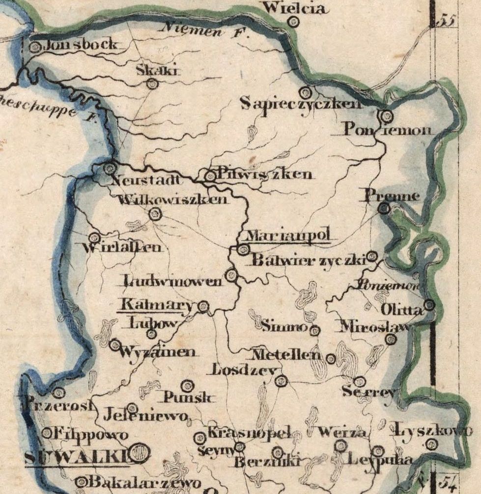
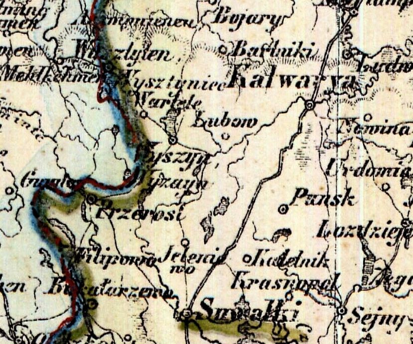
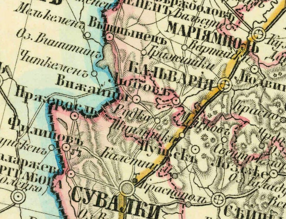
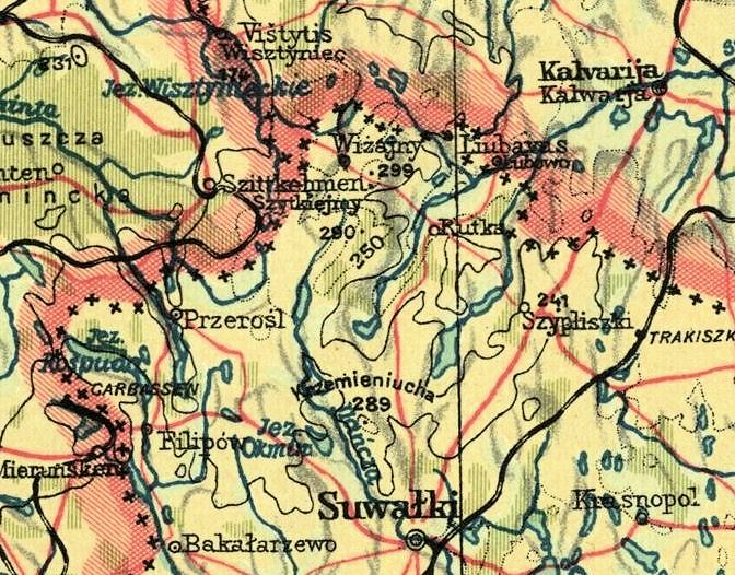
When possible, the maps have been trimmed to show Wiżajny
framed by Suwalki to the south-east and Kalvarija (now in
Lithuania) to the north-east. It is interesting to note how
the name of the town varies in different time periods,
jurisdictions, and languages. On the left is possibly
Wiżajny's first appearance on a map. For any of the maps on
this page, you click on the picture to see a larger image.
Visit http://lithuanianmaps.com/ to see the full map and many
other maps as well.
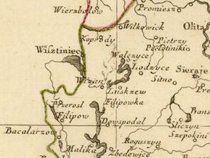
1781
Giovanni Antonio Rizzi-Zannoni
(Cartographer) - Antonio Zatta (Publisher): "Atlante
Polacco " (Atlas of Poland), Venice. “"Li PALATINATI
di WILNA, TROKI, INFLANT coi Ducati di Kurlandia E
Smudz..."
|
1788
F. A. Schraembl: "Generalkarte von
POLEN, LITAUEN...," Vienna, from "Allgemeiner
Grosser Schrämblischer Atlas."
|
1790
Edme Mentelle: "N° 4 (bis)
Dantzig," Paris, possibly from "Carte de l'ancien
royaume de Pologne," published with P.G. Chanlaire
|
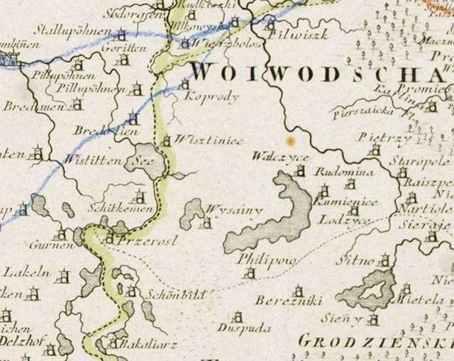
1791
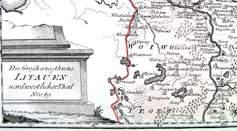
Franz Johann Joseph von Reilly
(publisher) - Anton Friedrich Busching and Johann
Ernst Fabri (map compilers): a set of four maps of
the Grand Duchy of Lithuania, published in Vienna -
"Des Grossherzogtums LITAUEN...” Map detail from
“...nordwestlicher Theil, Nro. 49" (northwest)”
|
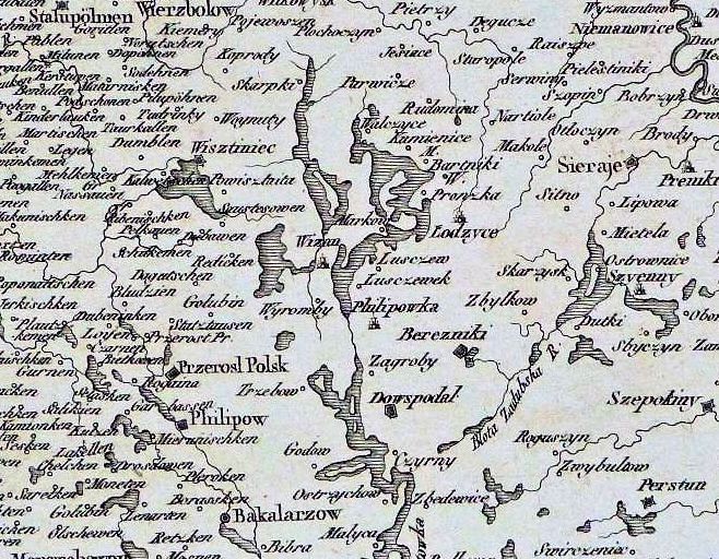
1796
(Anon.): "Polen, Litauen und
Kurland...."
|
1808
Robert Wilkinson: "Prussia," from
his "A General Atlas," published in London from 1800
to 1816
|
1813
A.P.H. Nordmann: "CARTE des
vormalignen ganzen Konigsreich Pohlen, nach seiner
dermaligen Eintheilung..“ (Map of the entire Kingdom
of Poland, after its partition…) based on the atlas
of Imperial Russia of General Suchtelen. Newly
designed by A.P.H. Nordman, Vienna.
|
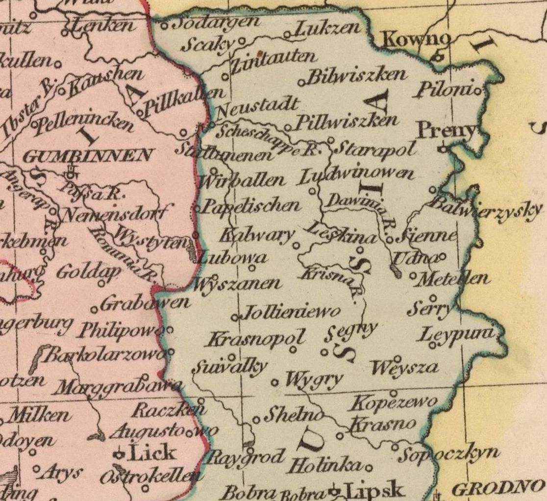
1815
John Pinkerton: "POLAND," London,
from "Pinkerton's Modern Atlas." Pinkerton’s map is
eight years out of date, showing Wyszamen as still
in New East Prussia.
|
1819
Adolf Steiler: "OSTSEE-LAENDER von
der Oder bis zur Newa," Gotha, Sweden, from his
"Hand-Atlas," showing Wyzayn in “Polen”
|
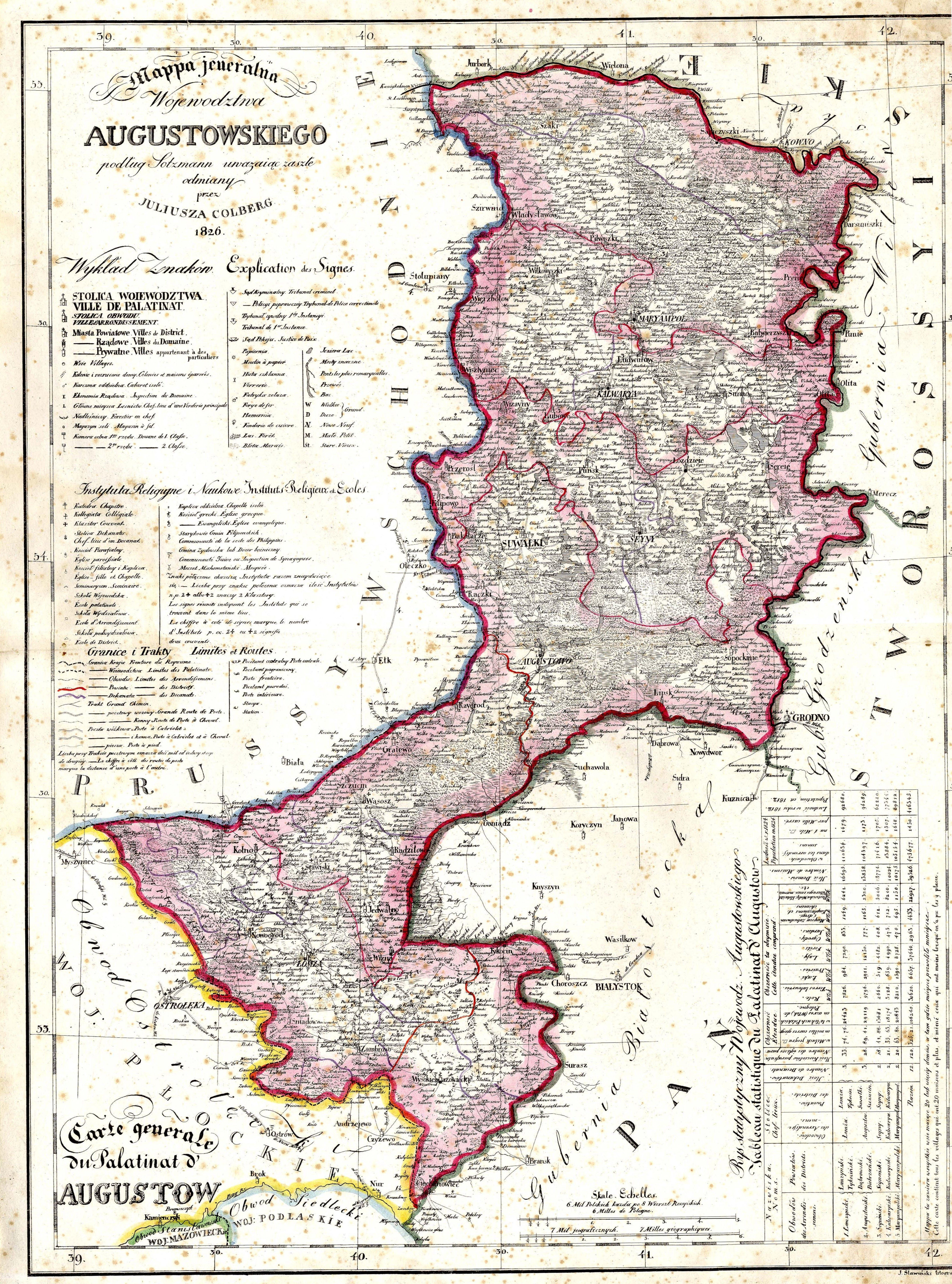
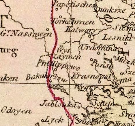
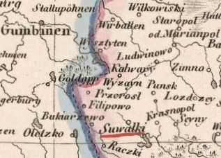
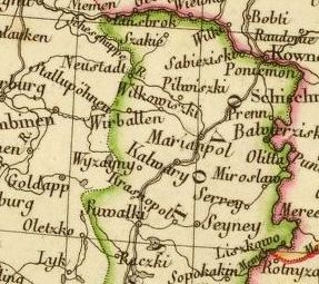
1826
Juliusza Colberg: "Wojewodztwa
Augustowskiego," Krakow, from "Atlas Krolestwa
Polskiego" (Atlas of the Polish Kingdom),
|
1827
Philippe Vandermaelen: "PARTIE DE
LA RUSSIE, No. 9," Brussels, from his "Atlas
universel de geographie physique, politique,
statistique...,"
|
1828
J. Kośmiński, "Karta Królestwa
Polskiego,"
|
1829
Wilhelm Ernst August Schlieben
(geographer) - Georg Joachim Goschen (publisher):
"Russland Gouvernates" and "Polen," Leipzig, from
Herman's 1830 "Atlas von Europa."
|
1850
Friedrich H. Handtke:
"GENERAL-KARTE VOM WESTLICHEN RUSSLAND nebst
PREUSSEN, POSEN und GALIZIEN," Glogau (then in
Germany, now in Poland).
|
1862
(Anon.) Карта европейской России и
Кавказского края (Map of European Russia and
Caucasus): IV. Санкт Петербург - Гельсингфорс -
Ревель - Рига - Вильно - Стокгольм (St. Petersburg,
Helsingfors [Helsinki], Revel [Talinn], Riga, Vilno,
Stockholm). Вижаины (Vizhany)
|
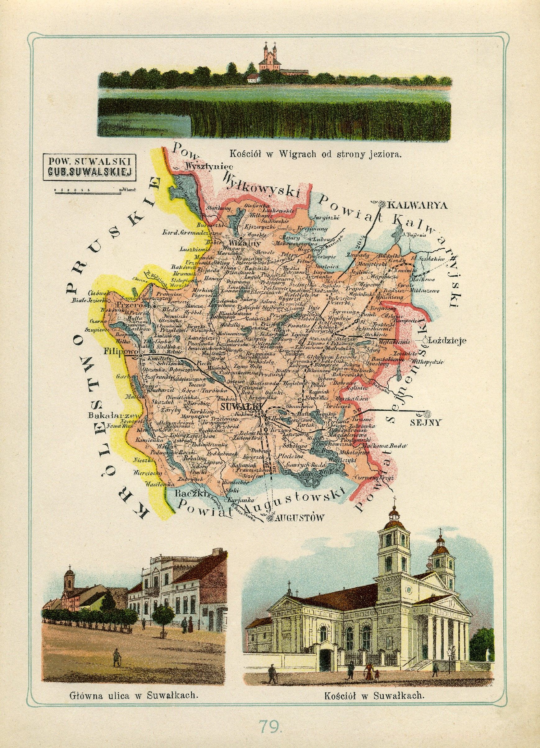
1907
Pow. Suwalski. Atlas geograficzny
ilustrowany Królestwa Polskiego / J. M. Bazewicz
|
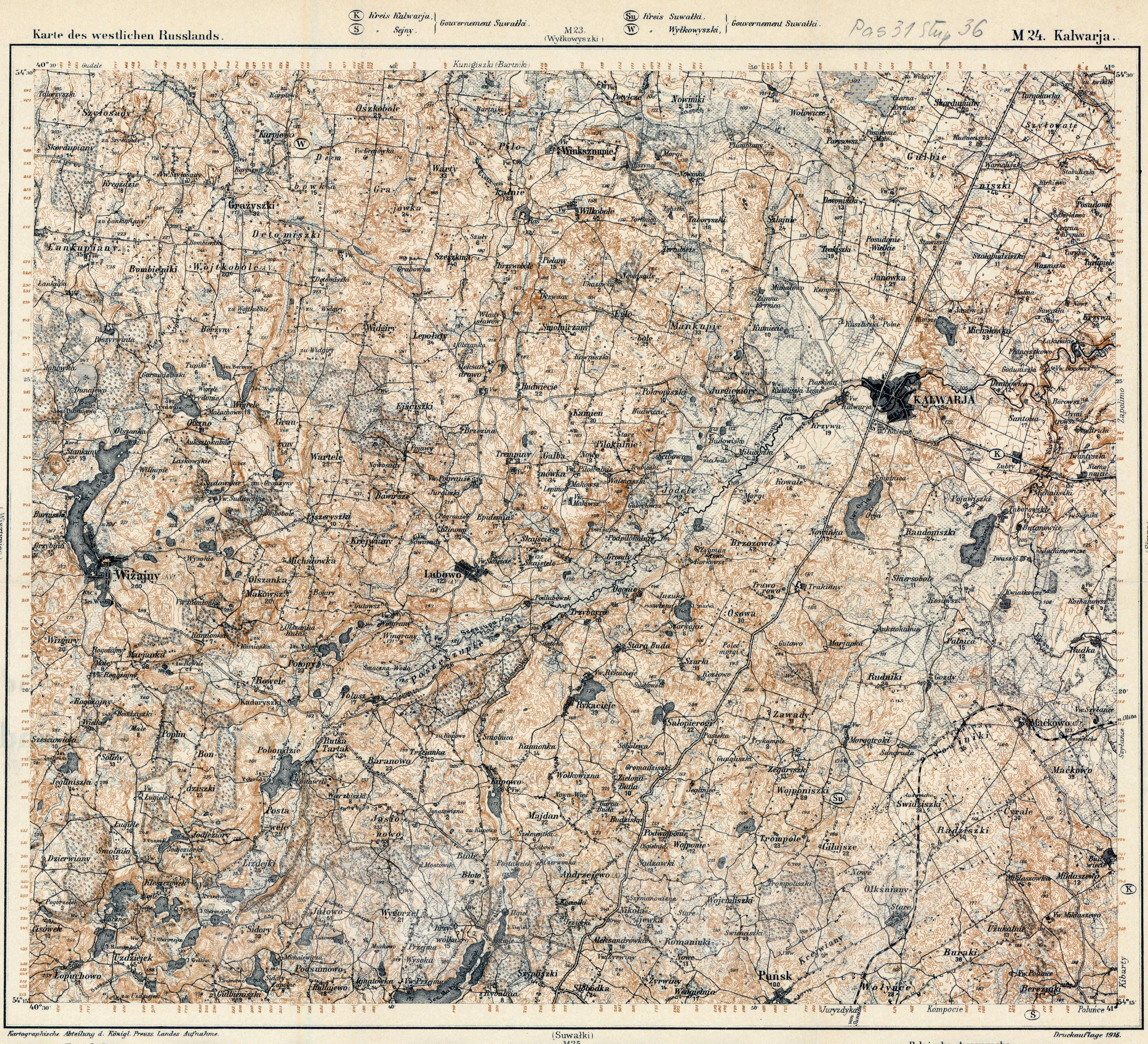
1915
Karte des westlichen Russlands,
"M24"
|
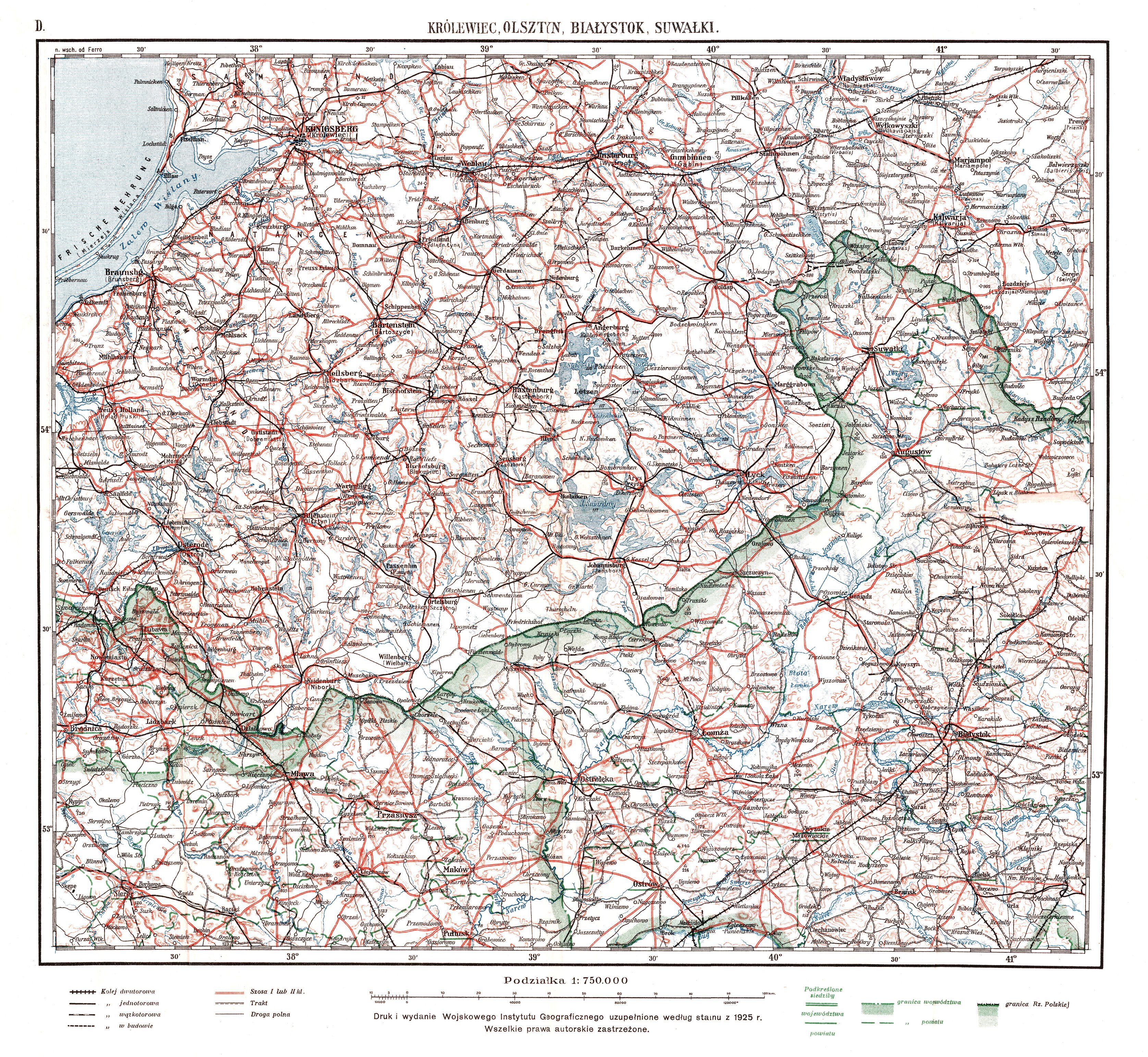
1925
Polish-produced map
|
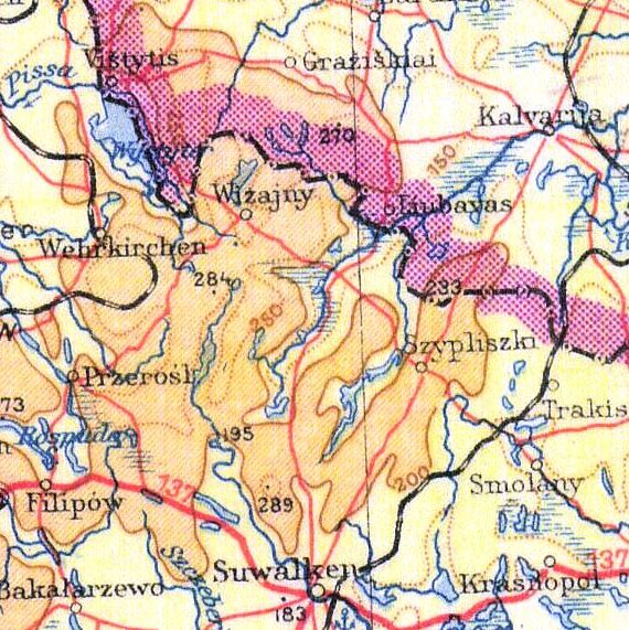
1939
Übersichts Karte von Mitteleuropa
|
1941
Ostpreussen map
|