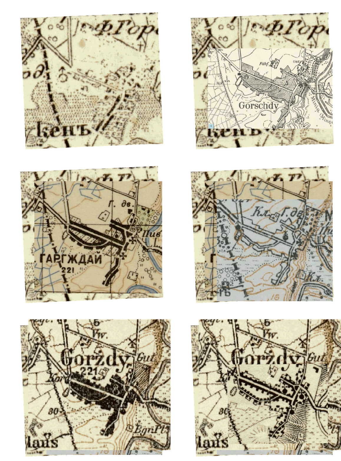

Comparison of Maps of Gargzdai, 1860 - 1929
showing Synagogue Symbols

This animation compares six maps of Gargzdai, and in particular the location of symbols for the synagogue.
The following maps are repeatedly cycled at 6 second intervals:
1. Russian Empire (Russian 1866-1872)
2. #0294 Laugallen (1:25,000) (German 1940, but stated to be based on Russian Map 1895, 1:42,000) (showing Gorschdy)Gorschdy from Map #0294 at SLUB/ Deutsche Fotothek; original at Sächsische Landesbibliothek - Staats- und Universitätsbibliothek Dresden (SLUB)
Note: Map IX-10-A (1915) at same scale of 1:25,000 is available at mapywig
3. Russian Military (1:50,000) (1910)
4. Russian (1:84,000) IX-10 (1914)
5. Karte des Deutschen Reiches #4 Paaschken - Szweksznie (1:100,000) (1913-1914) (showing Gorzdy)
6. Karte des Deutschen Reiches (1:100,000) (1921-1929)
The first map, Russian Empire 1866-1872, does not contain a symbol for the synagogue. However the map shows a horizontal rectangle west of the market area which contains two buildings. This rectangle might arguably show two Jewish buildings (synagogue and beit midrash?) linked as a single compound. However comparison with the other maps shows the rectangle to be west and north of where all the other maps locate the synagogue.
The second map is at the largest scale of this group of maps, and would offer the best opportunity to accurately locate the synagogue. Comparison with the 1945 aerial photo, and German fire map from 1939, shows that the wooden synagogue as of 1941 was located at the southern edge, not the center, of the circle portion of the synagogue symbol. The synagogue symbol in this map series including an open circle probably indicates building was made of wood. Solid circle would indicate masonry. See legend of map symbols here. Equivalent symbols distinguish wooden from stone mosques on some Soviet maps. Soviet Topographic Map Symbols, p. 15.
US topographic maps follow the rule: "Center of symbol represents center of feature." Some examples from German maps of Berlin at David Rumsey map collection show these maps appear to follow the same rule - the location of a church is shown by the center of the circle component of the symbol, and not by the edge of the circle or the cross component. However maps do not always follow this rule precisely.
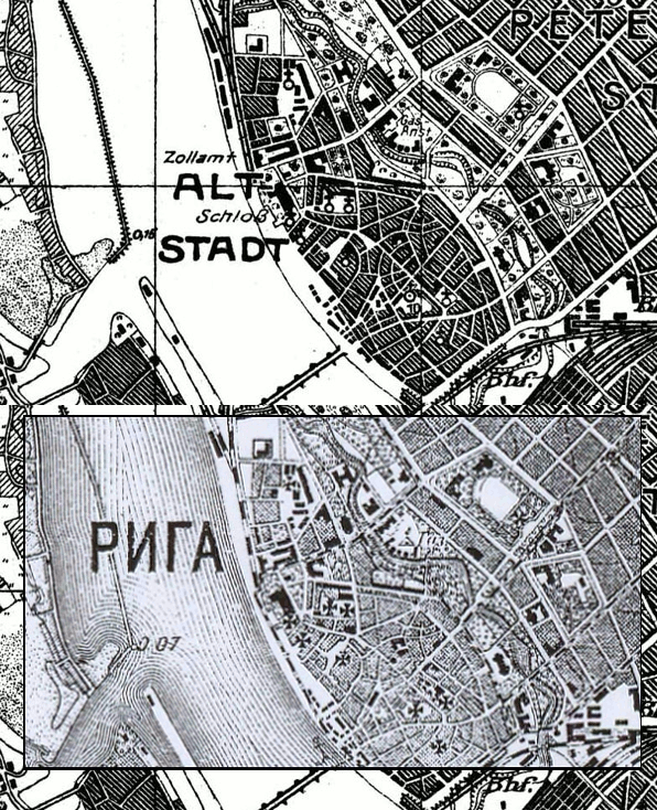
Comparison of large scale German and Russian maps of Riga, Latvia (maps displayed at maps4u.lt) shows considerable variation in placement of the church symbols. It seems the symbols are often placed for typographical clarity rather than attempting to exactly locate the building.

(Some firewall or ad-blocking settings may block this .gif animation, and it may not be visible with some browsers or devices.)
This page updated February 2, 2021