 |
|
| Contents | |
| Lubny Homepage | |
| History | |
| Town Life | |
| The Holocaust |
|
| Data |
|
| Maps of Lubny |
|
| JewishGen
Home Page |
|
| KehilaLinks Home Page |
|
|
| Click each map to get the full size view Thanks to Gary Liss for these! |
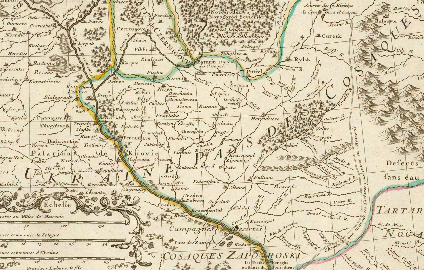 Russia 1706: Lisle Full Title: (Carte de Moscovie. Southern section. Dressee par Guillaume De l'Isle de l'Academie royale des Sciences a Son Excellence Monseigneur Andre Artemonides de Matueof Ministre d'Etat de sa Majeste Csarienne l'Empereur des Russes, son Lieutenant gnal. en la Principaute de Jaroslavie ... Par son tres humble et tres obeisst. Serviteur De l'Isle. A Paris, chez l'Auteur sur le Quai de l'Horologe, avec Privilege, 1706). Grave par Liebaux le fils. Short Title: Map of Moscovie. Date: 1706 Cartographer: Lisle, Guillaume de Scale: 1:2,600,000 Region portrayed: Russian Empire, Ukraine |
 Russia in Europe 1747: Bowen Full Title: A new & accurate map of Moscovy or Russia in Europe, with its aquisitions. Drawn from surveys & the best modern maps. The whole being regulated by astronomical observations. By Emanl. Bowen. (London: Printed for William Innys, Richard Ware, Aaron Ward, J. and P. Knapton, John Clarke, T. Longman and T. Shewell, Thomas Osborne, Henry Whitridge ... M.DCC.XLVII) Short Title: Russia in Europe Date: 1747 Cartographer: Bowen, Emanuel Scale: 1:11,500,000 Region portrayed: Russian Empire, Ukraine |
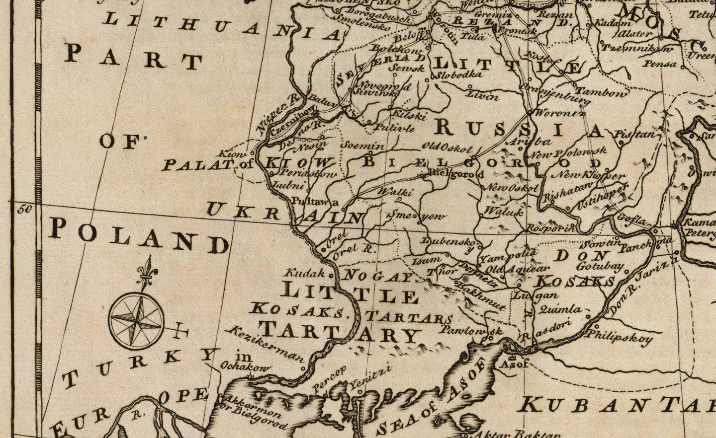
 Russia in Europe 1799: Wilkinson Full Title: Russia in Europe with the Dismemberments from Poland in 1773, 1793, and 1795. Short Title: Russia in Europe Date: 1799 Cartographer: Wilkinson, Robert Scale: 1:10,100,000 Region portrayed: Russian Empire, Ukraine |
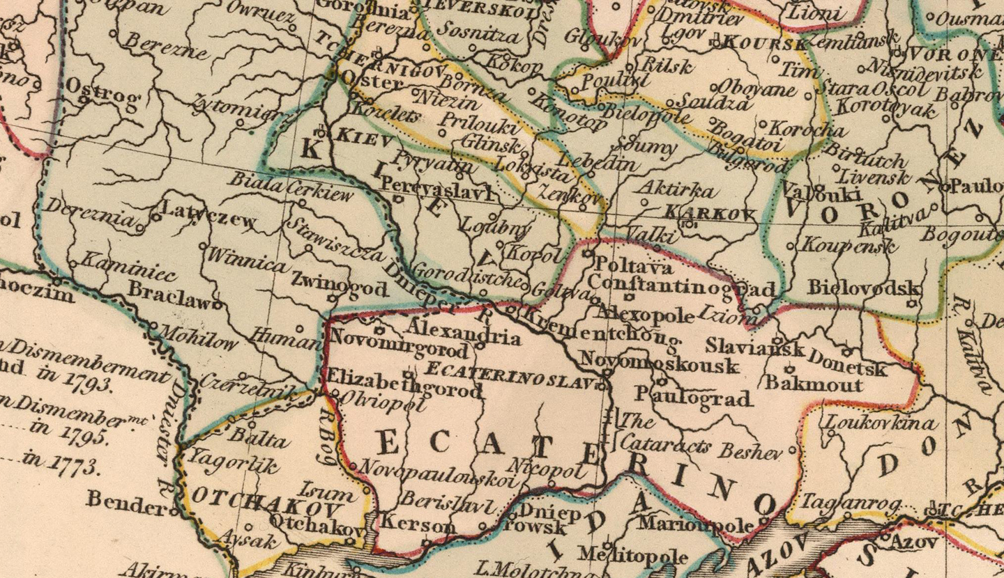
 Ukraine 1824: Delamarche Full Title: Atlas De La Geographie Ancienne et moderne, Adopte Par Le Conseil Royal De l'Instruction Publique, A l'usage des Colleges Royaux et des Maisons d'Education, pour suivre les Cours de Geographie et D'Histoire; Par Felix Delamarche, Successeur De Robert De Vaugondy, Geographe Du Roi. A Paris, Chez Felix Delamarche, Ingenieur-Mecanicien Pour Les Globes Et Spheres, Rue du Jardinet, No. 13. 1826. (Annee Scolaire.) Short Title: Russie D'Europe Partie Meridionale Date: 1824 Cartographer: Delamarche, Felix Scale: 1:7,500,000 Region portrayed: Russian Empire, Ukraine |
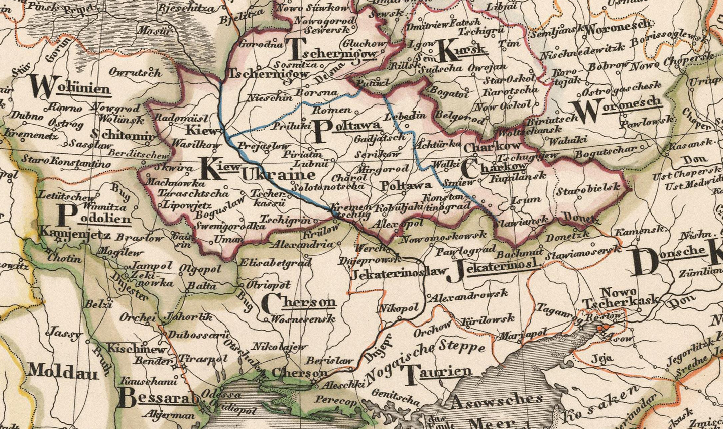
 European Russia 1833: Stieler Full Title: Hand Atlas Uber Alle Theile Der Erde nach dem neuesten Zustande Und Uber Das Weltgebaude. Herausgegebenn von Adolf Stieler, berbeitet von Demselben, so wie von C.G. Reichard, H. Hubbe, F.v. Stulpnagel, H. Berghaus u. I.C. Bar. Gotha bei Justus Perthes. (title page only) gez. v. Bar. gest. v. Edler in Gotha. Short Title: No. XL. Stieler's Hand-Atlas (No. 37). Europaeisches Russland auch Schweden u. Norwegen. Date: 1833 Cartographer: Stieler, Adolf Scale: 1:11,000,000 Region portrayed: Russian Empire, Ukraine |
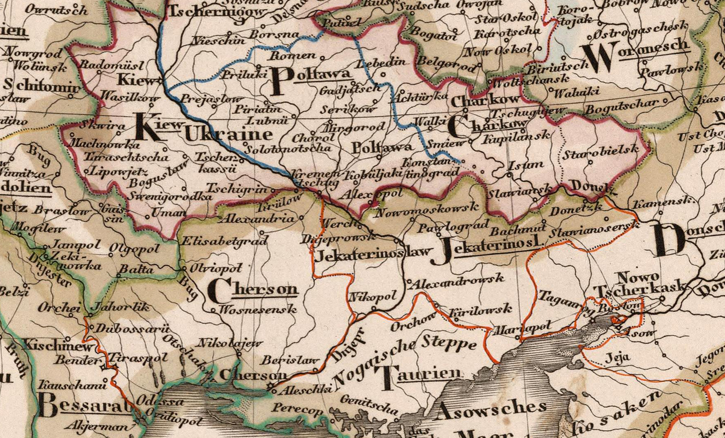
 European Russia 1850: Stieler Full Title: Hand Atlas Uber Alle Theile Der Erde nach dem neuesten Zustande Und Uber Das Weltgebaude. Herausgegebenn von Adolf Stieler, berbeitet von Demselben, so wie von C.G. Reichard, H. Hubbe, F.v. Stulpnagel, H. Berghaus u. I.C. Bar. Gotha bei Justus Perthes. (title page only) gez. v. Bar. gest. v. Edler in Gotha. Short Title: No. XL. Stieler's Hand-Atlas (No. 37). Europaeisches Russland auch Schweden u. Norwegen. Date: 1850 Cartographer: Stieler, Adolf Scale: 1:11,000,000 Region portrayed: Russian Empire, Ukraine |
 Russia 1870: Johnson Full Title: Johnson's New Illustrated Family Atlas Of The World, Was Awarded The First Prize Medal At The Universal Exposition Of 1867, In Paris, With A Treatise On Physical Geography, By A. Guyot, LL.D. ... With Descriptions, Geographical, Statistical, And Historical ... A Dictionary Of Religious Denominations, Sects, Parties, And Associations, Compiled By Professor Roswell D. Hitchcock, D.D. ... New York: A.J. Johnson, Publisher, 276 & 278 Mulberry Street. 1870. Entered ... One Thousand Eight Hundred and Seventy, by A.J. Johnson ... New York. Short Title: Russia Date: 1870 Cartographer: Johnson, A.J. Scale: 1: 7,850,000 Region portrayed: Russian Empire, Ukraine |
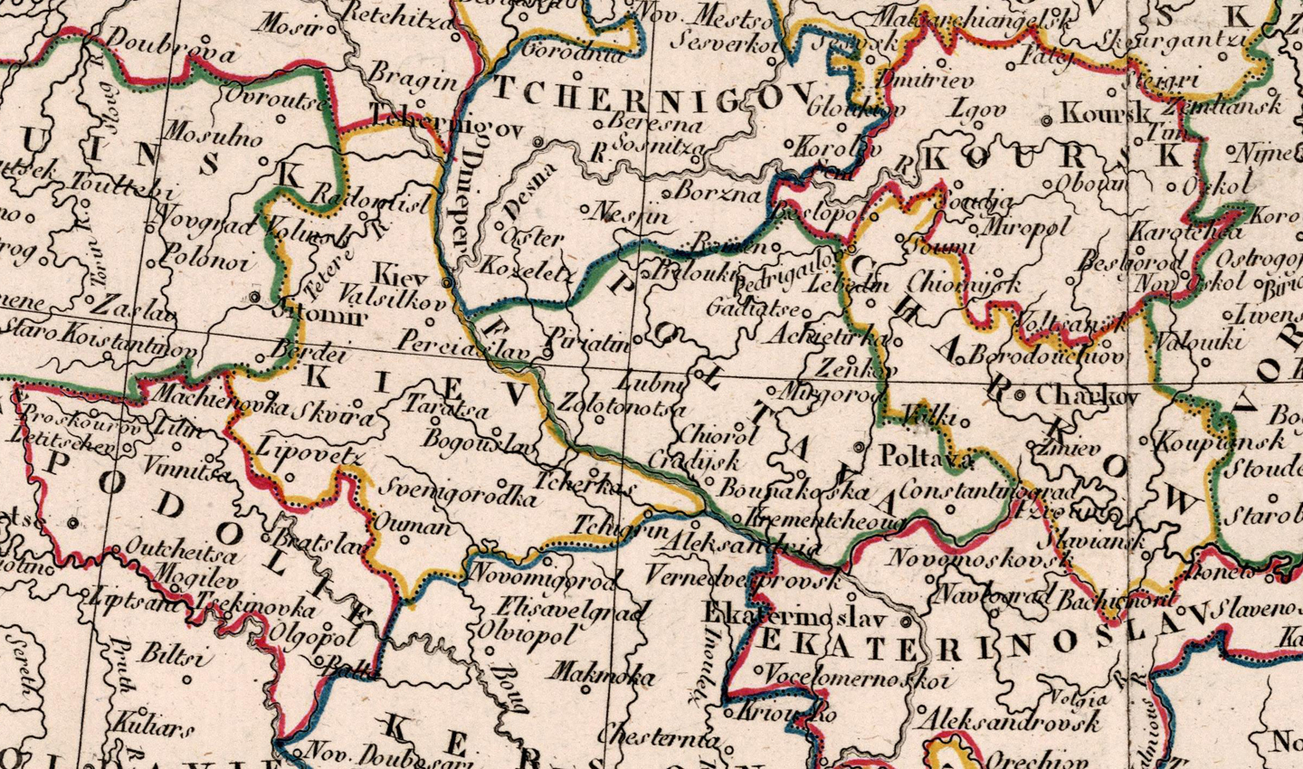
 European Russia 1881_ Andree Full Title: Richard Andree's Allgemeiner Handatlas in sechsundachtzig Karten mit erlauterndem Text. Herausgegeben von der Geographischen Anstalt von Velhagen & Klasing in Leipzig. Bielefeld und Leipzig, Verlag Von Velhagen & Klasing 1881. Short Title: Europaisches Russland Date: 1881 Cartographer: Andree, Richard Scale: 1:8,700,000 Region portrayed: Russian Empire, Ukraine |
 European Russia 1895: Andree Full Title: The Times atlas. Containing 117 pages of maps, and comprising 173 maps and an alphabetical index to 130,000 names. Published at the office of "The Times," Printing House Square, London, E.C. 1895. (colophon:) Cassell & Company. Limited, Belle Sauvage Works, London, E.C. Short Title: European Russia Date: 1895 Cartographer: Andree, Richard Scale: 1:8,700,000 Region portrayed: Russian Empire, Ukraine |
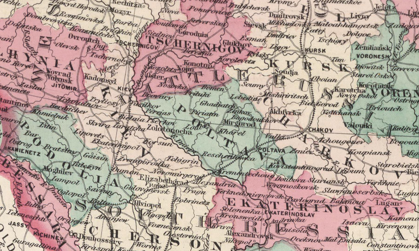
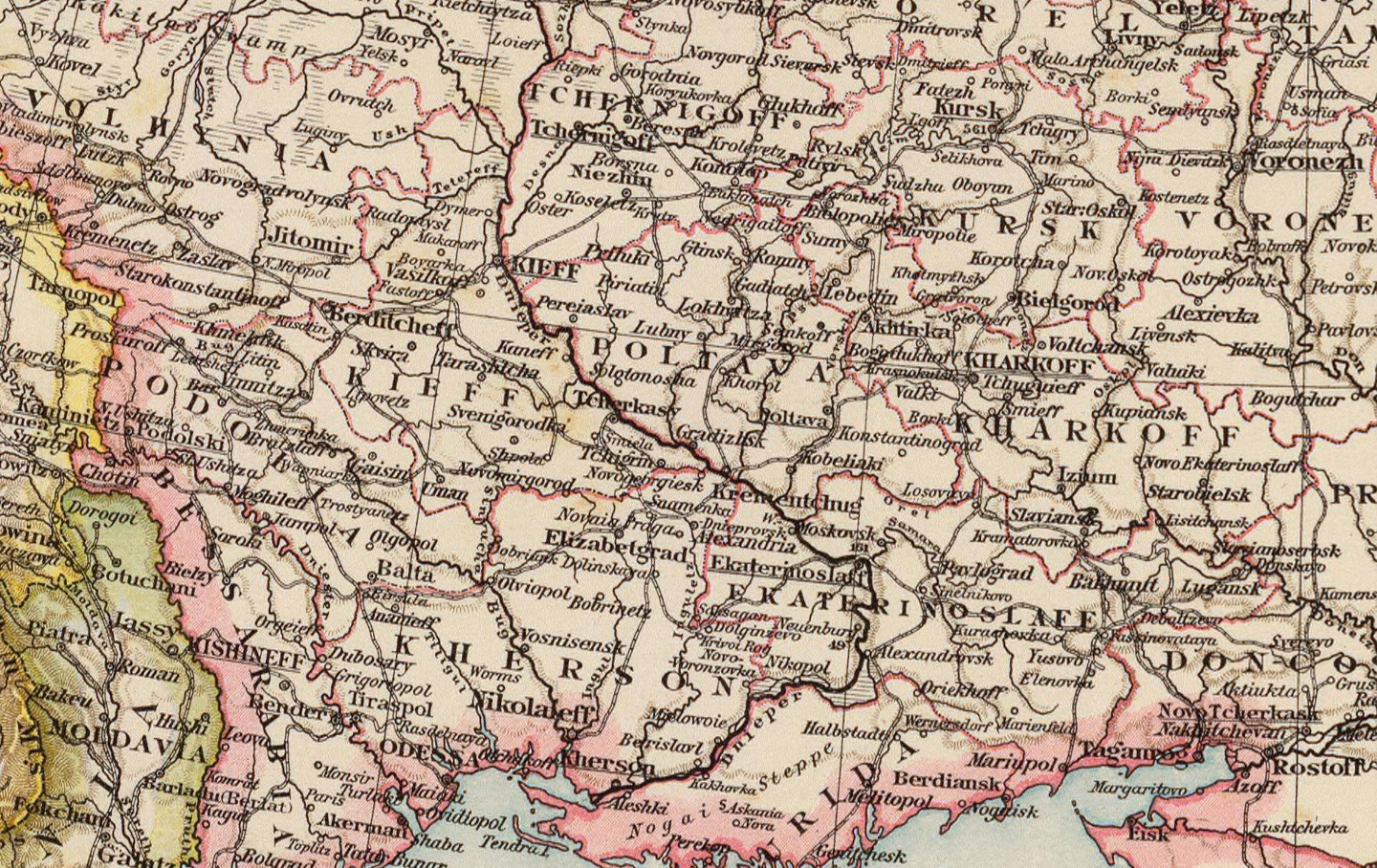
 Southwest Russia and Kingdom of Poland 1912: Johnston Full Title: South-West Russia. (with) Odessa. Showing the Extent of the Kingdom of Poland prior to its partition in 1772. Keith Johnston's General Atlas. May 1912. Engraved, Printed, and Published by W. & A.K. Johnston, Limited, Edinburgh & London. Short Title: Southwest Russia Date: 1912 Cartographer: Johnston, W. and A.K. Scale: 1: 3,456,000 Region portrayed: Russian Empire, Ukraine |
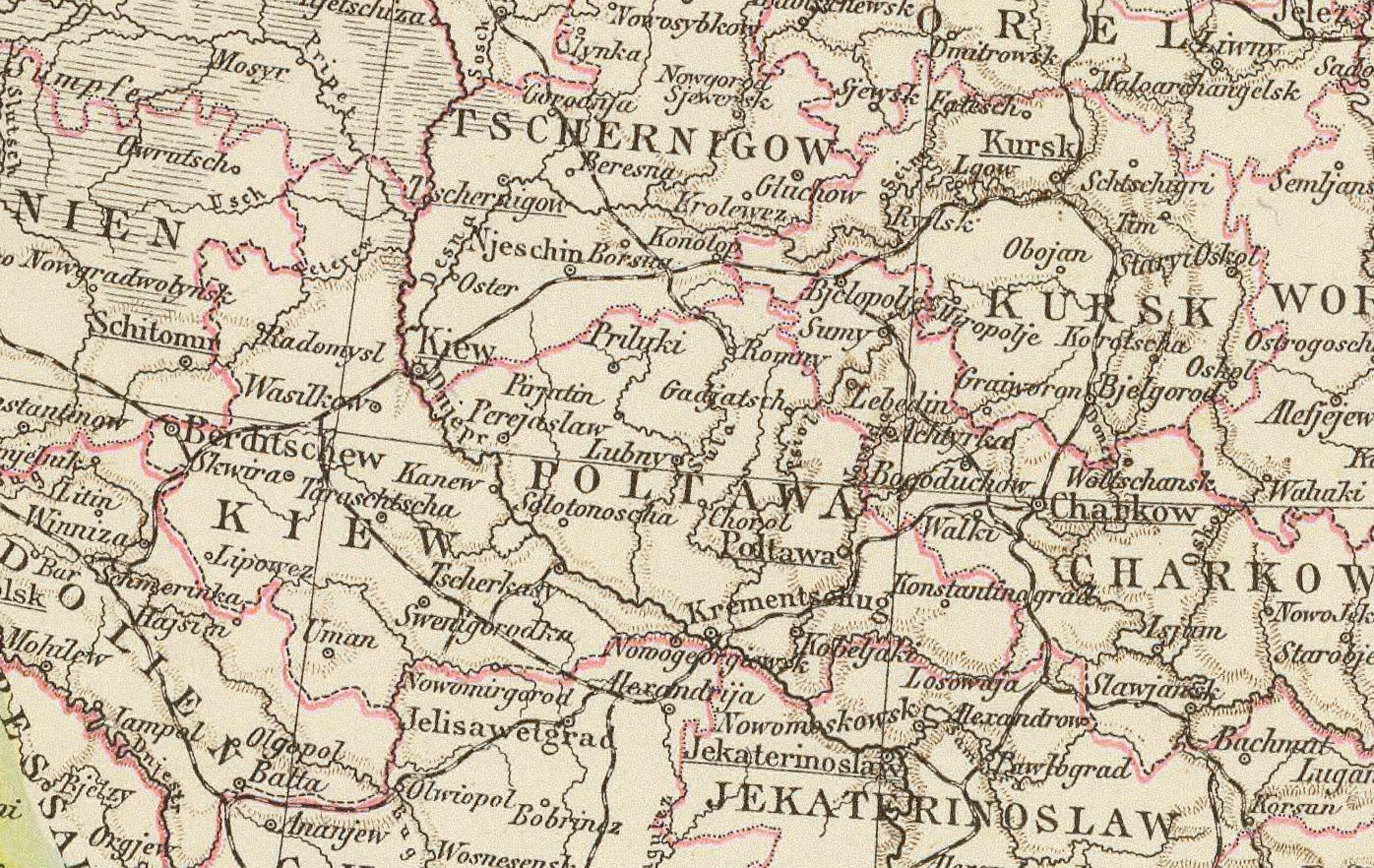
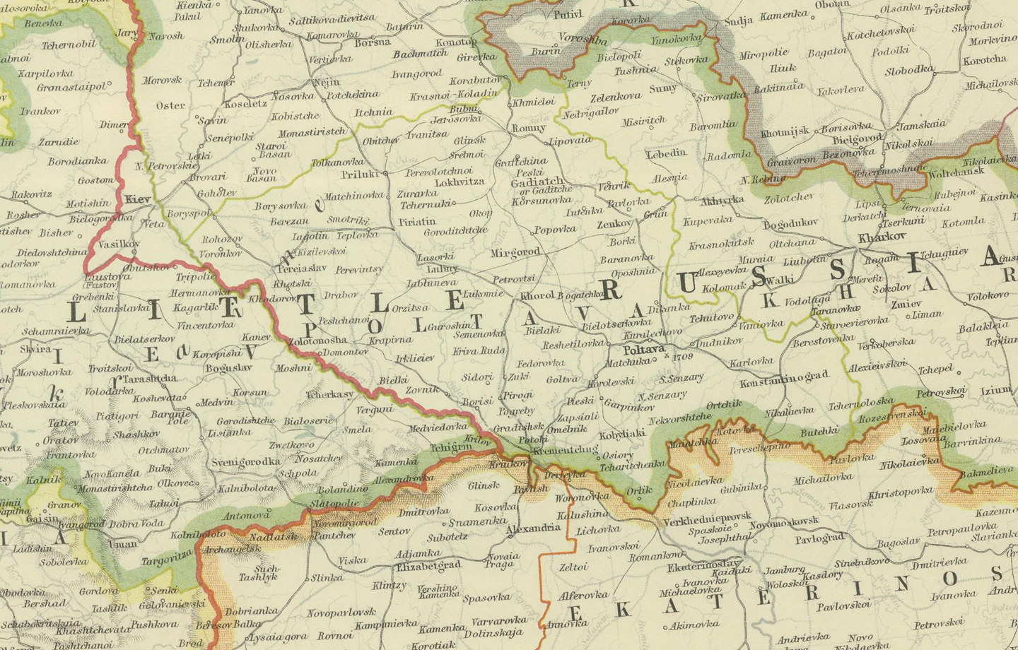
 Southern Russia 1922: Bartholomew Full Title: Southern Russia. The Edinburgh Geographical Institute, John Bartholomew & Son, Ltd. "The Times" atlas. (London: The Times, 1922) Short Title: Southern Russia Date: 1922 Cartographer: Barthomomew, John George Scale: 1:6,000,000 Region portrayed: Russian Empire, Ukraine |
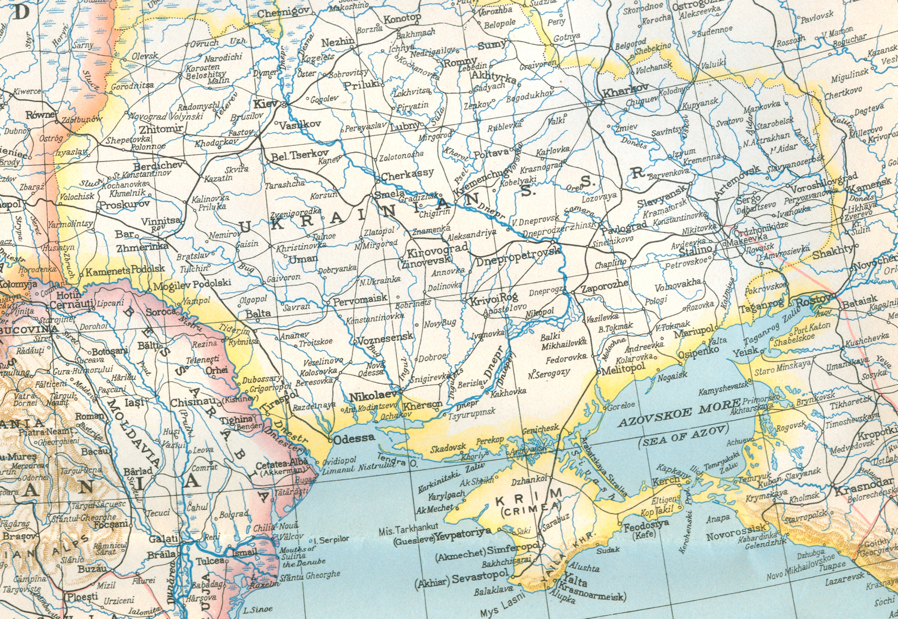 Europe and the Near East 1943: Nat Geo Soc Full Title: Europe and the Near East Date: 1943 Produced by: Cartographic Section of the National Geographic Society, Washington, D.C. Editor: Gilbert Grosvenor Chief cartographer: James M. Darley Physiography: Charles E. Riddiford Scale: 1:6,000,000 International boundaries as of Sept. 1, 1939, the day Germany invaded Poland Region portrayed: Russian Empire, Ukraine |
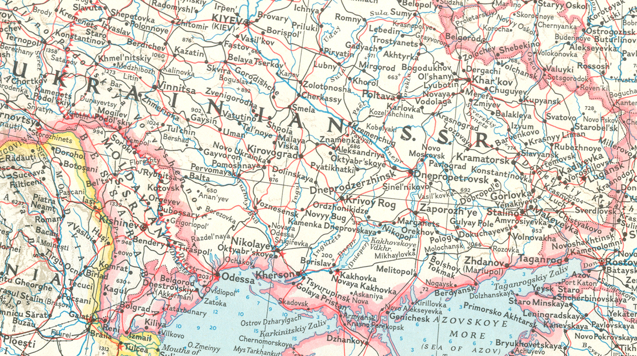 Western Soviet Union 1959: Nat Geo Soc Full Title: Title: Western Soviet Union: Atlas Plate 45 Date: 1959 Produced by: Cartographic Division of the National Geographic Society, Washington, D.C. Editor: Melville Bell Grosvenor Chief cartographer: James M. Darley Scale: 1: 6,336,000 Region portrayed: Russian Empire, Ukraine |