Photo/Map Comparisons of Vezaitine Forest
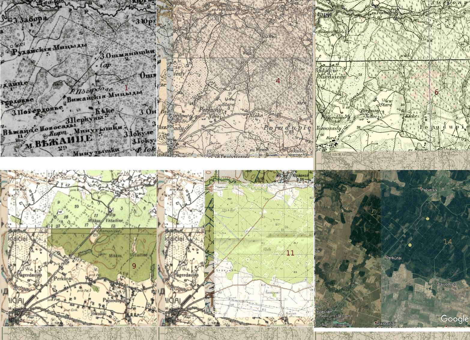
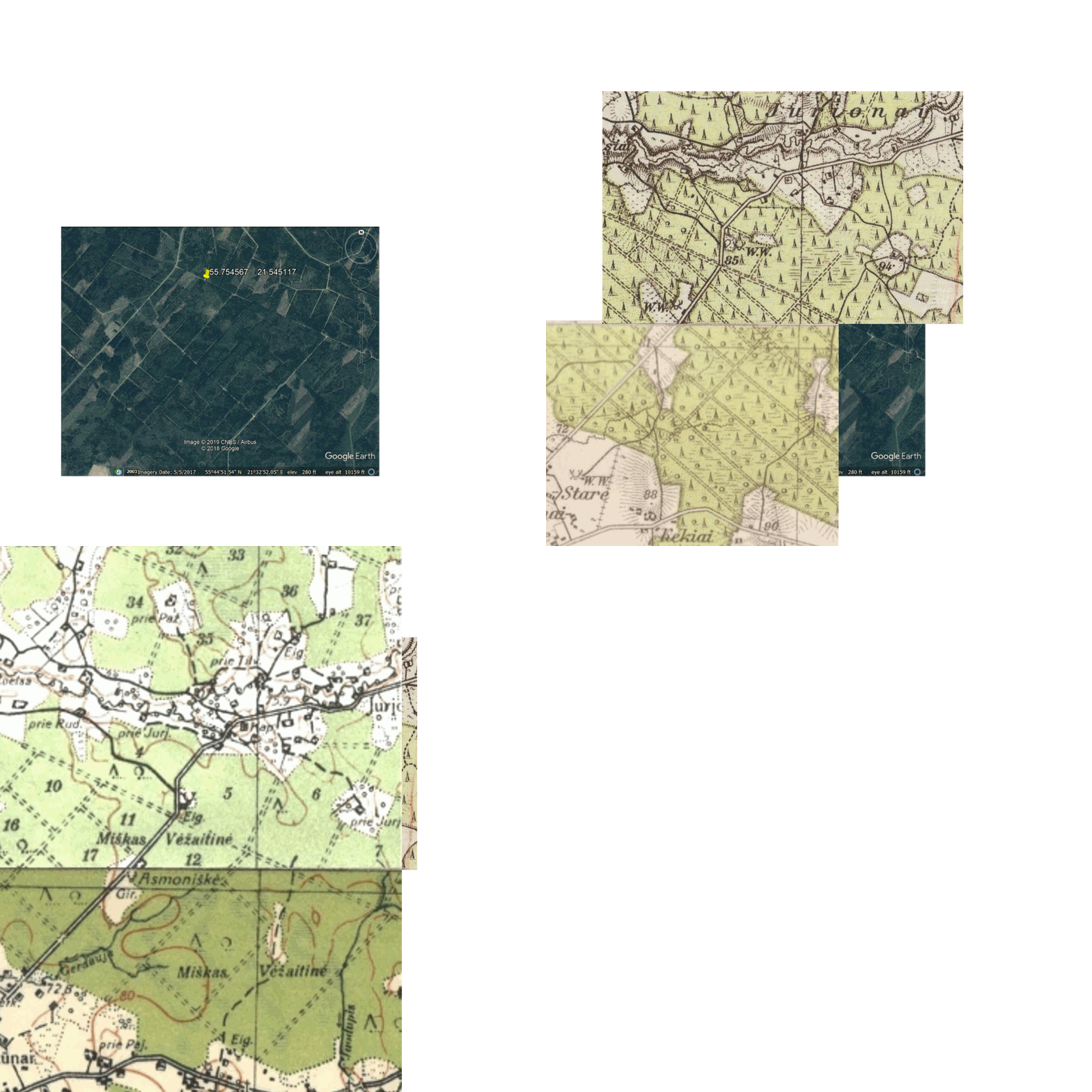
Locating the two killing sites of the women and children on historical
maps of the Vezaitine Forest may add information, for example, to
attempt to establish the routes by which the victims were taken to
the executions. The animations below align the image on Google
Earth, showing the execution sites, with German, Russian, Soviet and
Lithuanian maps from the time. Any such alignment is only approximate.
Animation
1
Vezaitine
Forest Comparison (1872-2019)
Animation 1 attempts an alignment covering a large area
of the Vezaitine Forest. The following maps and satellite photo are
approximately aligned:
10. Soviet N-34-8 1:100,000 Plunge (1978)
11. Soviet N-34-8-C 1:50,000 Kuliai (1978)
12. Soviet N-34-8-C 1:50,000 Kuliai (1988)
13. Google Earth image © 2019
CNES / Airbus; © 2018 Google; Image © 2019 Digital Globe
14. adds two women's killing sites to
Google Earth image © 2019 CNES / Airbus; © 2018 Google; Image ©
2019 Digital Globe
Note: For a current map, and aerial photos
from 2015-2017 and 2009-2010, see
maps.lt.
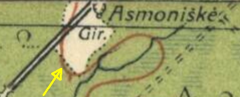
Those map and aerials show an apparent footpath similar to the dotted
line boundary indicated by the yellow arrow below, extending southeast
from the main road in Map #9, Animation 1 (
Lithuanian
Army Topographic 1301). No path is shown there on the other maps
in the Animation.
Animation
2
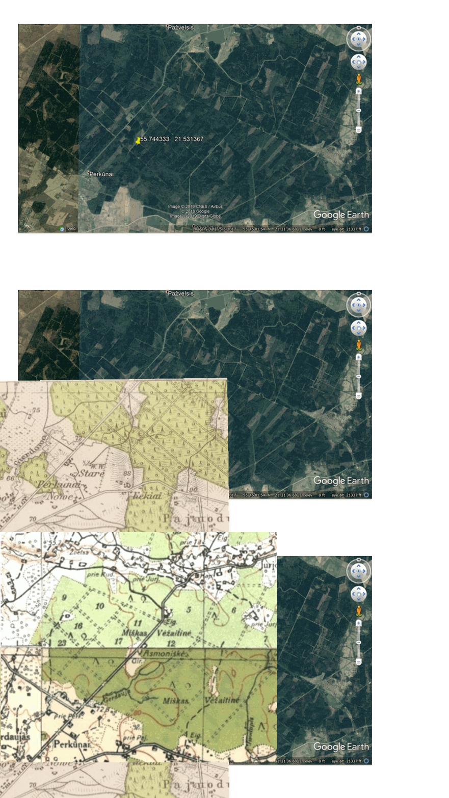
Southwest Site
By using the mouse to place
the computer's cursor on the pin, the site may be located on the other
maps in the animation.
Once again, this attempted
alignment covers a wide area of the forest.
Animation 3
Southwest Site - Magnified View
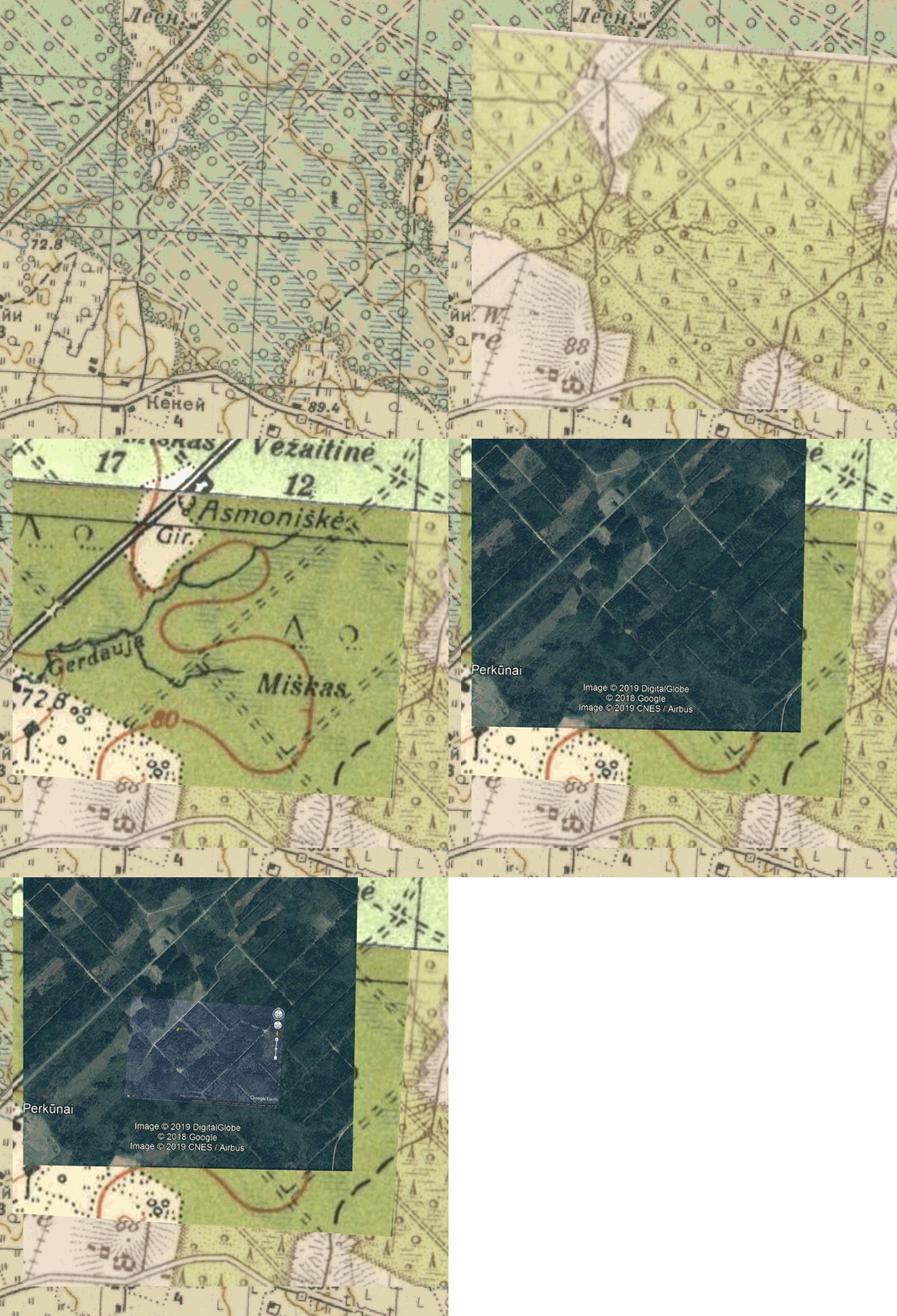
Animation 3 is focused on a smaller area of the forest. It attempts to
locate the southwest killing site more accurately, by looking for
apparent fixed points in road intersections in Animations 1 and 2,
closer to the killing site. If the location of these intersections
remained unchanged up to the present day, then they may be used to
obtain a more precise alignment. This animation cycles at intervals of
4.5 seconds:
2) Grossblatt No. 1, Memel - Karte des
Deutschen Reiches (June, 1941)
3) Lithuanian Army Topographic (1938-1939) (composite from maps 1200,
1201,
1300,
1301)
at lithuanianmaps.com.
4) Google Earth image (2019). Image © 2019 CNES / Airbus; © 2018
Google; Image © 2019 Digital Globe
5) Google Earth Image showing coordinates of Southwest Site from
Holocaust
Atlas of Lithuania. Image © 2019 CNES / Airbus; © 2018 Google;
Image © 2019 Digital Globe
Animation 4
Northeast Site
This page updated 10/01/2020
Copyright © 2019 -
2020 John S. Jaffer


