
BIALYGen
Bialystok Region Jewish Genealogy Group
GRODNO GUBERNIYA POLAND IMAGING PROJECT
SURVEY OF JEWISH CEMETERIES
by Heidi M. Szpek, Ph.D.
Associate Professor, Department of Philosophy and Religion Studies
Central Washington University
May 2007
Partial funding provided by: The Department of Philosophy & The Office of International Studies and Programs Grant Committee,
Central Washington University, Ellensburg, Washington 98926, USA
Back to Poland Imaging Project Cemeteries Index
|
Tykocin 53°12'19.20"N 22°45'32.16E Size: 4.5 acres Number of matzevoth: < 200 (180 counted; 30 with legible inscriptions; sign notes once 2500 graves)Bagnowka.com: Tykocin Gallery (1993, 1996; 2005-2006)
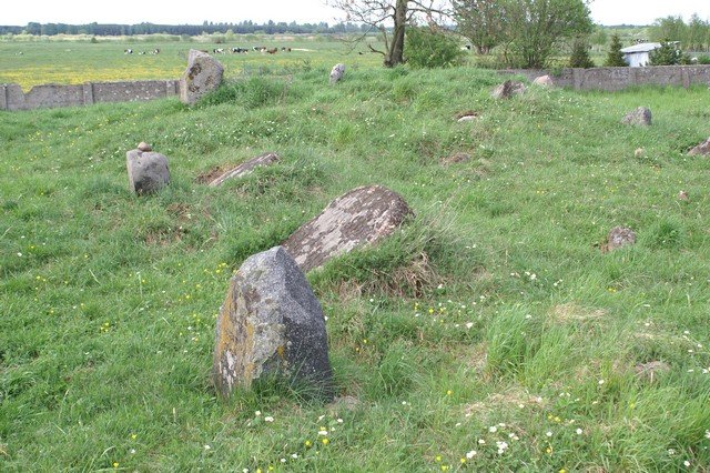
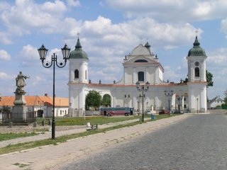
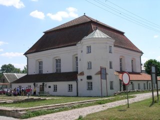
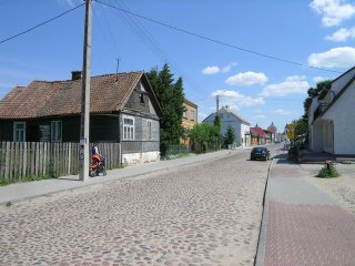
Image 1 Directions: The cemetery is easy to find as the Jewish cemetery is part of the Shtetl Museum of Tykocin. Tykocin is located c. 40 km NE of Bialystok, reached by taking highway 8 about 30 km east of Bialystok, then turning right (north) on highway 671, which leads directly to Tykocin. The cemetery is located on the western edge of town (part of the Jewish quarter) at the end of Ul. Pilsudskiego. The Holy Trinity Catholic Church stands at the eastern end of Ul. Pilsudskiego, in front of which is the Rynek (Image 2). There is a city map near the Church. Ul. Pilsudskiego runs perpendicular to the church. Following this street the Great Synagogue will be at left (Image 3). Continue along Pilsudskiego (Image 4), which will directly lead to the cemetery (Image 1).
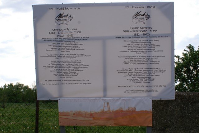
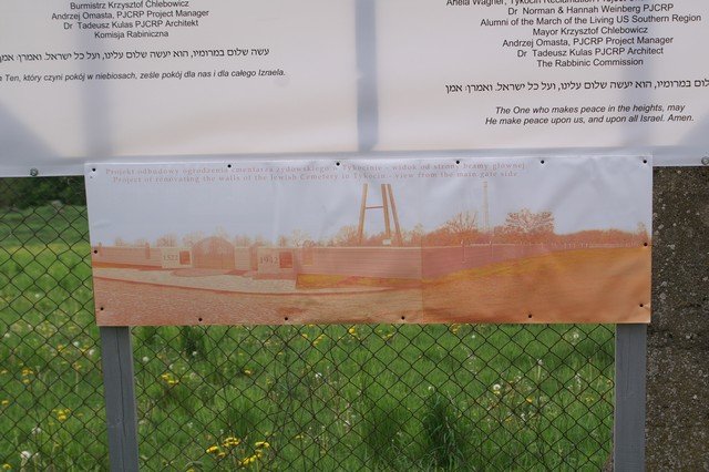
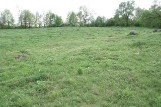
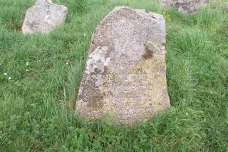
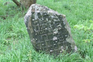
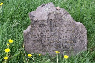
Conditions: As of March 2006, the cemetery is now marked with a sign indicating that this cemetery, established in 1522 with 2500 graves, will be undergoing reconstruction and serve as a place of study and prayer for youth groups (Images 5,6). At present there exists a partial stone wall on the northern border of the cemetery (Image 1) with a simple chain link fence marking the remaining northern, eastern and southern sides (Image 7). The area rapidly covers with low lying vegetation, while various trees and bushes flank the southern side (Image 8). In May 2007, 180 matzevoth were located, most boulder-style, some partially buried in the earth, some covered with moss or lichen. Thirty matzevoth preserve legible inscriptions (Images 9-10). Numerous gentle mounds appear throughout this c. 4.5 acre site, but most mounds are a blanket of grass that covering dung from cows which pasture in the fields open to the west of the cemetery or simply mounds of dirt. The greatest threats to this cemetery are the vegetation and erosion of any remaining inscriptions due to weather conditions.
Image 5
Image 6
Back to Poland Imaging Project Cemeteries Index
|