
BIALYGen
Bialystok Region Jewish Genealogy Group
GRODNO GUBERNIYA POLAND IMAGING PROJECT
SURVEY OF JEWISH CEMETERIES
by Heidi M. Szpek, Ph.D.
Associate Professor, Department of Philosophy and Religion Studies
Central Washington University
May 2007
Partial funding provided by: The Department of Philosophy & The Office of International Studies and Programs Grant Committee,
Central Washington University, Ellensburg, Washington 98926, USA
Back to Poland Imaging Project Cemeteries Index
|
Jasionowka
53°24'N 23°02'E
Image 1
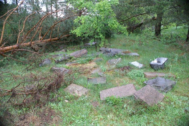
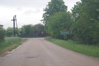
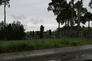
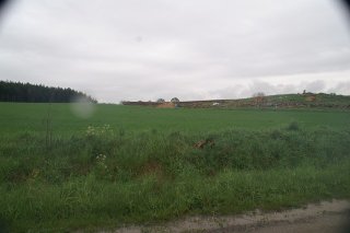
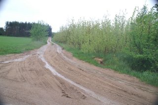
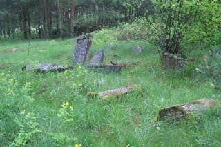
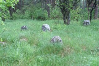
Directions: The Jewish cemetery of Jasionowka is easy to locate. Though it will not be visible from the county road from which it is accessed. The cemetery is approximately 40 km NW of Bialystok and reached by traveling 28 km on Highway 65 going NW out of Bialystok to Knyszyn. In Knyszyn take route 671 NE for about 10 km to Jasionowka. In Jasionowka the road will fork, a county road at left (north) and 671 continuing ahead. Turn left on the county road (going north to Słomianka) (Image 2). Shortly, at right, you will pass a Catholic Cemetery, a bit further, a new stone wall for the cemetery (Images 3,4), a road that leads to this stone wall construction and THEN a dirt road heading upwards into the forest (Image 5). Proceed up this road into the woods, at left is a dump, at right (in May 2007 was a large fallen tree and) a grouping of 33 fallen matzevoth (Image 1).
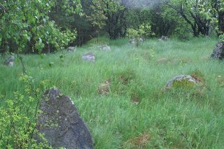
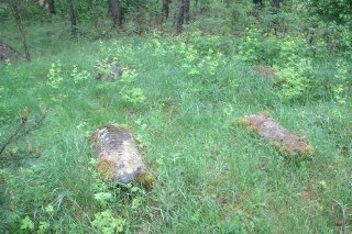
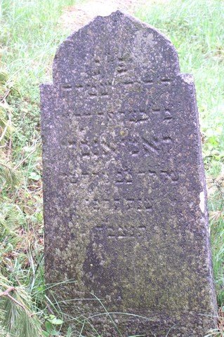
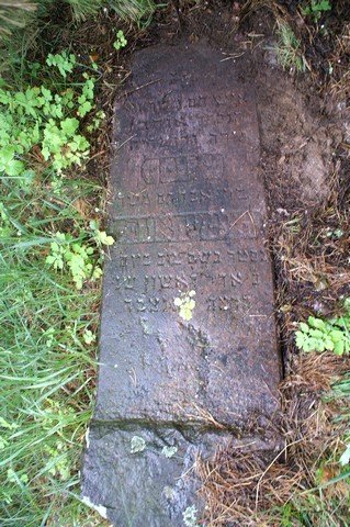
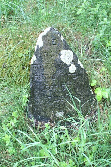
Conditions: The cemetery is located hidden from the county road by a pine ridge forest. The cemetery itself is predominately a grassy field with a few trees. It is situated on a hill, creating a ridge around three sides with varying heights (Images 6,7). At the back is a steep ravine. Remnants of a masonry wall can be found on the western and northern sides. On entering, a grouping of 33 fallen matzevoth are found (Image 1). An additional 200 matzevoth were counted over a c. 3 acres area (Images 6-9), most are found in the first acre as you enter. Matzevoth preserve inscriptions with various degrees of legibility (Images 10-12), many with lichen (Images 8,9,12). More than 100 supports covered with moss and without matzevoth were also noted (Image 8). The greatest threats are the nearby garbage dump, vegetation overgrowth and climate.
Back to Poland Imaging Project Cemeteries Index
|