
MENU
Skip menuMaps of Pogrebishche and Nearby Shtetls.
General Geography
Mapquest (current map)
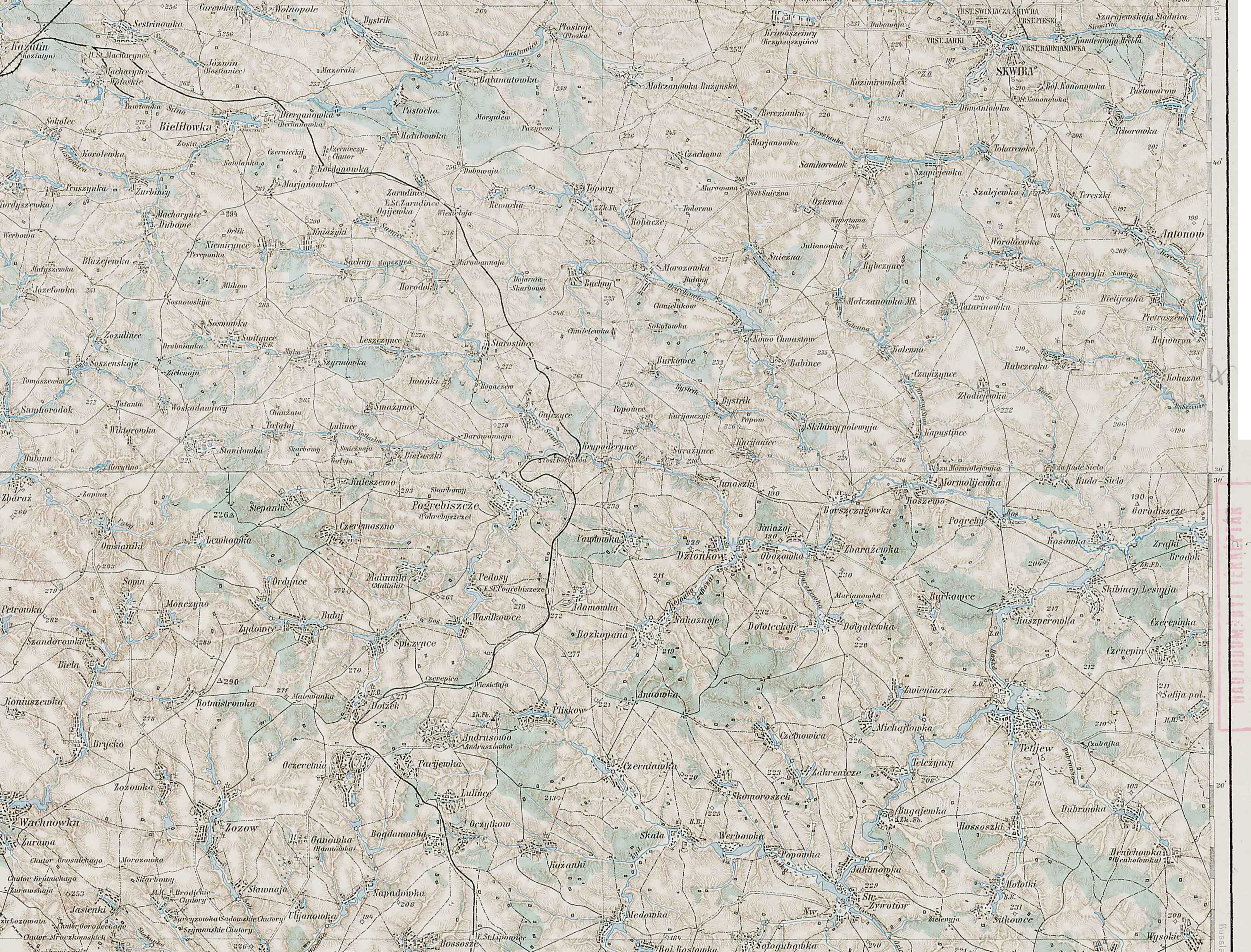
1910 Austrian Army Map (click to enlarge)
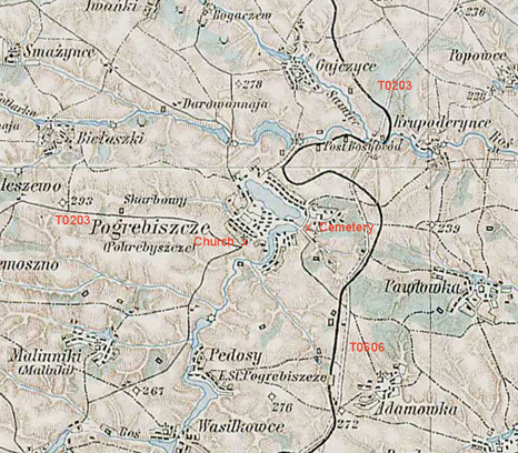
The City of Pogrebishche
Pogrebishche was a small town and no detailed map of the town is available in the 21st century, let alone from 100 years ago. The most specific map we have found thus far is a detail from the 1910 Austrian Army map above, to which we have added some annotations.
Nearby Shtetls
Pliskov - 8 Miles S
Borschagovka - 12 Miles E
Ruzhin - 16 Miles N
Belilovka - 17 Miles NW
Samgorodok - 19 Miles W
Tetiev - 19 Miles ESE
Lipovets - 20 Miles SSW
Zhivotovka - 21 Miles SE
Vakhnovka - 22 Miles WSW
Skvira - 25 Miles NE
Kazatin - 25 Miles NW
Ilintsya - 25 Miles S
Pavoloch - 28 Miles NNE
Volodarka - 29 Miles E
Bila Tserkva - 43 Miles ENE