BoguslavKiev Gubernia, Ukraine
KehilaLink Search
To visualize the dropdown menu you have to activate Javascript.
Goto the SITE MAP
Home
History
Local History
Historical Maps
Boguslav Past and Now
Interviews
Photos
People
City
Links
Records
1789 Revision List
1806 New Surnames
1767 Bohuslav Starost List
1832-1833 Mills and Inns
Historical Maps
Street Map
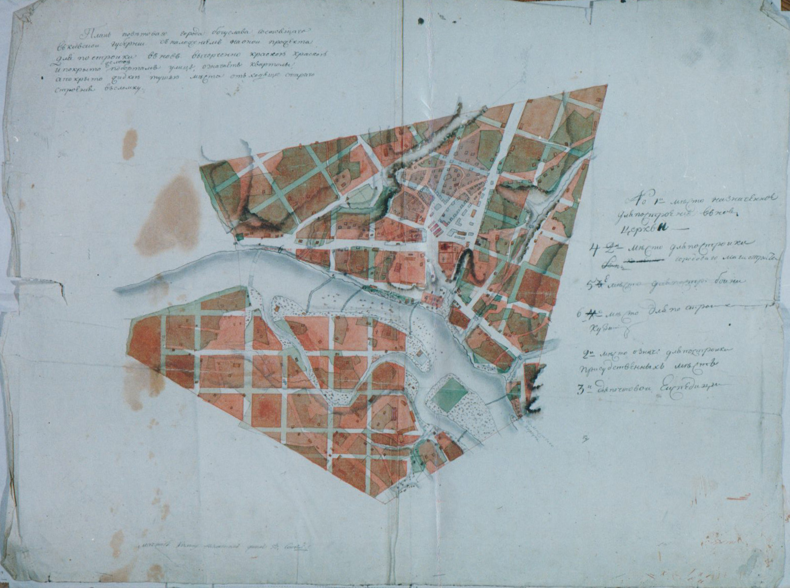
xviii Century Boguslav City
(source: State Archive in the Kiev Oblast;
Fond 1542; Opis 1; Delo 1284)
(click to enlarge)
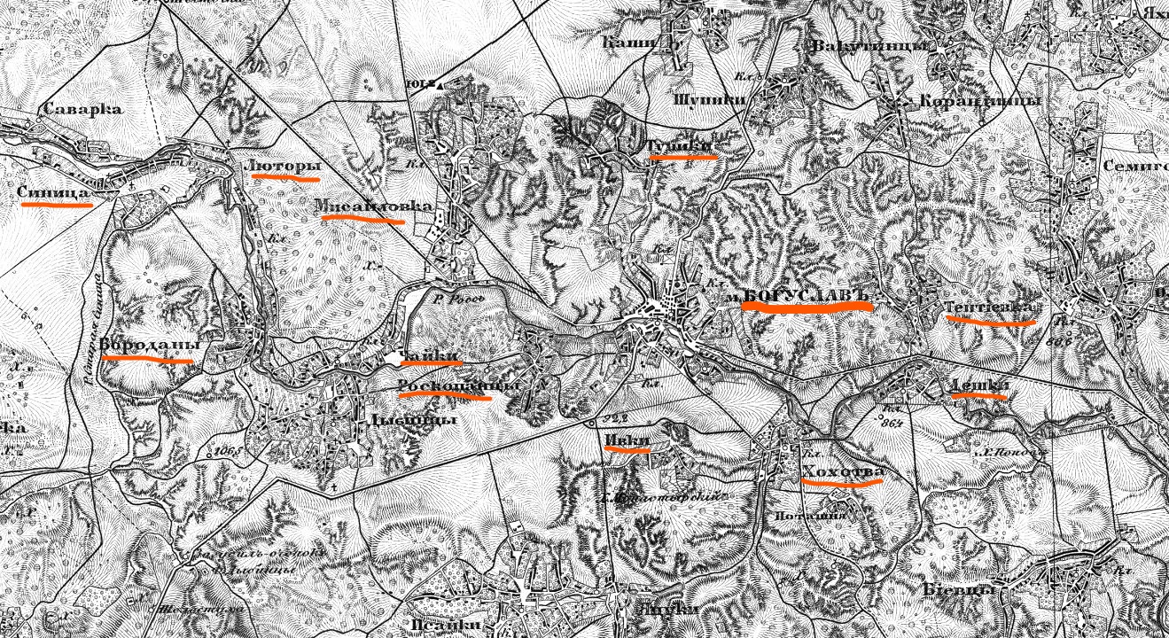
Topographic Map
xix Century Boguslav Volost
(source: Library of Congress)
(click to enlarge)
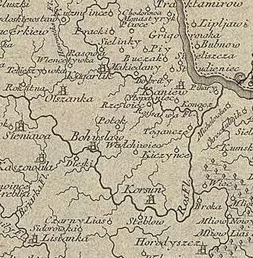
Regional Map
1720 Boguslav Vicinity
Kiev Woiewodstwo
(source: Mapova Sbirka PiFUR)
(click to enlarge)
Last Modified: 04-09-2021
Share:
Contact Ilya Zeldes
|
Site Map
|
Ukraine SIG Home
|
KehilaLinks Home
|
JewishGen Home
This page is hosted at no cost to the public by JewishGen, Inc., a non-profit corporation. If you feel there is a benefit to you in accessing this site, your
[JewishGen-erosity]
is appreciated.
webmaster: richard L. baum
Copyright © Ronald Doctor 2011-2012 - All Rights Reserved.