
Buildings of the Jewish Community
There are several sources of information concerning
the buildings of the Jewish community, including the recollections
and town
diagram provided by George Birman, the town drawing in the Gorzd Memorial Book,
aerial photos #157
and #158
dated January 16, 1945, the 1923 synagogue plans in the Lithuanian
Archives, a German
firemap
from 1939, recollections of Gargzdai residents set forth in
the Memorial Book and elsewhere, and whatever may be learned from
present conditions on the ground or in satellite photos on maps.lt
and Google
Earth. Aside from a photo
of the ruins taken by George Birman in 1945, and the 1945
aerials, no photos are known to exist of any of the buildings,
with the exception of one possible photo of an ark.
_____________________________________________________________
[Note: Possible photo of ark: A photograph labelled "The aron kodesh in Gorzhd" appears in Rabbi Ephraim Oshry, The Annihilation of Lithuanian Jewry (Brooklyn: The Judaica Press, Inc., 1995), ISBN 1-880582-18-X, p. 195. What appears to be this same photo, but perhaps a different copy, may be found in the archives of Yad Vashem. The Yad Vashem webpage currently states the picture to be of Grudziadz, Poland. The handwriting on the back of the photo, as posted at Yad Vashem, states it to be "Gruzd" and "study hall" (in Hebrew alphabet), and "Gruzdziai" (in Latin alphabet). The Yad Vashem archives have also previously attributed this photo to Gruzdziai - see previous link at p. 210. This same photo is attributed to Gruzdziai in Josef Rosin, Preserving our Litvak Heritage, Vol. II (2007).
The towns of Gargzdai (Gorzd) and Gruzdziai (Gruzd)
are frequently conflated.
Aside from the photo of the aron kodesh, Rabbi
Oshry's book shows a second photograph entitled "view of Gorzhd"
on p.195. This street view is the same photo attributed to
Gruzdziai in the archives
of Yad Vashem, where it is dated 1927. The same photo
appears in the Gorzd
Memorial Book, p. 48 (English section) where it is labelled
"Market Street." Rosin in Preserving
our Litvak Heritage Vol. II (2007) attributes this street
photo to Gruzdziai.
The author of the present webpage obtained from an online auction site a copy of the aron kodesh photograph. On the back it contains separate ink stamps from Vad Yashem and Encyclopedia Judaica, and handwritten notes in English and Hebrew. The handwritten notes refer to Gruzdziai. In other handwriting, someone has crossed out the "ru" in Gruzdziai, and written above those two letters the letters "ar." Someone evidently thought the original handwritten attribution of Gruzdziai was incorrect, and the ark pictured was in "Garzdziai."
The auction seller in Israel reported that he had acquired the photo (and other items) a number of years ago from the archives of the Encyclopedia Judaica. The stamp for Encyclopedia Judaica contains the notation that the photo is Illust. No. 71/899 and Neg. 16451. The notation 71/899 appears on several photos of Lithuanian synagogues, listed by the same seller, bearing the stamps of Encyclopedia Judaica and Yad Vashem. The photo does not seem to be printed in Encyclopedia Judaica (1st Ed.), which has no entries for Gargzdai, Gorzd, Gruzdziai, or Gruzd.
It is unknown whether Rabbi Oshry, as well as the
anonymous annotator of the photograph formerly in the possession
of Encyclopedia Judaica, had particular reasons for attributing
the aron kodesh photo to Gargzdai and not Gruzdziai. This remains
a topic for further investigation.]
________________________________________________________________
The pictures in the town diagram near the front of the Gorzd Memorial Book give some idea of the appearance of the buildings.

The aerial photos reflect conditions after a devastating fire in 1939, and battles in June, 1941 and October, 1944. Presumably further destructive efforts were aimed against the buildings during the Nazi occupation. The Gorzd Memorial book, published in 1980, reflected the memories of those who had left prior to 1941 and in most cases much earlier. They probably worked without any maps or photos. The configuration of the buildings did not remain constant over the years, and various sources may reflect different time periods. Given all these sources of uncertainty, it is inevitable to find conflicting memories and interpretations. Nonetheless, there are remarkable areas of agreement.
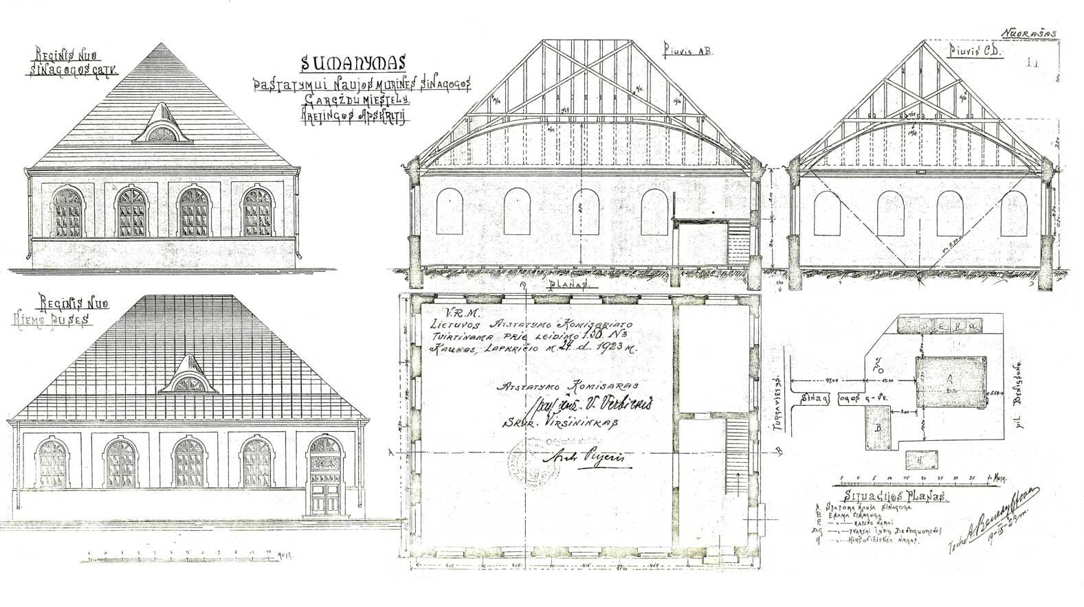
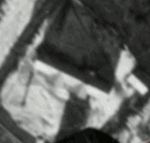
Illustration 2A
Illustration
2(a) contains plans of the synagogue complex from the
Lithuanian archives, LCVA, f. 1622, ap. 4, b. 1086, dated
1923, formerly posted by Gargzdai
Area Museum. The plans consist of large
architectural drawings of the new synagogue (a floorplan,
elevations and cross-sections), together with a smaller
plot plan (1/5 the scale of the larger drawings) showing
the location of several buildings within the synagogue
complex. These are labelled as the
existing synagogue (B), the new synagogue (A), and the
existing rabbi's residence and four classrooms.

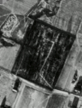
The aerial photograph #157 of Gargzdai, aligned to true north, with synagogue plans superimposed, is shown below in Illustration 3:
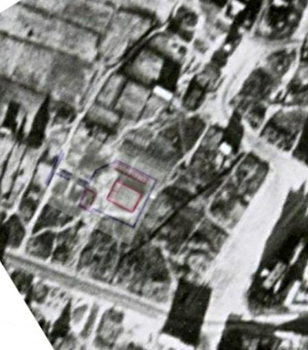
The
best match between the plans and aerial applies only
to the large building. As for the existing
synagogue, see discussion below at Illustration 21.
The rabbi's residence and classroom were evidently
constructed in a different place than shown in the
plans.
Janina Valanciute writes in Gargzdu miesto ir parapijos istorija (Vilnius 1998, ISBN 9986-23-047-0) that the new stone synagogue was not completed until 1928. There could have been considerable variation from the 1923 plans.
Present
day satellite photos show that the area formerly
occupied by the new synagogue shown in the 1923
plans is now a grass-covered area and basketball
court. The author has been told by two
residents, in 2001 and 2008, that a wooden home to
the west of the grass-covered area is at the former
location of the synagogue. The resident speaking in
2008 indicated that this synagogue had been made of
brick. Its location is consistent with the
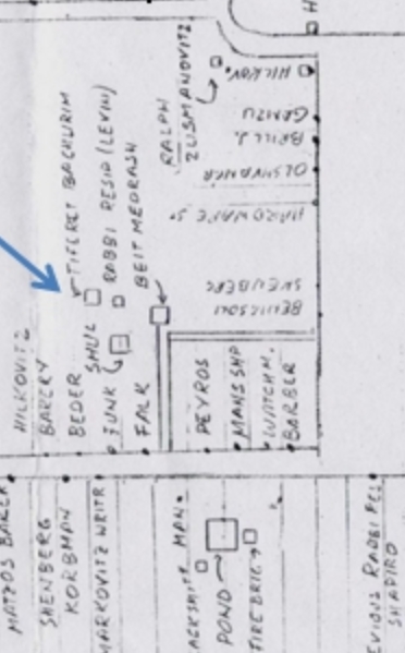
building which former Gorzd resident George Birman
labelled Tiferet Bachurim in his Town Plan, and
which Birman also said was made of brick. Birman had
the benefit of Aerial #157 when making his diagram.
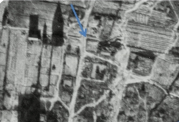 |
|
| Likely location of Tiferet Bachurim on 1945 aerial | George Birman town plan (portion) |
Illustration
4
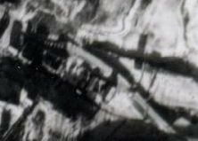
George Birman told the author that in the 1930's there were four buildings of the Jewish community in this area: a Beit Midrash (made of wood), a Shul (made of white masonry), a Tiferet Bachurim (for teenage boys, made of brick), and the rabbi's residence/school. His Town Plan indicates that the Beit Midrash was the building farthest to the east, while the Shul was to its southwest. The Gorzd Memorial Book (Illustration 1 above) shows the two labeled buildings in a similar configuration to that shown in the Birman diagram. The diagram in the Gorzd Memorial Book indicates that the Beit Midrash is the larger rectangular building with the arched windows, which looks similar to the building shown in the 1923 plans, and the building to its southwest is labeled "Shul." The building which Mr. Birman labelled "Bet Midrash" on his town plan was the newer building, which was made of masonry, while the building he labelled "Shul" was the older building, made of wood. It is highly likely that he simply misspoke when he described the building materials of the Shul and Beit Midrash.
After
construction of the new Beit Midrash,
the old Beit Midrash building was
used
by
Tiferet
Bachurim. This
appears to be the
topmost building shown
in the diagram in the
Gorzd Memorial Book.
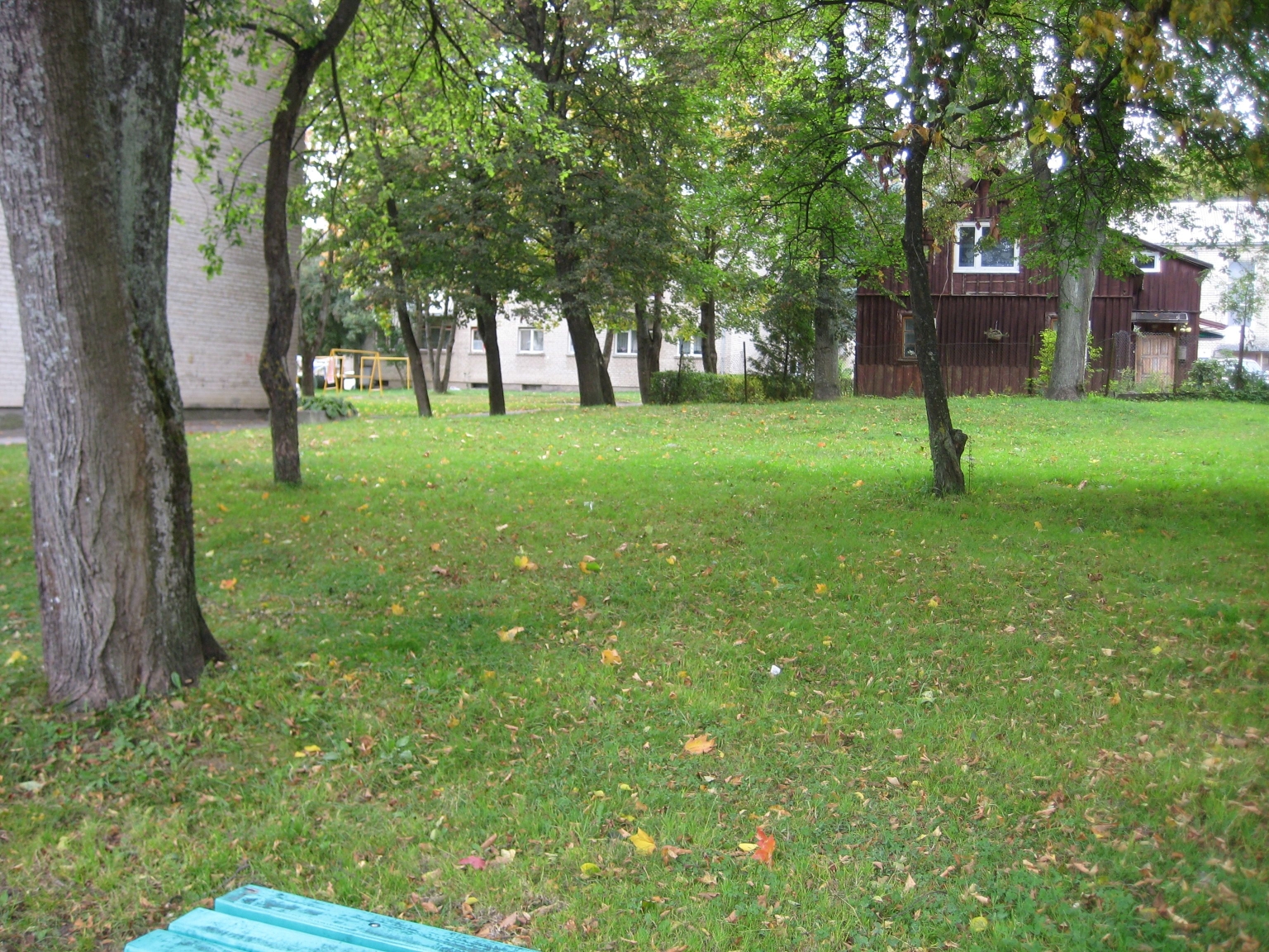 |
 |
 |
| Looking west towards
location of old synagogue and Tiferet Bachurim (2009) Wooden house indentified by two residents as site of former synagogue Photo taken from basketball court |
Looking north towards
likely site of Tiferet Bachurim (2009) Street running east-west identified by a resident in 2008 as Synagogue Street. Street is shown on 1923 plan of synagogue ("Sinagogus g-ve [street]"), Illustration 2A |
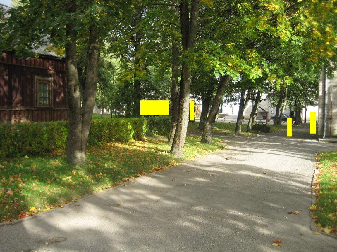
Looking east on
SynagogueStreet (2009) (yellow rectangles inserted for privacy) |
Illustration 5
In
order to place this building on the 1945 aerial,
one can align the aerial with a modern map at openstreetmaps.org,
and adjust the items in a graphics program until they
correspond. Top of the map and photo is towards
northeast.
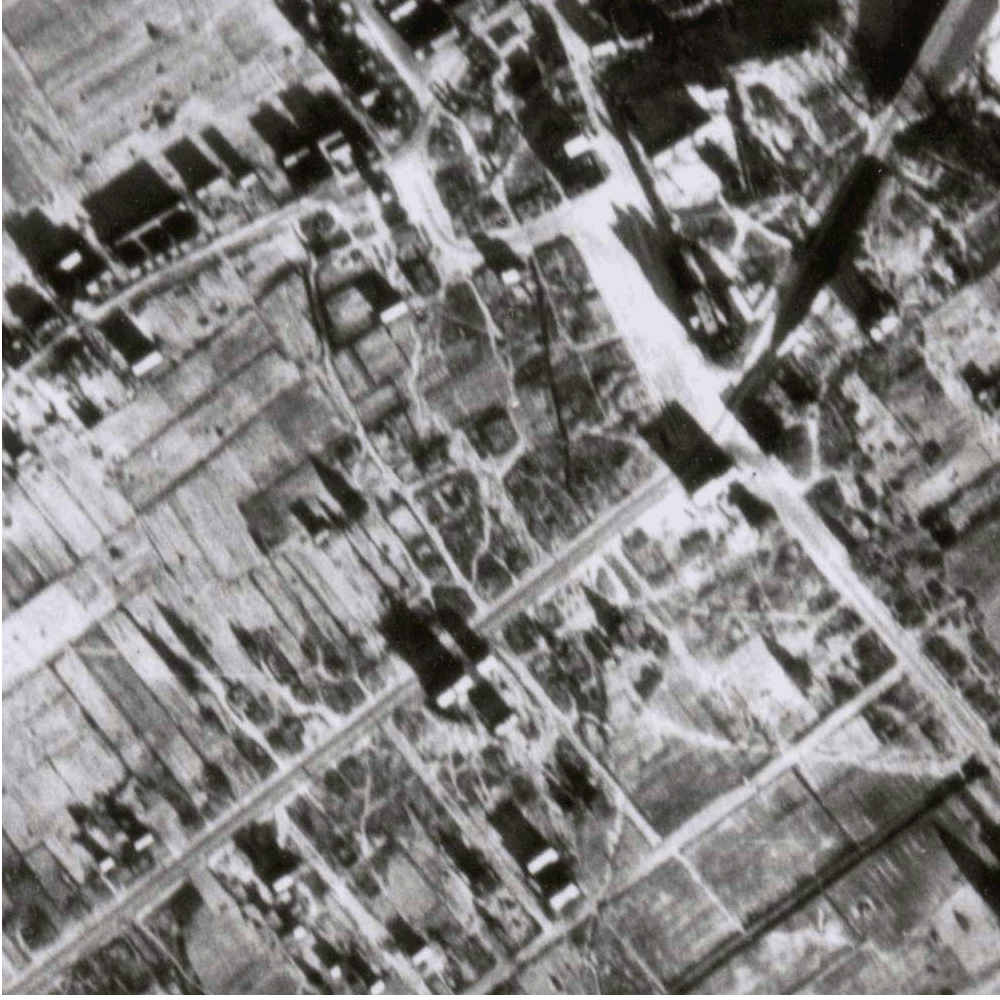
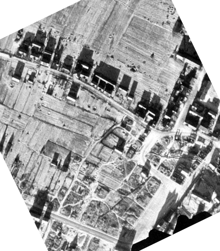
Illustration 6
Note: Building identified by residents as former synagogue is marked #14 on openstreetmaps.org map.
Map from OpenStreetMap © OpenStreetMap contributors. copyright information for openstreetmap.orgThis type of comparison is inexact, and different attempts can result in different alignments, even far enough apart to align different buildings. Slightly different comparisons of the map and aerial are shown farther below on this page.
 |
 |
|
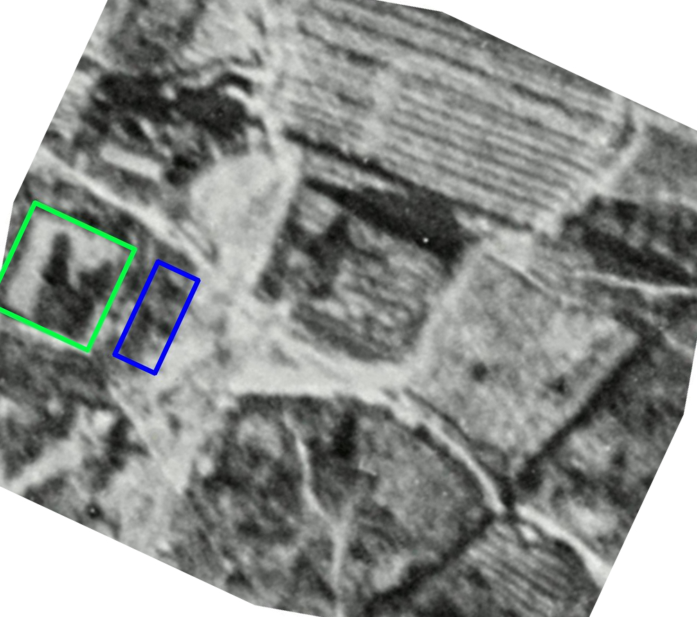
Portion of Aerial
#158 (January 16, 1945) showing
synagogue area. North is at the top.
For animation
showing the relationship between photos
#157 and #158, see here.
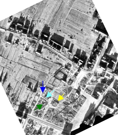
|
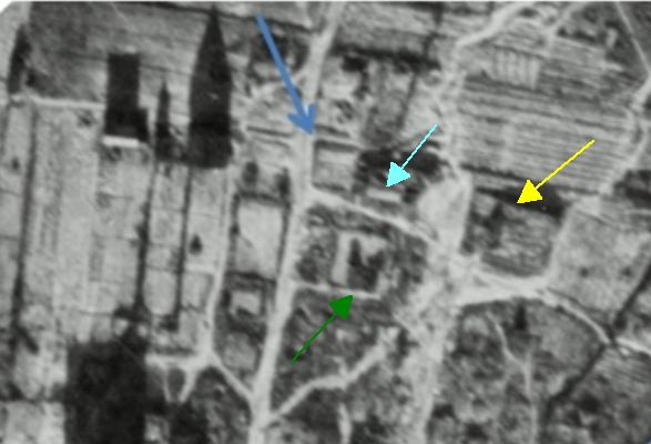
1)
new Beit Midrash, made of masonry
(yellow arrow),
2) old shul, made of wood (green arrow) (?), 3) Tiferet Bachurim, made of brick, at site of former Beit Midrash (dark blue arrow), and 4) rabbi's residence and school (light blue arrow) (?) |
The Gargzdai plans show an interior wall and women's gallery. The interior wall has been added in Illustration 3 above to the west interior of the largest building. This internal wall matches features on the aerial photo.
The large architectural plans show the internal wall (and women's gallery on the second floor) on the right-hand side of the plans, and two exterior doors on the lower right corner. (The two doors are probably separate entrances for men and women. Sergey Kravstov, "Synagogue Architecture in Lithuania," in Synagogues in Lithuania, supra, p. 53; Maria and Kazimierz Piechotka, Wooden Synagogues, Institute of Polish Architecture of the Polytechnic of Warsaw (1959), p 36.) The floorplan would not necessarily show north at the top, but the accompanying plot plan shows the exterior doors to be at the southeast corner of the building. The women's gallery could not be on the east side, because the aron kodesh (ark) was traditionally placed on the eastern wall. The women's gallery would commonly be on the west side, over the vestibule. Thus, Illustration 3 assumes that the plans somehow were drawn in a mirror image of how the building was actually constructed. Perhaps the person originally drawing the plans had not been told of the traditional orientation towards the east. A path on the ground, shown in the photo, leads to where an entrance would be located, if the entrances were at the southwest corner, not the southeast corner as shown on the plot plan.
For reference to the aron
kodesh on the east side
of Lithuanian and Polish synagogues,
and/or the women's gallery on the west
side, see Kravstov, supra, p.49-50;
Levin, supra, pp. 36-37; Marija
Rupeikiene, "The Sacral Heritage of
Jewish Culture," in A. Jomantas, ed., Jewish
Cultural History in Lithuania,
Department of Cultural Heritage under
the Ministry of Culture, Versus aureus
(2006), ISBN 9955-699-47-7, at pp. 158,
159, 160, 163, 164; Alois Breier, Max
Eisler and Max Grunwald, Holzsynagogen
in Polen [Wooden
Synagogues in Poland] (1934), p.63;
Maria and Kazimierz Piechotka, Wooden
Synagogues, Institute
of Polish Architecture of the
Polytechnic of Warsaw (1959), pp. 23,
28.
The
plans for the Sveksna synagogue
(constructed 1928) are highly similar to
the Gargzdai plans. Additional
Sveksna plans formerly posted online
(see Illustration 15 below) show the ark
on the east wall, and the women's
gallery on the west side upper floor.
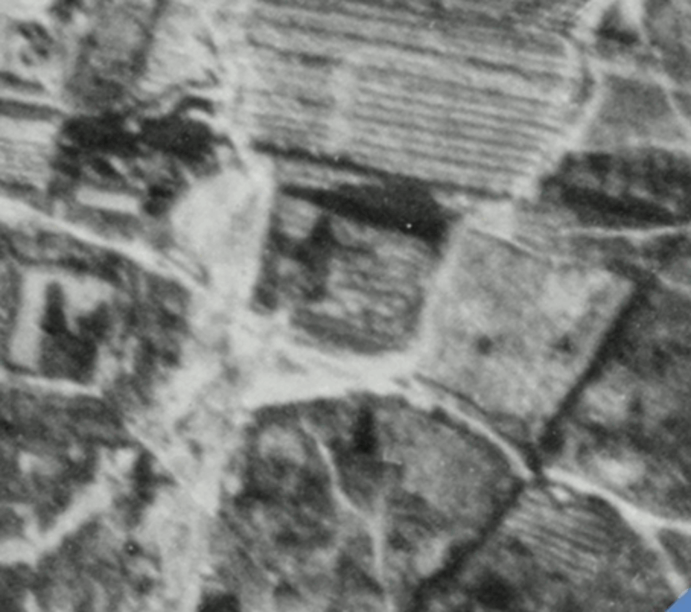
Illustration 9
Animation showing at 3 second intervals:
Notes: High resolution scan of Aerial #158 was obtained from U.S. National Archives.
Small white dot at upper right corner of synagogue building, and several less bright dots NW of the bright dot, may be airborne barrage balloons. No dots appear here in Aerial #157, photographed a moment before.
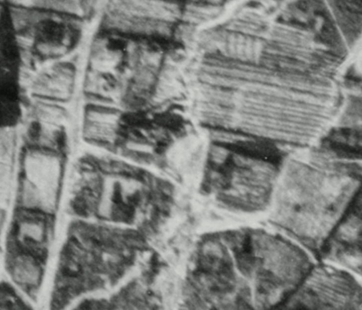


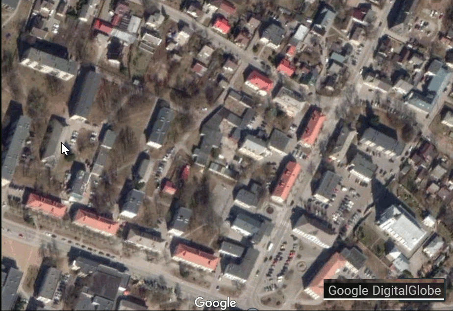
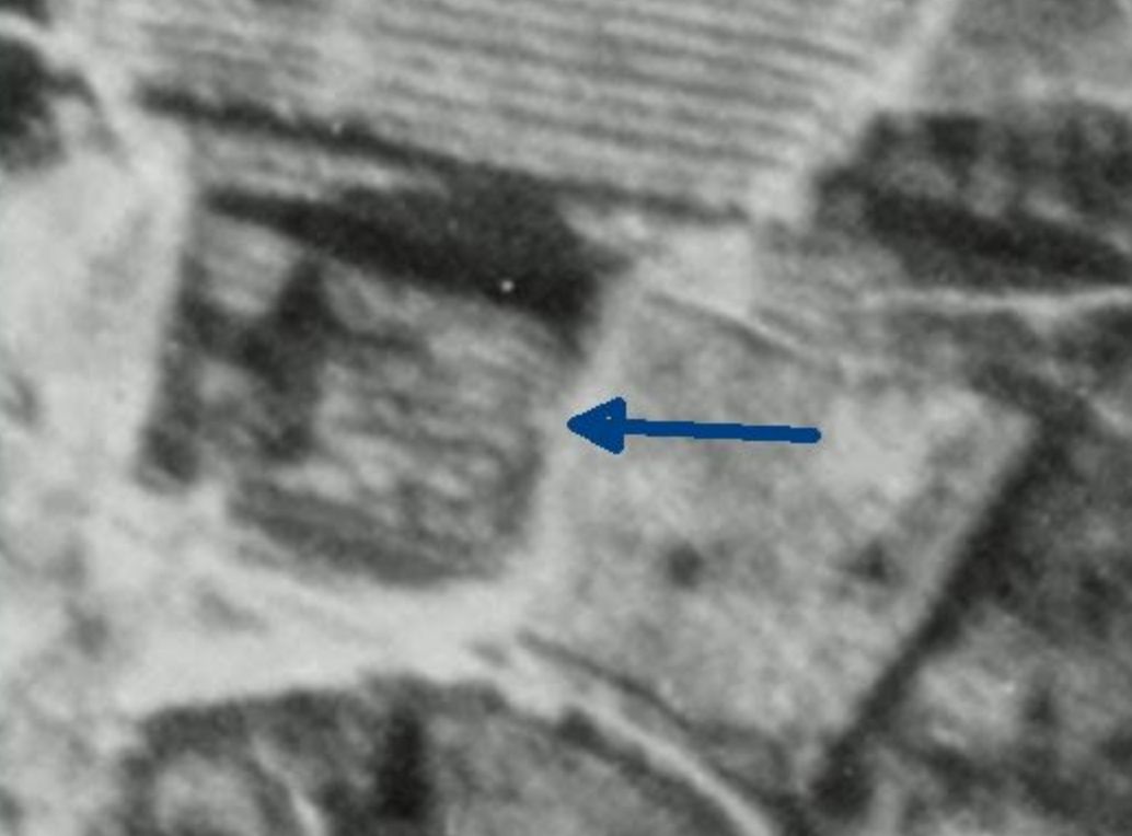
Illustration 14
Does white square (at tip of blue arrow) show the
remnants of ark and steps leading to it?

In comparing the Sveksna elevation with
Aerial #158, the base of the steps to the
ark in Sveksna is of similar size to the
white square at the east wall shown on
Aerial #158.

Animation showing at three second intervals:
Note: the Sveksna plans do not show dimensions, so the above animation was creating assuming the Sveksna synagogue is approximately the same length as the Gargzdai synagogue/Beit Midrash. The Gargzdai synagogue plans show its length to be 21.5 m, while the Google Earth measuring tool shows the Sveksna synagogue building (existing at the time of the satellite photo) to have a length of approximately 22 m.
Comparison with current map and satellite photo suggests this centerpoint of the eastern wall of the new Gargzdai synagogue/Beit Midrash, now may lie near the southeastern corner of basketball court, at the far side of the court shown below. (Yellow rectangles in photo hide individuals for privacy.) Standard international width for a basketball court is 15 m., a measurement which is confirmed for this court using the Google Earth measuring tool. Therefore, if this placement of the building is correct, some of the building (approximately, the women's gallery and area beneath it) may have been at the location of the grass in foreground, but the major portion of the building may have been on the present day basketball court.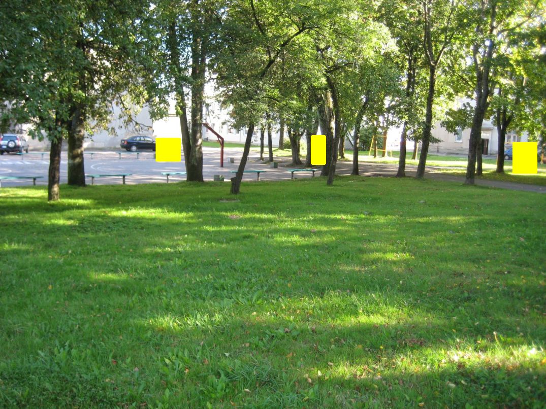
| Photo from 1945 aerial | Control Point - link to current photo |
Potential Problems in Using Point to
Align 1945 Aerials with Satellite Image |
 |
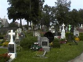
Catholic cemetery and angled interior road. | Cemetery is some distance away from religious buildings. |
 |
From Aerial
#158: Chapel east of church (at right center); partially obscured shadow of bell tower (at bottom center) |
The photos seem to show the plan of the chapel has somewhat changed since 1945, in that it was longer than it is today. |
 |
From Aerial #157: Bell tower south of church, casting shadow towards north |
View of bell tower on aerial is
unclear. |
 |
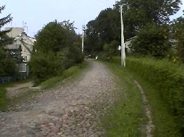
Minijos
gatve (street) |
Location of cobblestone street unchanged between 1945 and present, but descent of street to lower elevation causes apparent shift in position. |
| Other streets,
corners and paths. |
Location of centerlines and edges may have changed with paving and modernization. | |
 |
Round spot [Well (?)], and circular statue garden east of Klaipeda Regional Tourist Information Center | At the present time there is no evidence, other than the location, that the design and placement of the statue garden were connected to the circle appearing on the aerial photographs. |
 |
Building identified by current residents as former synagogue. | While
the building seems to
closely correspond to
this location in the
1945 aerials, using
this as a major basis
for initial alignments
may be a questionable
assumption in
attempting to prove
the location of the
religious buildings.
May be used with more
confidence after
likely correspondence
is demonstrated. |
For information on Sveksna
synagogue, which is similar to the
Gargzdai plans, see:
recent
photo
historic
photo
KehilaLinks
page
for Sveksna
Index
of Jewish Art, Hebrew University
of Jerusalem, "Synagogue in
Sveksna"
The
restored synagogue building on 7
L. Zamenhofo St., Kaunas (first
constructed in 1850), pictured at
Vikipedija,
bears a resemblance to the plans
of the Gargzdai synagogue. The
restored synagogue is pictured in
Rupeikiene, p. 157, and discussed
on p. 163. It is also described in
the Synagogues
of Kaunas.
Another of Kaunas' thirty-six pre-war synagogues, shown in an aerial photograph on an undated postcard, also somewhat resembles the Gargzdai plans.
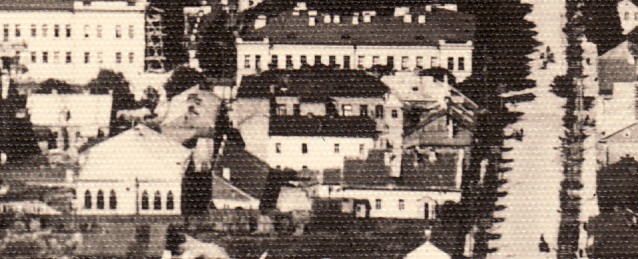
Photo looks west along present
day Kestucio gatve. Building at
lower left is now located at 26B
Gedimino, and is described
in the Synagogues
of Kaunas. Pictured here
and here
on Wikimedia.
Jewish Synagogues of Lithuania at JewishGen
Neishtot-Tavrig
(Zemaiciu
Naumiestis) at Jewish
Community of Lithuania
wiki: Wooden synagogues of the former Polish-Lithuanian Commonwealth
This page updated 4/28/21
Identification of Features on Aerial Photo | Aerial Photo of Gargzdai