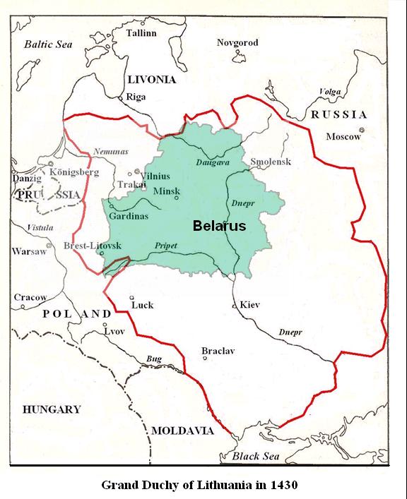
Grand Duchy of Lithuania in 1430
The red border shows the geographical extent of the Grand Duchy of Lithuania in 1430 in terms of modern-day borders. The geographical territory shown in light-green was known as White Russia (Belaia Rus') in the fifteenth century, and Belarus from the seventeenth century to today.

Source:Kanowski, Max. "Gdlbelarus1400.JPG", Wikipedia, 11 February 2006.