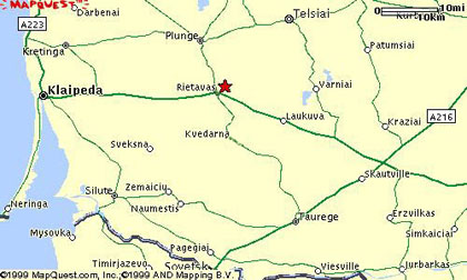
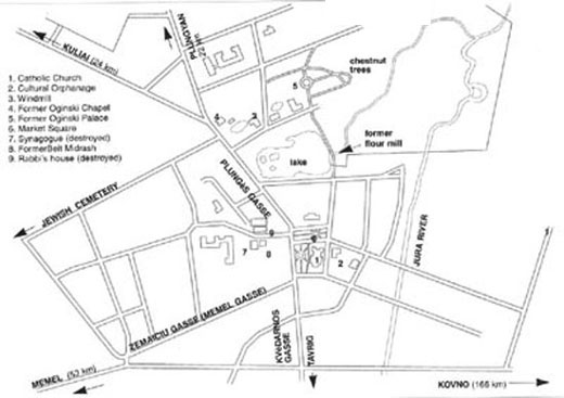
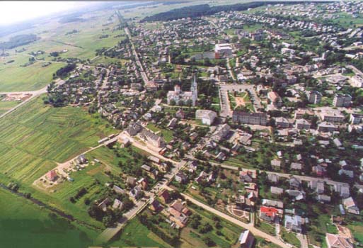
Ritavas (Ritove) is
a small town situated on the coastal plain of north-western
Lithuania. In the days before Lithuania
gained its independence, and the area was still in the Czarist empire,
it was in the Rasseiniai district of the province (guberniya)
of Kovno (Kaunas). It was on the main
road to the German port of Memel
(present-day Klapeida, part of Lithuania), which is 30
miles away to the west, and
was the main commercial centre in the area. It was also not
far from the Courland port of
Libau (Liepaja, now part of
Latvia), which was the main departure
points for ships sailing to London.
The countryside between Ritavas and the
coast was low-lying and marshy, and the area was
known as Samogitia (Zamut), which meant
"low land". Transport was by horse
and cart, but the road to Memel - at best a dusty track - was often
muddy and unpassable in wet weather. The road to the north
led to Plunyan (Plunge) 13 miles away, and
from there eastward to the other large town in the area, Tels
(Telsiai). There was no railway
station before the establishment of the independent
state of Lithuania in 1918; the
nearest rail station was in Plunyan.
The River Jura flows through the town, and eventually joins
the River Nieman in the south,
which flowed through parts of Germany
to the sea. There were many
lakes, streams and forests, and the area was one of great natural
beauty. Today the area north
of Plunge is a national park.
|