

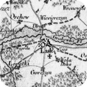
Detailed Prussian map of Łask and environs
produced by David Gilly and published in 1802-
1803. The map shows that the the town was a
main coaching/post inn stop (denoted by the cross)
and a place to change coach horses, that it had six
adjacent water-mills, three bridges over the river
Grabia and that it was close by extensive
woodlands.


Compiled by Martin Davis © 2010 -15
Google Map of Lask
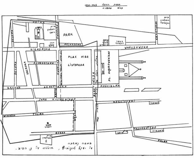
Map produce for the Lask Yizkor (Remembrance) Book published in Tel Aviv in 1967.
The map shows the location of the former Great Synagogue - upper centre - and adjacent communal buildings.