Maps of Kletsk
|
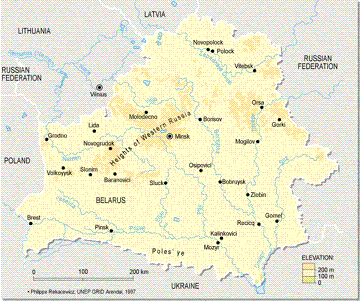
Kletsk is located left-center in this modern map, from The Times Atlas of the World, courtesy of the UN Environment Programme (UNEP), Arendal, Norway. Minsk, the capital of Belarus, at approximately center, is a reference point for the following map. The location of Kletsk may be approximated by drawing a line between Baranovici and Slutsk, to the southwest of Minsk. Kletsk is located approximately at the halfway point. Belarus is flat. This map shows no elevations above 200m (656 feet) and the greater part of the country is at about 100m. Note the Heights of Western Russia generally to the west of Minsk. There are some of these somewhat higher areas in the area of Kletsk. Not indicated on this map are the vast areas of marshes extending from the Pripat River, which runs east-west across much of the southern portion of Belarus. These extend as far north as Minsk, and are probably a defining factor in the area of Kletsk to this day. |
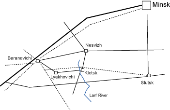 |
This sketch depicts a composite of the last 100 or so years, and illustrates some importantgeographical factors in the lives of Kletskers. Roads are shown as solid lines, railroads as dashed.
The Lan' River passes just to the west of modern Kletsk. |
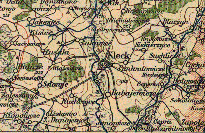
A portion of a 1929 map from the Wojskowy Instytut Geograpficzny, courtesy of Stanford University Map Library.
KehilaLinks Home | JewishGen Home
This page is hosted at no cost to the public by JewishGen, Inc., a non-profit corporation.
If you feel there is a benefit to you in accessing this site, your JewishGen-erosity is appreciated.
| Contact: |
Last Updated: HDN 05-Mar-2023 12:28
Copyright © 2023 Henry Neugass