|
|
Ivano Frankivsk, Ukraine
& Vicinity |
| Google Map View of Kalush |
MapQuest View of Kalush |
View Larger Map |
|
|
 Map of Austro-Hungarian Empire (1882) -- Galicia. From Blackie & Sons Atlas (Edinburgh, 1882). NOTE: Will open in a new browser window or tab Map of Austro-Hungarian Empire (1882) -- Galicia. From Blackie & Sons Atlas (Edinburgh, 1882). NOTE: Will open in a new browser window or tab
|
Regional Area Map, showing the general region of Ivano Frankivsk, south of Lviv, with clickable towns to some of the neighboring ShtetLinks sites Home Pages - Bolekhov, Delyatin, Dolina, Ivano Frankivsk, Kalush. NOTE: Will open in a new browser window or tab
|
Cadastral Map of the town center of Kalush
Cadastral feldskizzen map of the town center of Kalush (Kalusz),
administrative district of Kalush, region of Ivano-Frankivsk, undated.
The six map sheets copied cover the entire residential area and all
houses; also included are the residential districts of New Kalush (Neu
Kalusz), Bania, and Zahirya Zagorze). A Jewish cemetery and associated
Jewish community lands are located to the northwest of the town
center. A revised cadastral map showing house numbers, and many of the
field parcels have householder names. |
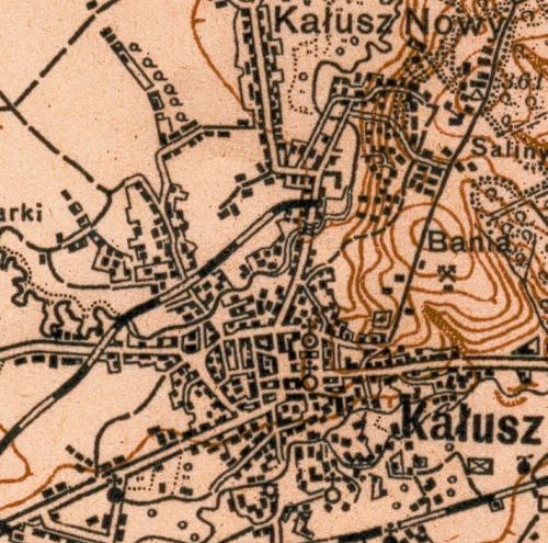
Kalusz military map scale 1:100000 c1910 showing town details.
|
|
|