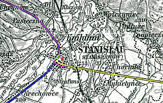
This is an area map showing an Overview of
Stanislawow, with only the general shape of the major streets in town, showing enlarged
town detail from a 1905 Austrian military map supplied by Tomek Wisniewski to Denise
Azbill. Below is a slightly
larger area, showing a bit of the surrounding suburbs or hamlets. |
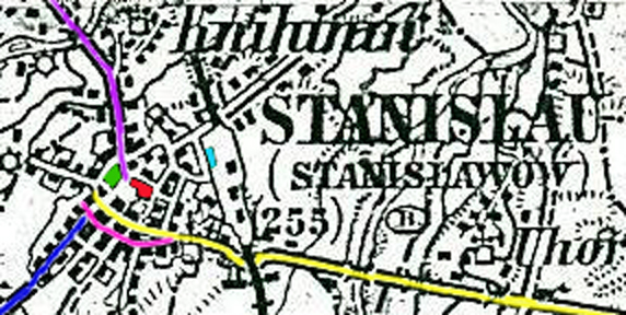
| Notice the unique shapes of the main streets. The street marked in yellow is Sapiezynska Street, constituting the main business promenade in the center of town, and leading to/from the East of the city. The curved street below, marked in pink, is Sobieskiego, housing the main post office building, dividing the business area from the rather humble (mixed with grand, varying street by street) residential section to the South. The northeast area has fancier residential areas; e.g., near the Roxolana Hotel, with predictable multi-family dwellings closer to the Railway station (marked in light blue) on the East side of town. If you look closely, you can even see the City Park (marked in green) in the Northwest. That's Halicka Street (in purple) heading out of town to the North, Northwest, towards Lviv (Lwow, Lemberg, Lemberik). The street jutting out to the Southwest is Kazimierzowska Street (in dark blue), which becomes Karpinskiego Street north of Sobieskiego, in the heart of the old downtown. Rynek, the town square (in red) is at the obvious center of town. (See Area XX on the Zoom In) |

Zoom In -- Click here or on the center of town in the map, above, to Walk the Streets of Old Jewish Stanislawow, by following a detailed town plan.
 |
|