Identification of Post-War Photos of Gargzdai
taken by George Birman
posted at
United States Holocaust Memorial Museum
Photos at Album
2, 1944-1946, Item 8: (album page bears dates April 21, 1945 in
lower left corner, and April 16. 1945 in lower right corner; pictures
are not otherwise identified on album page)
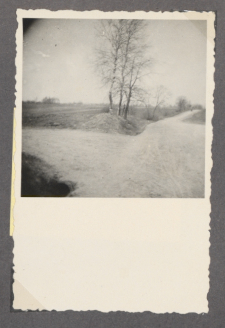
Item 8(1)
Ruins of new masonry Beit Midrash
|
Item 8(2)
Unknown |
Item 8(3)
Entrance road to NE killing site for women and children (road
heading to left)
camera view looks SW towards Vezaiciai
|
Item 8(4)
Bluff at west side of Jewish cemetery |
Item 8(5)
view from east side of Minija River
Camera view looks west across river, towards large palace of
former noble estate, at north end of estate lands |
Item 8(6)
NE site of killing of women and children |
Item 8(7)
Palace of former noble estate, at north end of estate lands
|
Item 8(8)
Gravestone in Jewish Cemetery |
Item 8(1)
Ruins of new masonry Beit Midrash
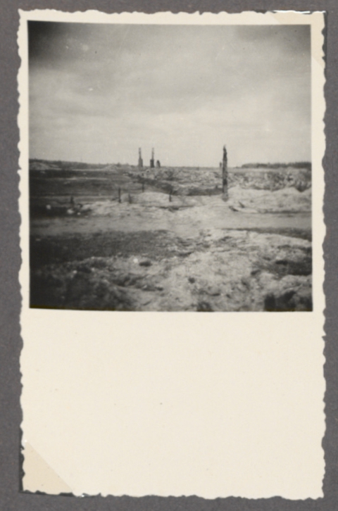
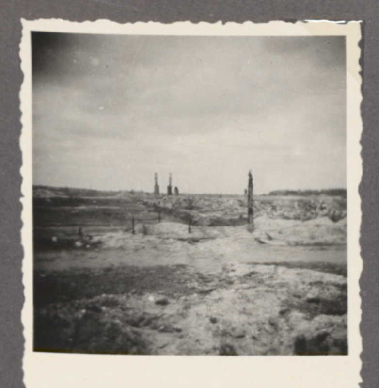
Photo courtesy of United States
Holocaust Memorial Museum
1993.41.2
Album 2, Item 8
George Birman Papers
Factors supporting identification of
subject of Birman photo:
Site would be of prime
interest to Birman.
View faces east because
river is seen in background.
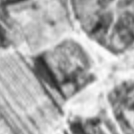
Aerial photos
#157
and
#158
show shadow of northern wall of the ruins of the new masonry Beit
Midrash. The shadow shows profile of the wall, although the height is
exaggerated due to low angle of late afternoon sun. On the aerials, the
wall drops off sharply in height as the northeast corner is approached.
Birman photo shows similar profile in wall at left.
Aerial photo oriented with southeast at
top
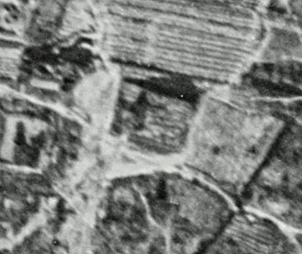
Above: Ruins of Beit Midrash from Aerial # 158
enhanced with unsharp mask function of graphics program
Oriented with north at top
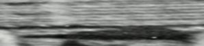
Above: North wall of Beit Midrash ruins, from Aerial #158, oriented with
north at top
Vertical dimension of photo compressed to 25% of original, to let shadow
more closely approximate profile of remnants of north wall
Question: Are the
twin columns, in background of George Birman's photo, remnants from the
Catholic Church which was burned at the time of the invasion in June,
1941?
Item 8(2)
Unknown
Can any reader
identify this location?
Item 8(3)
Entrance road to NE killing site for women and children (road
heading to left)
camera view looks SW towards Vezaiciai
Photo courtesy of United States Holocaust Memorial Museum
1993.41.2
Album 2, Item 8
George Birman Papers
Factors supporting
identification of subject of Birman photo:
Documenting the turnoff point to the site of the killing would be of
prime interest to Birman.
Direction of the roads matches direction on historical maps and at
present time
Turnoff point on Lithuanian topo (1938)
North at top
Map rotated to match direction of Birman photo
Red arrow: road to Vezaiciai
Orange Arrow: Road to NE site
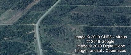
Turnoff position on Google Earth
Road at top edge leads to Vezaiciai; road at left edge leads to NE Site
Item 8(6)
NE Site of Killing of Women and Children
Photo courtesy of United States
Holocaust Memorial Museum
1993.41.2
Album 2, Item 8
George Birman Papers
Factors supporting identification of
subject of Birman photo:
NE site would have been
easier to locate than SW site.
Far right edge of Birman
photo may show start of slope up to location of present day memorial
sign. See present day photo
here
at
Lithuanian
Cultural Site. SW site is on flat terrain.
Gargzdai
main page