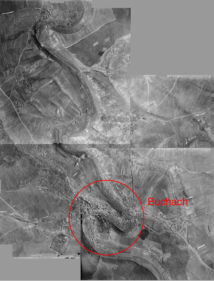
Aerial Photographs of Buchach
|
The image on the right was produced by combining 4 aerial photographs of Buchach. The 4 original photographs were taken on April 15, 1944 by the German Air Force and were captured by the Allies. A more detailed history of Buchach during WWII is available from Martin Rudner and from sections of the Yizkor book for Buchach entitled Second Witness and Third Witness. Briefly, Buchach was occupied by German forces on July 7, 1941; liberated by Russian forces on March 23, 1944; recaptured in a counter attack by German forces on April 3, 1944; and finally liberated by Russian forces on July 21, 1944. These photos are probably reconnaissance photos taken in connection with the German counter attack. The photographs are availabe through the National Archives and Records Administration (NARA) They are identified as RG 373~GX 12125 SD~Exposures 32, 33, 62, 63. A vendor suggested by NARA scanned the original photographs at a resolution of 300 dpi (dots per inch). The image shown below was produced by combining the 4 digital files. The original photographs were taken at 4pm and the shadows of trees and houses suggest that north is up in the photograph. Click on the image to see a larger version of this composite. Compare this aerial photograph to the detailed map of Buchach. The S-shaped course of the Strypa river are clearly seen in both the map and the photograph. |
 |
- The center of Buchach showing the bridges over the Strypa river, the Jewish cemetery, the Fedor hill, many landmarks, and a large swastika carved in the side of a cliff.
- The center of Buchach with annotations identifying many key sites in the town. The annotations were obtained largely through the efforts of former Buchach resident Etunia Bauer Katz (see her book in the Bibliography) and her daughter Felice Katz plus Alexander Dunai and 5-6 Burchach residents who stopped to examine the aerial photographs and to identify sites. If anyone can identify any other sites please get in touch with Tom Weiss and the new sites will be added to the image. During the holocaust, thousands of Jews were shot at a number of sites in Buchach including: the Jewish cemetery, Fedor hill, and Legi field.
- (2) a detail of the swastika carved in the side of a cliff;
- (3) a detail of one of the bridges showing vehicles on the bridge and craters (from bombs?) along the edges of the river;
- (4) a detail of the Jewish cemetery.