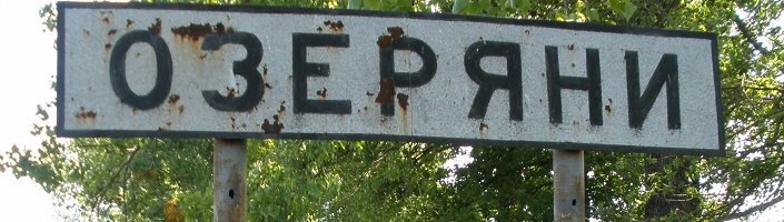
The small village of Ozeryany was founded in 1848. Located in Volhynia, a historic region in what is now northwestern Ukraine, Volhynia,
was called Volyn in Ukrainian and Russian, and Wolyn' in Polish. Ozeryany is located at 50° 28'N, 26° 02'E in the Rivnens’ka oblast of Ukraine. Ozeryany is
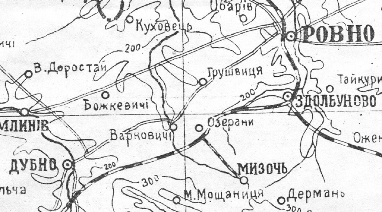
three miles from Varkovychi, seven miles from Mizoch, and about equidistant from the cities of Dubno and Rivne.
 The land in Volhynia where Ozeryany would eventually be established was under Polish-Lithuanian Commonwealth rule before 1795.
 After the third Partition of Poland in 1795 by its stronger neighbors,
this region was annexed and became part of the Russian Empire.
After the third Partition of Poland in 1795 by its stronger neighbors,
this region was annexed and became part of the Russian Empire.
 After World War I, Ozeryany became under rule of the reconstituted country of Poland.
 With the outbreak of World War II in September of 1939 and the subsequent invasion by the Soviet Union, Ozeryany became part of the Ukrainian Soviet
Socialist Republic, Rovno Oblast.
With the outbreak of World War II in September of 1939 and the subsequent invasion by the Soviet Union, Ozeryany became part of the Ukrainian Soviet
Socialist Republic, Rovno Oblast.
 When the Germans attacked their Soviet ally in 1941, the area around Ozeryany was incorporated into the German Reichskommissariat Ukraine.
With the defeat of Nazi Germany, this region once again was part of the Soviet Union, Ukrainian S.S.R. and remained so until the establishment of the Republic of Ukraine in 1991.
 Today, there are at least seven villages in Ukraine with the name of Ozerany. “Our” Ozeran or Ozerany (Озеряни in Ukrainian) is located in the Dubens’kyi raion (district) and the Rivnens’ka oblast (province) of Ukraine at 50° 28'N, 26° 02'E.*
View Ozeryany via:
Озеряни (Ozeryany) on current-day map (Google)
Oserjany (Ozeyany) on 1912 German map (Andress Allgemeiner Handatlas)
Ozierany (Ozeyany) on 1926 Polish map (Wojskowy Instytut Geograficzny)
Озеряни (Ozeyany) on 1959 Soviet map (Atlas of Soviet Administration Maps)
* The geographic coordinates have significance because there were many villages in the old Russian Empire named Ozeryany or with variant spellings:
48° 48’N, 25° 06’E (Ivano-Frankivs’ka oblast, Ukraine);
48° 53’N, 25° 57’E (Ternopil's'ka oblast, Ukraine);
49° 38’N, 25° 20’E (Ternopil's'ka oblast, Ukraine);
50° 17N, 29° 32’E (Zhytomyrs’ka oblast, Ukraine);
50° 30N, 32° 55’E (Chernihivs’ka oblast, Ukraine);
51° 01’N, 24° 48’E (Volyns’ka oblast, Ukraine);
51° 14’N, 16° 05’E (Legnica County, Lower Silesian Voivodeship, Poland);
53° 12’N, 23° 51’E (Sokółka County, Podlaskie Voivodeship, Poland);
53° 24’N,25° 39’E (Belarus);
53° 58’N, 20° 44’E (Olsztyn County, Warmian-Masurian Voivodeship, Poland); and
54° 32’N, 16° 34’E (Sławno County, West Pomeranian Voivodeship, Poland).


