Kvedarna


VILLAGE MAP -1910

Portion of the 1910 village map in the Kaunas Archives, showing lot numbers.

A: The Jewish Cemetery   

B.    Area of Jewish Communal Buildings

F.    Rietavas Street (Retovskaya)

G.    Laukava Street (Lavkovskaya)

C:  Market Street (Bazarnaya)

D:  The Catholic church

E.   The village square and market place


 Click here for larger scale map


To view sites, click on the thumb-nail photos below.  To return to this page afterwards, click "Back" on the top left of your screen
 

Jewish Cemetery  (81Kb )

Empty site where the shul once stood (46 Kb)

Square of Remembrance (Market Square) (41 Kb)

Memorial where the Ohel used to stand (88 Kb)


Site map
Description
Family Finder
Contemporary Records

  JewishGen Home Page    /   LitvakSIG Home Page   /   JewishGen Lithuania Database  

Copyright © 2016 – Alan Nathan

Webpage compiled by  Sam Aaron   February 1999    Last  Revision: Jan 2006

Co-ordinator Alan Nathan


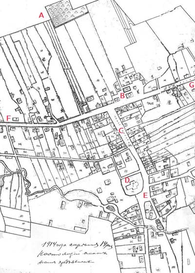
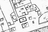
DETAILS OF AREA OF COMMUNAL BUILDINGS

34:  Synagogue 
 

35:  Place of the old synagogue
 

37:  Rabbi's house 
 

 44:  Community bath house
 

 Back to map page