shtetlinks

Gargzdai (Gorzd), Lithuania


Military Formations in Aerial Photographs

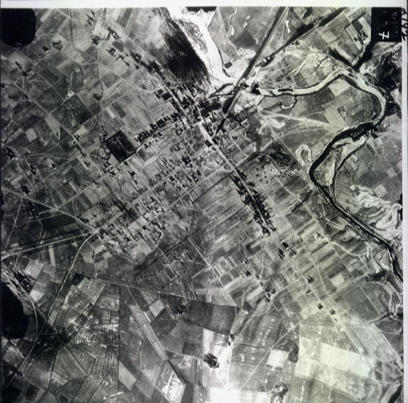
Reconnaissance photos would likely be taken close to the front lines. The aerial photos of Gargzdai were taken January 16, 1945. The Soviet Information Bureau reported that Gorzdy (as well as Kretinga and Palanga) fell to Soviet troops on October 10, 1944. "Vezaice" (i.e. Vezaiciai) had fallen on October 9. (http://eng.9may.ru/11.10.1944/eng_inform/m9002478, website no longer active). At the time of the aerial photograph, three months later, Soviet forces controlled Gargzdai.  Germany still controlled Memel and a small pocket surrounding it.  Memel/Klaipeda fell to the Soviet forces twelve days after the aerial photo, on January 28, 1945.

Battle of Memel at Wikipedia

For a map of the military situation between October, 1944 and January, 1945, see here at www.lithuanianmaps.com. 

For other WWII aerial photos of military installations in Lithuania, see here at ww2aerialreconstudies.com,


Anti-Aircraft Deployments

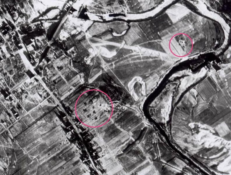
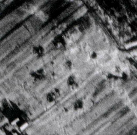
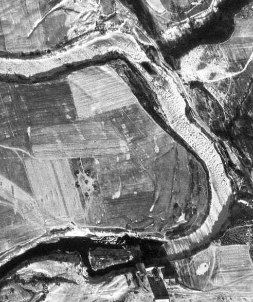
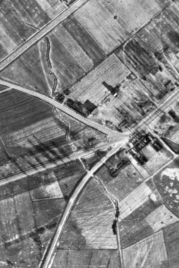
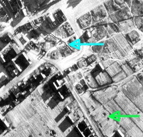
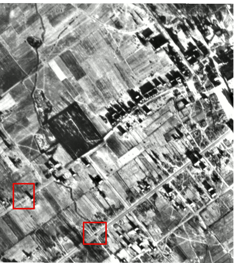
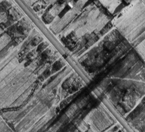
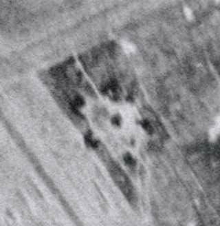
A reader skilled in the interpretation of aerial photographs has pointed to the areas circled below in photo #157 as possible anti-aircraft deployments. Area at lower left adjoins the Jewish cemetery.


antiaircraft in
                156
Deployment shown in aerial  #157
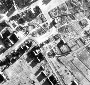
Same deployment shown in aerial #156

Note: These anti-aircraft formations may be seen in the German Military Fortifications map dated mid December, 1944 available at mapywig. For animation comparing aerial photo and military map, click here.

military

This map indicates "German or former German fortifications discovered by aerial photography" (in blue) running through the Jewish cemetery

dec 1944 legend

"LB" = Luftbild = aerial photo
"Panzerabwehrgraben" = antitank ditch

shown German positions

Top line: "Blue : German or former German positions, so far as they can be recognized as such"


Anti-Tank Ditches, and Bomb or Shell Craters


antitank ditch ditch and bomb
                craters


ditch with arrows
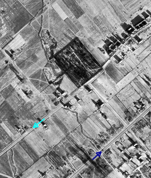
Aerial photo #158 shows anti-tank ditch at western approach to town. Modern aerial photo at Google Earth shows that portion of this ditch is now the site of the road to Kretinga. Aerial photo #158 shows ditch through Market Area, and Bomb or Shell Craters


Damage to Bridge


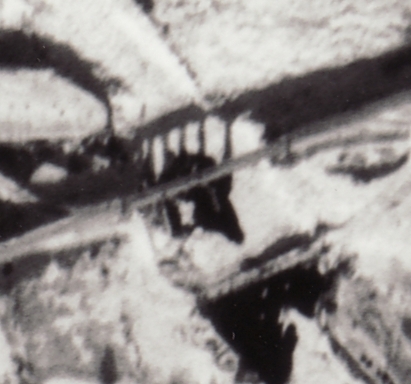
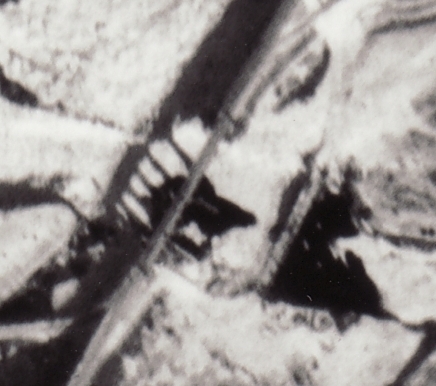
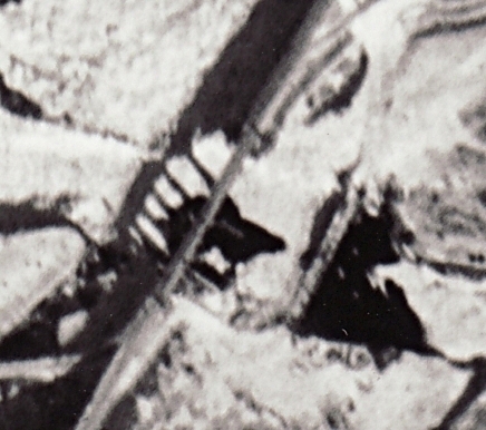
Photo #157 shows damage to bridge (span and supports), and temporary bridge to south

Shown without rotation, for greater clarity
Processed with unsharp mask


Moving Vehicles

Comparison of overlapping photos #157 and #158 shows moving vehicles (animated .gif may not work with some browsers or devices)

animation showing moving vehicles

Squares show locations of two moving vehicles, which were traveling in opposite directions.  Earlier photo #157 has vehicles in center of square.  Later photo #158 shows vehicles moving towards corner of square.

Arrows in photo #158 below point to the two moving vehicles, and show direction of travel.

moving traffic arrows

Moving Vehicle and Barrage Balloons

moving vehicle and barrage balloons

White dots which show up in one picture but not the other may be barrage balloons. One such dot is near the left edge of the above picture, about half way between the top and bottom.
 These balloons were used to suspend aerial steel cables to discourage low flying aircraft. Since it was far above ground, a balloon beneath the reconnaissance plane visible in one aerial photo would disappear in the next.

Photo of Soviet barrage balloons shown in military parade, 1942
Deploying barrage balloons was a dangerous undertaking

For map showing locations of photos #156, #157 and #158, click here.  ID number of photo increased as reconnaissance plane flew north.


Gargzdai Main Page

This page was updated March 18, 2020

Copyright © 2006 - 2020 John S. Jaffer