Aerial Photograph of Market Area and Destroyed Synagogues
 |
 |
| Original Photograph #157 Market Area scanned at 600 dots per inch |
Photograph #157 Modified with "unsharp
mask" function in freeware graphics program |
 |
 |
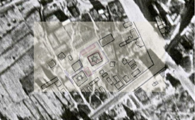
| The Virtual
Exhibition at the website of the Gargzdai
Area
Museum contains plans of the synagogue complex, LCVA, f.
1622, ap. 4, b. 1086, dated 1923 (at Virtual Exhibition webpage,
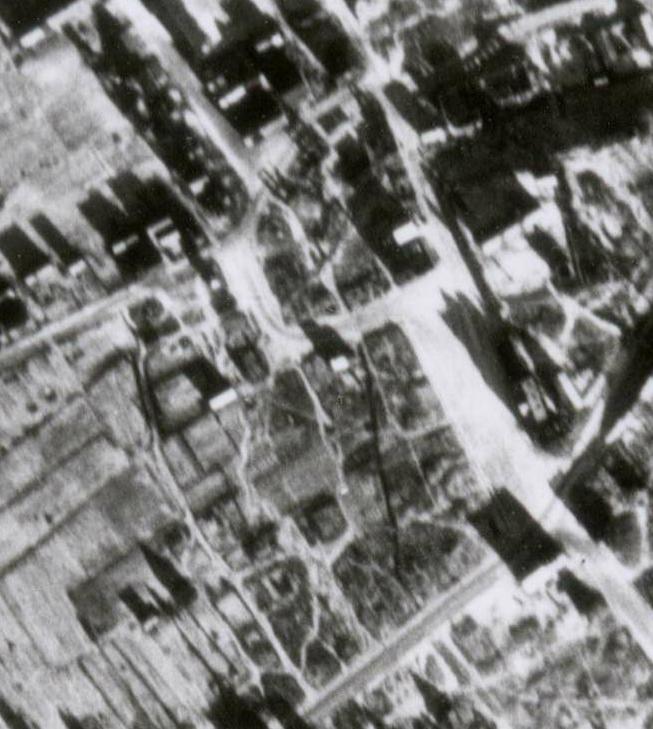
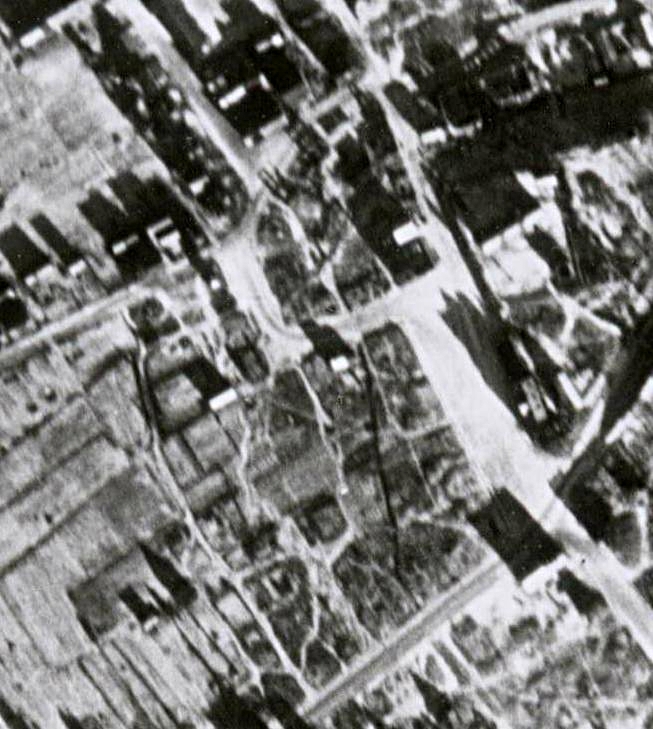
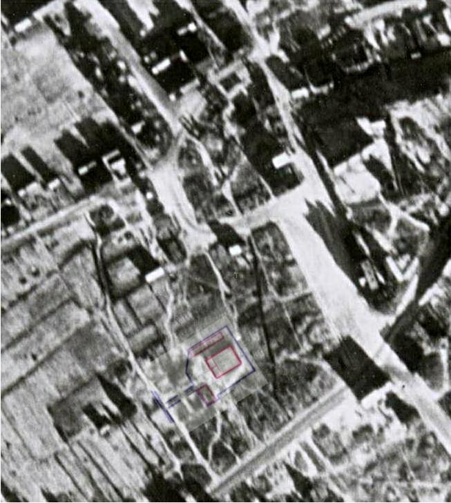
click on plan near bottom of page to enlarge). The plans consist of a large architectural drawing of the new building, together with a smaller plot plan showing the location of several buildings within the synagogue complex. Above is likely location of complex as shown on the plot plan. The large building is called the new synagogue in the plans, and the Beis Medresh in the Gorzd Memorial Book. The building was completed in 1928. Valanciute, Gatzdu miesto ir parapijos istorija, p. 505 (1998). The narrow building to the north is labelled on the plans as existing rabbi's home and classrooms. However no building appears here in the 1945 aerial. George Birman's diagram shows a smaller rectangular building, also oriented E-W, but located to the southwest, between the Tiferet Bachurim and the Beit Midrash. The Gorzd memorial book shows a narrow rectangular building, but oriented N-W, not E-W. In 2008, a resident recalled classrooms even farther to the west. On the plans, the smaller building to the southwest is labelled as existing synagogue. Its identification on the aerial photo is unclear. There is a strong match between the large building shown in the plans, and features in the aerial photograph, particularly if the plans of this building are reversed from left to right. For further information on the buildings of the religious community, click here. |
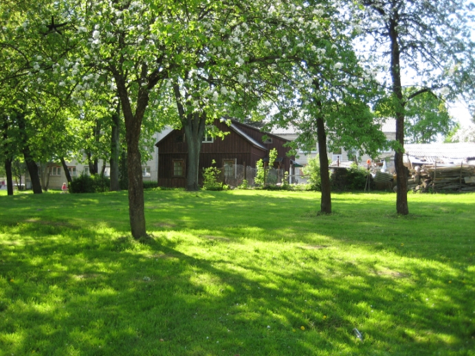
On the author's trip to Gargzdai in 2001,
an elderly resident pointed to the wooden dwelling shown above,
and indicated (through a translator) that it had been
constructed within the area where the synagogue had once
stood. This location for the synagogue was later confirmed
by another Gargzdai resident in 2008, when the above photograph
was taken. This resident in 2008 indicated that the present
wooden building was built on the site of a previous brick
synagogue of approximately the same size. Photo was taken
looking towards the west. Comparison of current
satellite photo on Google Earth
with wartime aerial Photos #157 and #158, and George Birman's
town
diagram, suggests that the existing wooden building above may be
at the site of
the old beit midrash, made of brick, and later used by the
Tiferet Bachurim (an organization for teenage boys).. Comparison of the 1945 aerials with current satellite photo on Google Earth shows that the area once apparently occupied by the new synagogue is now a grass and treed area (above) and basketball court. For further information, see Buildings of the Religious Community. |
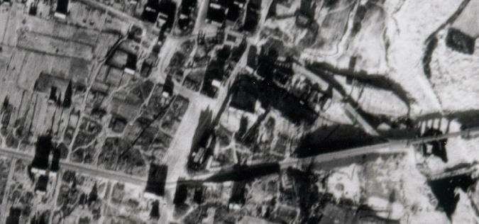
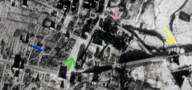
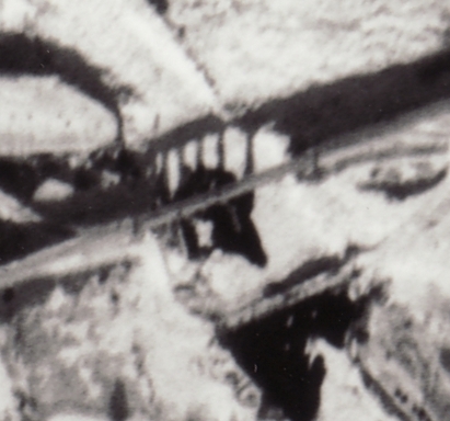
Market Area from Photo #157 (300 dots per inch) aligned with North
| Blue |
Synagogue Street (identified by a resident in 2008). There is now a pathway at this approximate location. |
| Green |
View towards Market Area |
| Rose |
Brewery ruins (shadow falling on Minijos g-ve
(St.)). Ulm Judgment indicates civilians stayed in the basement of
the brewery during the German attack on June 22, 1941. A current
Gargzdai resident has pointed to this location as the former
brewery. |
| Yellow |
Bridge over Minija River (shadow falling on ice); showing damage to span and supports, and temporary bridge to south |
|
|
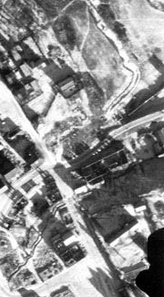 |
| Brewery ruins from Aerial #157 |
Brewery ruins from Aerial
#158 |
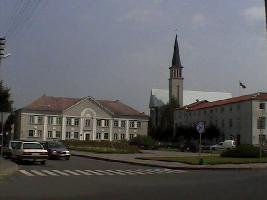
Church and Former Market Area
Looking Northeast from Klaipedos g-ve (St.)
Further information about the location of the religious
buildings comes from a diagram of the August,1939 fire in a periodical
entitled Die Feuerlösch Polizei [The Firemen Police], published
in Berlin on October 15, 1939. For further information about the
diagram and a comparison with the aerial photo, click here.
Identification of Features on Aerial Photo | Aerial Photo of Gargzdai