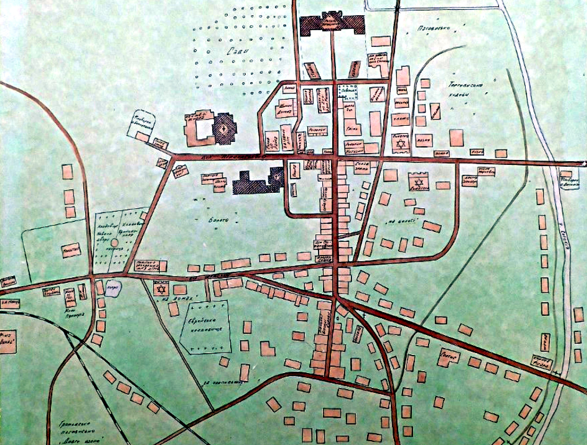
Krystynopol in 1939, courtesy of John Panzer and krystynopol.info:
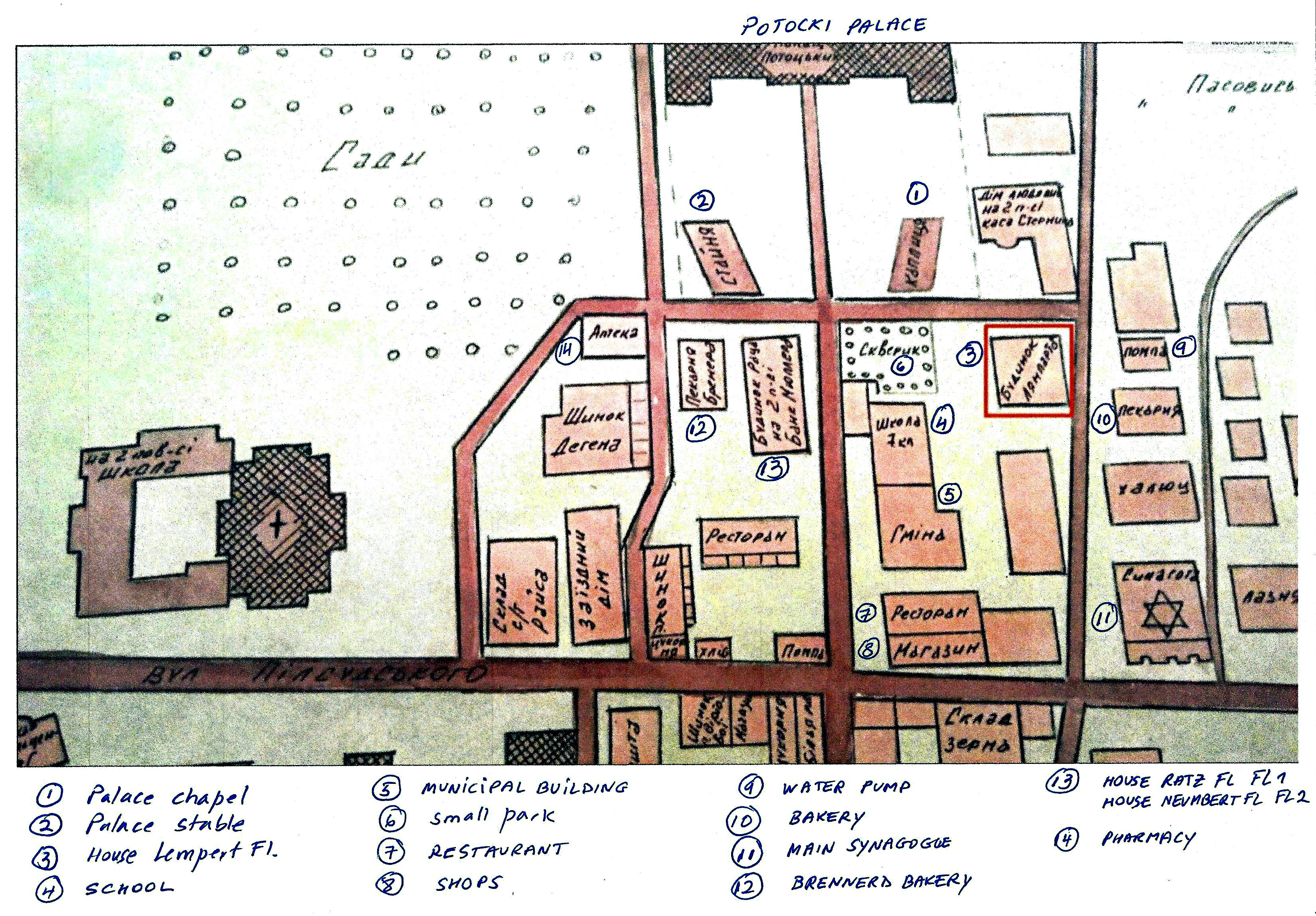
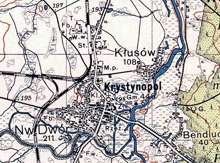
A closeup of Krystynopol in 1939:
Below are some scanned images of atlas maps.
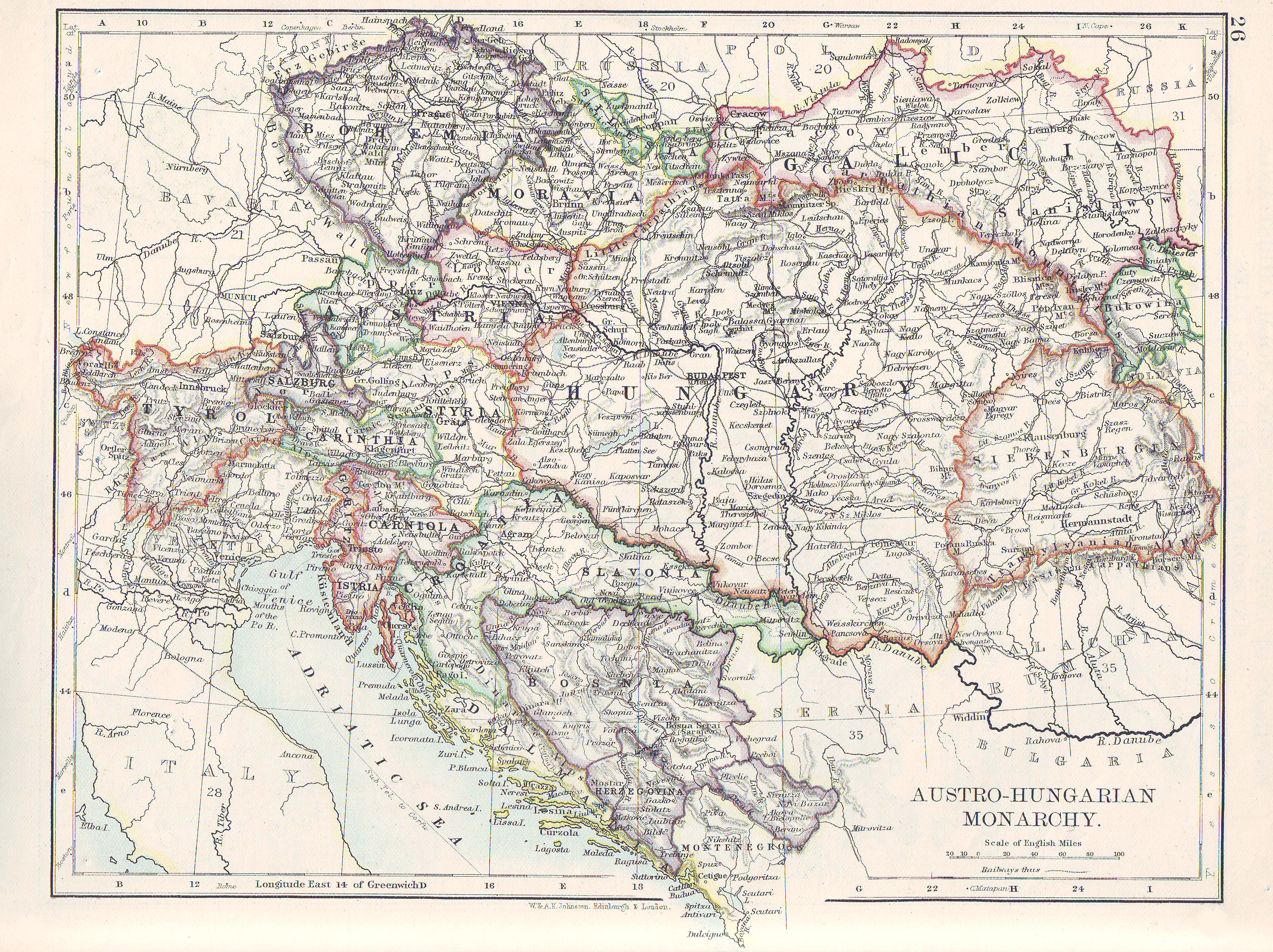
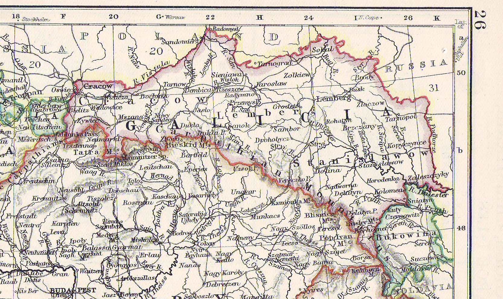
The Austro-Hungarian Empire in 1874: Krystynopol was in the province of Galicia during the sovereignty of the Austro-Hungarian Empire. The Austro-Hungarian Empire ruled over Galicia from 1867 to 1918. Galicia is at the top right corner of the map below.
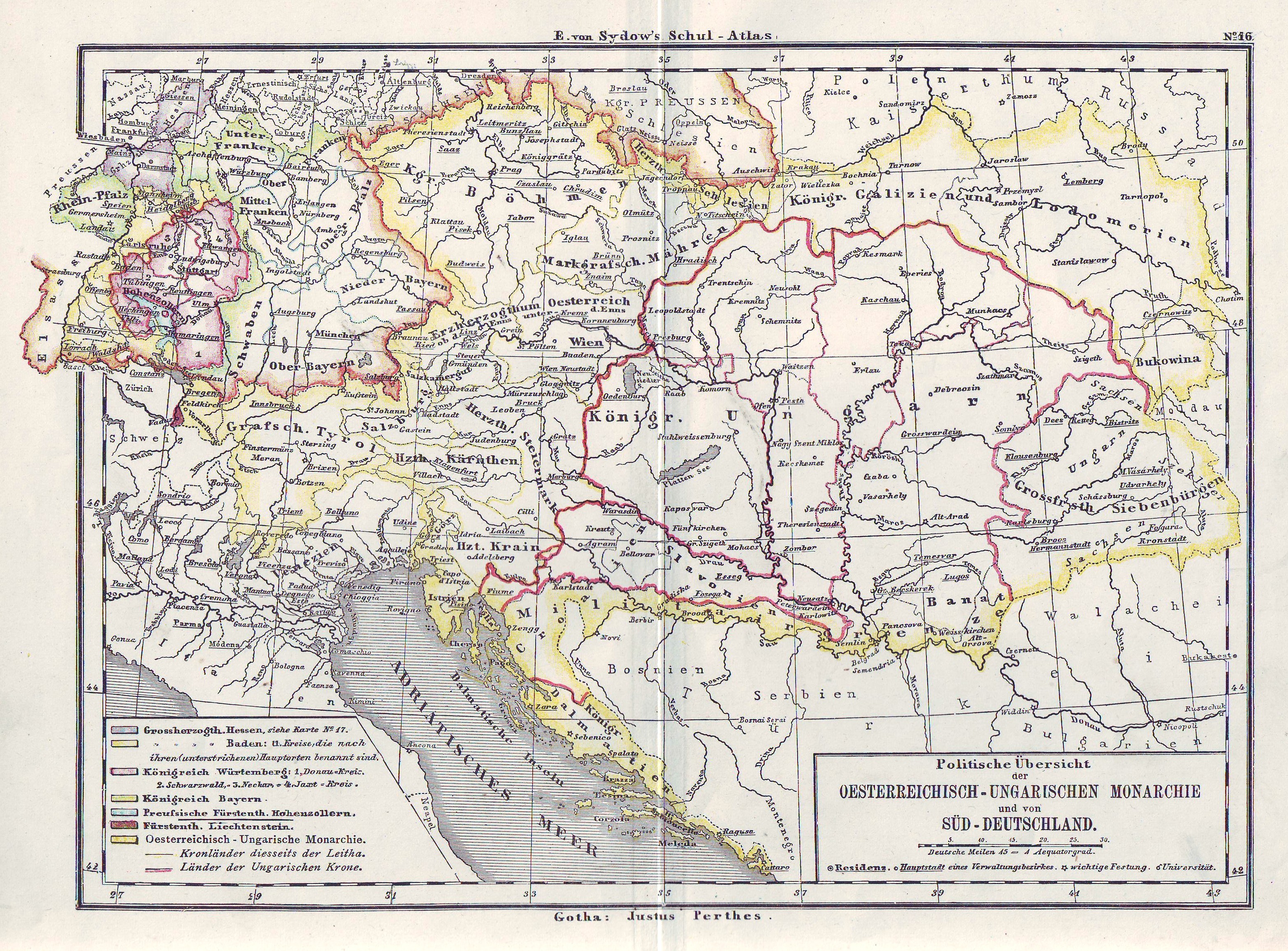
The Austro-Hungarian Empire in 1897: Again, Galicia is at the top right.
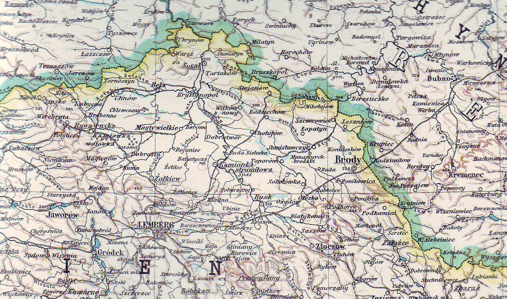
This is a close-up view of the 1897 map. Sokal, the district center for Krystynopol, is shown next to the Bug River at the top right corner.
Galicia in 1915: This atlas image shows Krystynopol's location seven miles south of Sokal.
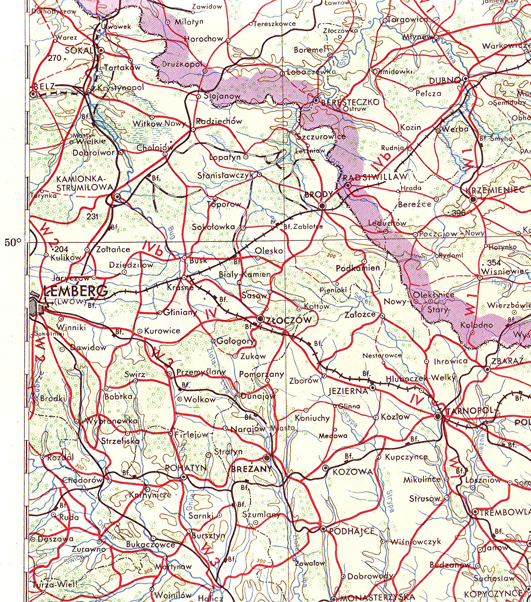
Krystynopol, 1943: This image is from a 1943 war map. Krystynopol is in the upper left corner.
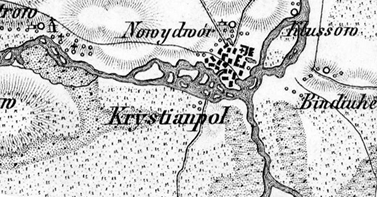
Detail from a German map, c. 1900:


This page was created by B. Hapner (click here to email me). I am looking for more photographs, stories and information to post.
Copyright ©2008-2026