This web site is dedicated to the study of Jewish family history in the Chernigov Gubernia/Oblast/province in Ukraine
Alternate names Chernihiv Oblast [Ukrainian: Черні́гівська о́бласть, romanized: Chernihivska Oblast], Chernigov Gubernia [Rusian], Tshernigov [Yiddish], Czernihow [Polish], Tschernigow [German], Cernigovas [Lithuanian]
Location Currently, the oblast is bordered on the west by the Kyiv Reservoir of the Dnieper River and Kyiv Oblast. It is bordered by Sumy Oblast to the east and Poltava Oblast to the south. The northern border of the oblast is part of Ukraine's international border with Belarus's Gomel Region in the north-west and the Russian Bryansk Oblast in the north-east. The oblast is bisected into northern and southern sections by the Desna River.
51° 20′ 24″ N, 32° 3′ 36″ E
refers to the center of this region

The Chernigov Gubernia in the northeast part of the Ukraine, within the Russian Pale of Settlement had a Jewish population that represented about 4-5% of the population in the late 19th century. For the most part, Jews lived in the cities and towns of the region. From the early 1800s on, Jews were involved in trade, in management and rent collection on the immense estates of nobles, management of taverns, in small crafts and as middlemen in the purchase of agricultural produce and its shipment and sale to larger communities in the west.
Later in the century Jews become workers and owners of sugar refineries, whiskey distilleries, breweries and textile mills. They lived in towns such as Bakhmach, Chernigov, Gorodnya, Ichnya, Konotop, Korop, Mena, Nezhin, Oster, Priluki, Semenivka, Shchors and Sosnitsa where some of the tombstones in Jewish cemeteries are still evident.
This KehilaLinks site will include links to lists of the last names of ancestors who lived within the borders of the Chernigov Gubernia, images of tombstones (with translations), history of Jewish presence in the area with maps and details of the border changes over the past thousand years, and additional links to many sources of Jewish records.
Geography
At present, Chernihiv is an oblast, (a Ukrainian governmental unit) in the northeastern part of Ukraine. The capital city of this oblast is also named Chernihiv. (Most of Ukraine's oblasts are named after their capital cities.) The precise boundaries of the Chernihiv region have changed over the centuries.
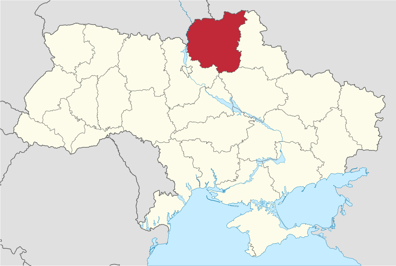 Chernihiv Oblast in Ukraine
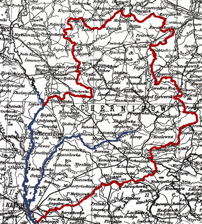
Chernigov (Tschernigow) Gubernia, 1909
The former Chernigov gubernia, outlined, with its southwestern boundary the Dniepr River. (click to see enlarged map)
From Stieler's Atlas of Modern Geography. 100 maps with 162 inset maps engraved on copper. Adapted for the use of the English-speaking public by B. V. Darbishire. Gotha, J. Perthes, 1909.
The Economy
Trade centers developed in the Chernigov region, in part because of its proximity to Russia and access to river transportation. The Desna River, which is 1130 km long, originates in Russia and drains into the Dnieper River near Kiev. The Dnieper flows on into the Black Sea to the south.
According to the census of 1666 important cities in the region including Nezhin, with 642 taxpaying households; Konotop, with 474; and Baturyn, with 365.
Chernihiv and Nezhin obtained the privileges of Magdeburg law. In the 18th century the number of manufacturing enterprises in the Chernihiv region increased: in 1728 sailcloth began to be manufactured in Pochep, and in 1737 woolen cloth began to be produced in Riashky village near Pryluky (700 workers) and in Sheptaky village near Novhorod-Siverskyi. Flour milling developed rapidly: in the 18th century there were 2,759 windmills and 1,511 watermills in the Chernigov region. Nezhin became the largest economic center of the region. Beginning in 1657, large fairs that attracted merchants from various cities in Ukraine and abroad were held in Nezhin.
By the end of the 18th century the urban population had increased significantly: in 1786 Gorodnya had a population of 11,000; Pryluky, 6,200; and Chernihiv, 3,900.
Jewish presence in Chernigov Gubernia
1897 makeup of the population of Chernigov
Ukrainians 85%
Belarusians 6%
Russians 5%
Jews, Poles, and Germans 4%
1914:
Ukrainians, 85.6%
Russians 9%
Jews, 4.9%
Germans 0.4%
Poles, 0.1%
Note: Much of the details above come from the Encyclopedia of Ukraine, vol. 1 (1984)
Thanks for your help.
Much of the information on this KehilaLinks site originated on the Chernigov Genealogy Group website. It had been collected by members of the Chernigov Genealogy Group 2006-2023
You'll find instructions on how to subscribe to the mailing list at https://groups.jewishgen.org/g/UKR-Chernigov
Subscribe by clicking on the blue subscribe button
Read new posts on the Chernigov Genealogy Group Archives at
https://groups.jewishgen.org/g/UKR-Chernigov/topics
Group Contact Information
Contact the Chernigov group at UKR-Chernigov@groups.jewishgen.org
Webmaster Reeva Kimble
Website updated December 2023
Copyright © 2023 Reeva Jacobson Kimble