
| Újfehértó Religious Locations |
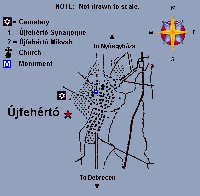
| Újfehértó had a synagogue, mikvah and cemetery. The Jews of Újfehértó worshiped in the village synagogue and were usually buried in the village cemetery. (Refer to the map below) |
| General Map of Újfehértó c. 1910 Map: Copyright ©2009 by Marshall J. KATZ, Permission granted for use on this KehilaLink page. |
|||||
|---|---|---|---|---|---|
|
|||||
|
|||||
)
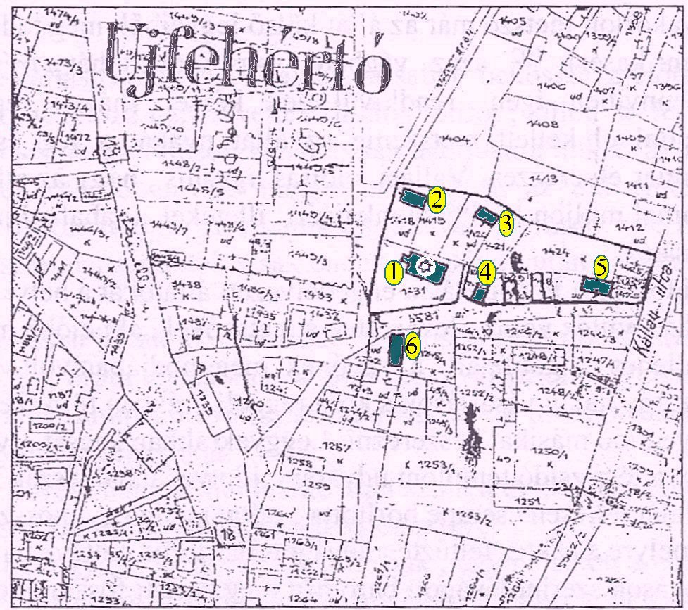
| Újfehértó Religious Locations in 1870 Source: Újfehértó Zsidósagá by Jozsef BUCZKO, Hungary Varosi Muzeum, Újfehértó, HU - Copyright © 1998 Annotated from memory by Jozsef BUCZKO, Hungary |
||
|---|---|---|
[click image and use Ctrl + to enlarge.]
|
| This page is hosted at no cost to the public by JewishGen, Inc., a non-profit corporation. If you feel there is a benefit to you in accessing this site, your JewishGen-erosity is appreciated. |
| Created by: Marshall J. KATZ, USA Compiled by: Eugene KATZ, USA with assistance from Jozsef BUCZKO, Hungary Amos Israel ZEZMER, France and the following JewishGen members/descendants and contributors of Újfehértó Jewish families: Eugene KATZ, USA |
| Updated: 24 August 2020 |
| Copyright © 2009 Eugene Katz All rights reserved. |
 |
Top of Page |