
3rd Military Mapping Survey of Austria-Hungary
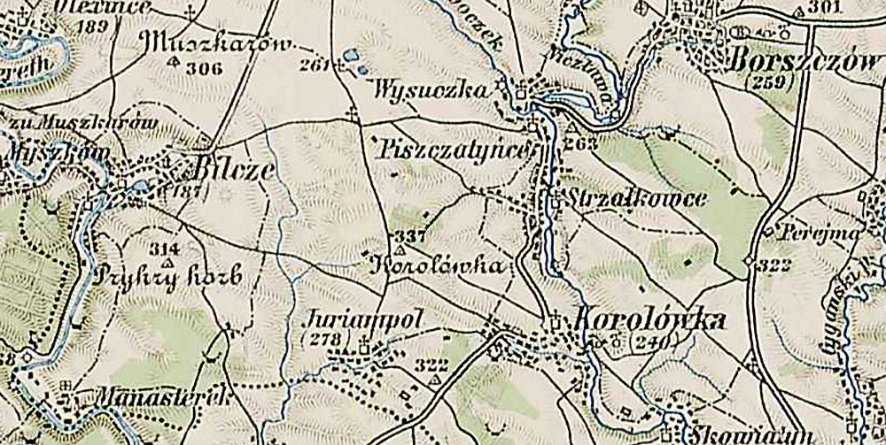
A small section of the 3rd Military Mapping Survey of Austria-Hungary showing Bilcze.
The scale: 1:200 000 is large enough to show detailed views of the smallest
village and even the rows of houses.
The Mapping Survey was done between 1868 – 1880. . The maps were created by
order of the Austrian Ministry of War.
The original sheets were published c. 1910.
This page is hosted at no cost to the public by JewishGen, Inc., a non-profit corporation. If you feel there is a benefit to you in accessing this site, your JewishGen-erosity is appreciated.
Last updated
03/08/12 by ELR
Copyright © 2012 SRRG