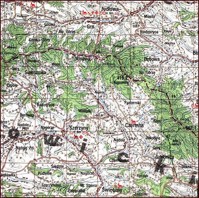
High resolution [100,000: 1] map showing Jodłowa. This map is part of a collection recently released for public use by the Headquarters of the Polish Army, Cartographic Division, Warsaw 1994. Each centimetre corresponds to 1 kilometre, or 1 inch equals approximately 1.5 miles.
Map courtesy of http://lemko.org/maps100/
© Copyright 2006 Kolbuszowa Region Research Group. All rights reserved.