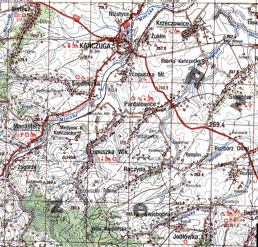
High resolution [100,000: 1] map showing Kańczuga, Manasterz, Medynia Łańcucka, Pantalowice, Siedleczka, Zagórze. These maps were recently released for public use by the Headquarters of the Polish Army, Cartographic Division, Warsaw 1994. Each centimetre corresponds to 1 kilometre, or 1 inch equals approximately 1.5 miles.
Map courtesy of http://lemko.org/maps100/
© Copyright 2017 Kolbuszowa Region Research Group. All rights reserved.